Chesterton dates to 1833, and 12% of its homes were built before 1940
More historic than 74% of U.S. towns · #266 of 593 in Indiana. What drives it
7 places in town are on the National Register, among them two historic districts with 36 buildings between them. Below: maps from 1893 on and the census since 1880.
Founding year: Wikipedia. First post office: 1836.The full story ↓
History grade
What drives Chesterton’s History grade
On its age, its old homes and the National Register, Chesterton is more historic than 74% of U.S. towns, #266 of 593 in Indiana. All 2 inputs are above most U.S. towns; its National Register listings ranks highest and its share of homes from before 1940 lowest.
B+
HistoryA character grade: shown, never part of Chesterton’s overall grade.
Indiana towns list more on the Register than most of the country (a typical Indiana town has 7.9 per 10,000 residents, the U.S. 2.4), so Chesterton’s 29.1 sits above most of its state (70% of Indiana towns have fewer) while its 42 historic buildings outnumber those of 84% of U.S. towns.
NoteThe founding year comes from Wikipedia alone; no second source gives 1833.
How sure. Graded on two of the three inputs, so a change in either one moves the letter more than it would with three. The pre-1940 share is a Census survey estimate (±4.1 points).
Founding year: Wikipedia (other dates in Quick answers). Homes: Census ACS 2020–24. National Register: National Park Service, May 2026 list; each listing counted once (boundary changes and added documentation belong to their listing), and a historic district counts its contributing buildings. How TownRatings grades history →
What stands out about Chesterton’s past
Read from the archive, the National Register and the record. The page puts what stands out first.
Lost post offices, old corners, places now gone and burying grounds
Chesterton’s post office has been open since 1870. Four other post offices opened and closed inside today’s town.
Coffee Creek
1836–1870
Calumet
1849–1853
Chesterton
1870–today
Croker
1893–1894
Crocker
1894–1905
18301930today
Hamlets and corners on the map
CrockerMorgan ParkWestern Acres
Gone or out of use
Thomas Schoolschool
2cemeteries and burying grounds inside Chesterton
ChestertonSaint Patricks
US Post Offices dataset (Blevins & Helbock, CC0). Places and cemeteries from the USGS Geographic Names Information System (2021).
Every building
Chesterton, building by building, 1893–1922
Fire insurance maps drew every building, what it was made of and what it was used for, so insurers could price the risk of fire. Pick a year, then a sheet.
Chesterton was first settled under the name Coffee Creek in 1833, with its post office being established in 1835. The post office would eventually be renamed to Calumet in 1850, as which the town was platted when the railroad was extended to that point in 1852. Due to a town on the same railroad also being named Calumet, the name would finally be changed to Chesterton in 1870 and it was reincorporated as a town in 1899 after a failed incorporation in 1869, with its population of 788 being the second-largest in Porter County at the time.
In that same j«ar Jesse Morgan came from Virginia and located on section 6, township 36, range 5; a short distance southea.st of the present town of Chesterton. His house became a sort of station of the Chicago and Detroit road and was soon widel.y known as the "Stage House." His two brothers, William and Isaac, came at the same time and settled in Washington township on the prairie which still bears their name. Others who came in 1833 were Adams S. Campbell, of Chautauqua county. New York; Reason Bell, of Wayne county, Ohio;
Text read by machine from the scan; it may contain errors.
trail crossed the eastern boundary of the county near the line between townships 36 and 37, north, and pursued a course a little north of west until it crossed the Calumet river about a mile west of the piescnt town of Chesterton. After crossing the Calumet it followed ap)>roximately the ridge to which Leverett has given the name of "Calumet Beach" and crossed tke west line of the county about a mile south of tlie shore of Lake Michigan. The original survey, made in 1834 aud 1835, shows in some portions of the county local trails, but as they weie not care-
Text read by machine from the scan; it may contain errors.
Scans and text from the Internet Archive. Books published in 1930 or earlier, which are in the public domain.
Timeline
Chesterton, 1833 to 1992
Woven from the archive, old maps, post office records, the National Register and the people born here.
In 1833, according to Wikipedia’s history of the town. Chesterton’s post office opened in 1836, and the census of 1880 counted 488 people here.
How does Chesterton rank for history?
Chesterton is more historic than 74% of U.S. towns, #266 of 593 in Indiana. The History grade combines the town’s founding era, the share of homes built before 1940 and its National Register listings. It’s a character grade, so it isn’t part of the overall grade. How it works.
What is on the National Register in Chesterton?
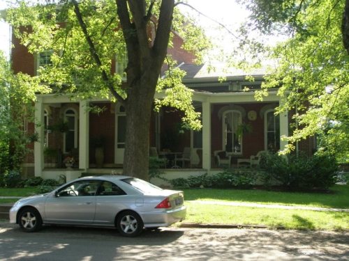
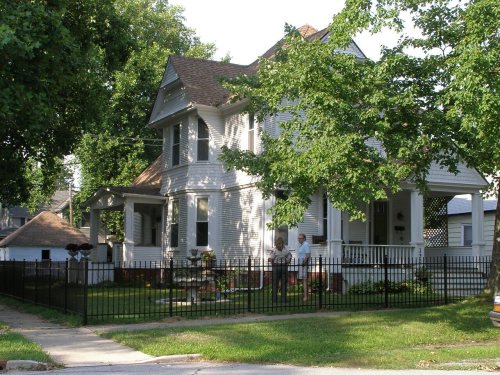
7 listings: 5 buildings, among them the Coambs, Norris and Harriet, Lustron House (listed 1992, the first), and 2 historic districts, the Chesterton Commercial Historic District and the Chesterton Residential Historic District, with 36 contributing buildings. 42 historic buildings in all.
How old are the homes in Chesterton?
12% of Chesterton’s homes were built before 1940 (Census estimate, ±4.1 points), against a typical 14% for an Indiana town; the median home was built in 1982.
Founding dates: Wikidata, Wikipedia, the U.S. post office records of Blevins & Helbock (CC0) and the Census. Homes by year built: Census ACS 2020–24. National Register of Historic Places: National Park Service (list of May 22, 2026). Old photos, postcards and papers: Wikimedia Commons, the Library of Congress and other public archives, credited on each item’s page. Maps: U.S. Geological Survey historical topographic maps (via Esri) and Sanborn fire-insurance maps (Library of Congress). History text and census tables: Wikipedia (CC BY-SA 4.0). Places that used to be: USGS Geographic Names Information System (2021).
From Wikimedia Commons (17), Wikidata (1), the National Register of Historic Places (7), Wikipedia, Wikidata and Wikipedia for famous people, U.S. Geological Survey historical maps, U.S. Census counts (via Wikipedia), the US Post Offices dataset (Blevins & Helbock), the USGS Geographic Names Information System, Sanborn fire insurance maps (Library of Congress) and old county and town histories (Internet Archive). Archive images are copied here with their credits and licenses, shown on each photo’s page. Refreshed monthly.


 2006
 2006
 2006
 2006
 2006
 2006
 2006
 2004
 2004
 2004
 2004
 2003
 2003
 2003
 2003
 2003
 2003