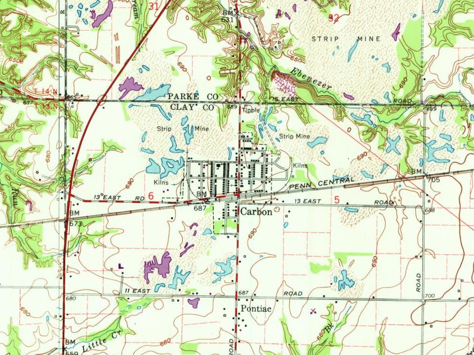
Carbon had its start by the building of the railroad through that territory. A post office was established at Carbon in 1870. It was named after the Carbon Coal Company.
Passages that mention Carbon, cut from the printed page as they were published.
History of Northampton, Lehigh, Monroe, Carbon, and Schuylkill counties1845Read the page →
Read the text
Port Carbon is now connected with the railroad to Philadelphia, through the Mount Carbon and Port Carbon railroad, which was opened on the 1st of December last, by tlie unyiulding perseverance of the engineers who were actively engaged in urging the work to its completion wiihin the time required by the charter.
Text read by machine from the scan; it may contain errors.
An illustrated history of the Yellowstone Valley1907 · page 240Read the page →
Read the text
Carbon is a station on the Rocky Fork branch of the Northern Pacific railroad. 38 miles southwest of Billings.
Text read by machine from the scan; it may contain errors.
An illustrated history of the Yellowstone Valley1907 · page 241Read the page →
Read the text
Carbon county has been aptly and correctly named the "Gem of the Mountains." This county was formed and organized in 1895 from what was formerly a part of the Crow Indian reservation and which was ceded to the government in 1892 and thrown open to settlement. It lies between the Yellowstone and Stillwater rivers on the north and west, the
Text read by machine from the scan; it may contain errors.
Scans and text from the Internet Archive. Books published in 1930 or earlier, which are in the public domain.
Timeline
Carbon, 1870 to 1950
Woven from the archive, old maps, post office records, the National Register and the people born here.
Founding dates: Wikidata, Wikipedia, the U.S. post office records of Blevins & Helbock (CC0) and the Census. Homes by year built: Census ACS 2020–24. National Register of Historic Places: National Park Service (list of May 22, 2026). Old photos, postcards and papers: Wikimedia Commons, the Library of Congress and other public archives, credited on each item’s page. Maps: U.S. Geological Survey historical topographic maps (via Esri) and Sanborn fire-insurance maps (Library of Congress). History text and census tables: Wikipedia (CC BY-SA 4.0). Places that used to be: USGS Geographic Names Information System (2021). How TownRatings grades history →
From Wikipedia, U.S. Geological Survey historical maps, U.S. Census counts (via Wikipedia), the US Post Offices dataset (Blevins & Helbock), Sanborn fire insurance maps (Library of Congress) and old county and town histories (Internet Archive). Archive images are copied here with their credits and licenses, shown on each photo’s page. Refreshed monthly.