129 years in pictures
Census counts: 944 in 1890, a peak of 215,940 in 1970, 91,970 in 2020. The archive holds 1 old photo or paper going back to 1997 and 5 maps from 1900 on.
- 1897Calumet Township is settled
Each edition grades its towns against each other only.
A city of 89,730, settled in 1897.
Calumet Township grades D overall, 573rd of 585 graded towns in Indiana, mostly because of health and schools. On CDC estimates, its residents' health ranks in the bottom 2% nationally. Its schools rank behind 96% of the state's. One bright spot: a typical home costs about $126K, 1.4 years of the Chicago metro’s $91K median household income. 27% of residents live below the poverty line in Calumet Township, where Indiana’s towns sit at 10% and U.S. towns at 9.6%. On the outdoors, just 21 of Indiana’s 1,098 towns do better. Indiana Dunes National Park, at 1,892 acres with 6.8 miles of trail, is the biggest park or preserve.
Where Calumet Township beats most towns, and one thing worth knowing.
| Widest gap | Calumet Township | IN |
|---|---|---|
| More adults facing a utility shut-off | 23.4% | 8.4% |
8.8% of the town is conserved land, across 64 parks and preserves.
Each subject compared with towns across the country (schools within Indiana), ordered by how far Calumet Township is from typical.
How TownRatings grades towns →
Census counts: 944 in 1890, a peak of 215,940 in 1970, 91,970 in 2020. The archive holds 1 old photo or paper going back to 1997 and 5 maps from 1900 on.
Museums, parks, gardens and other places to visit around Calumet Township. Close and well known come first.
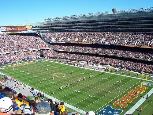
Big draw24 mi Stadium & arenaSoldier Field
Big draw30 mi Stadium & arenaWrigley Field
Big draw19 mi MuseumBarack Obama Presidential Center
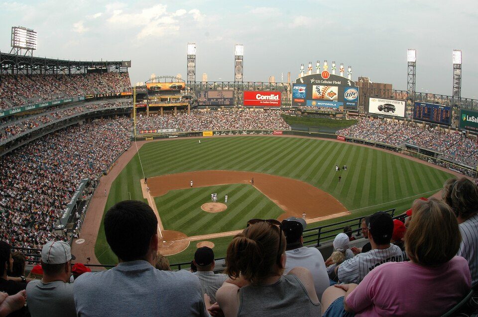
Big draw22 mi Stadium & arenaRate Field
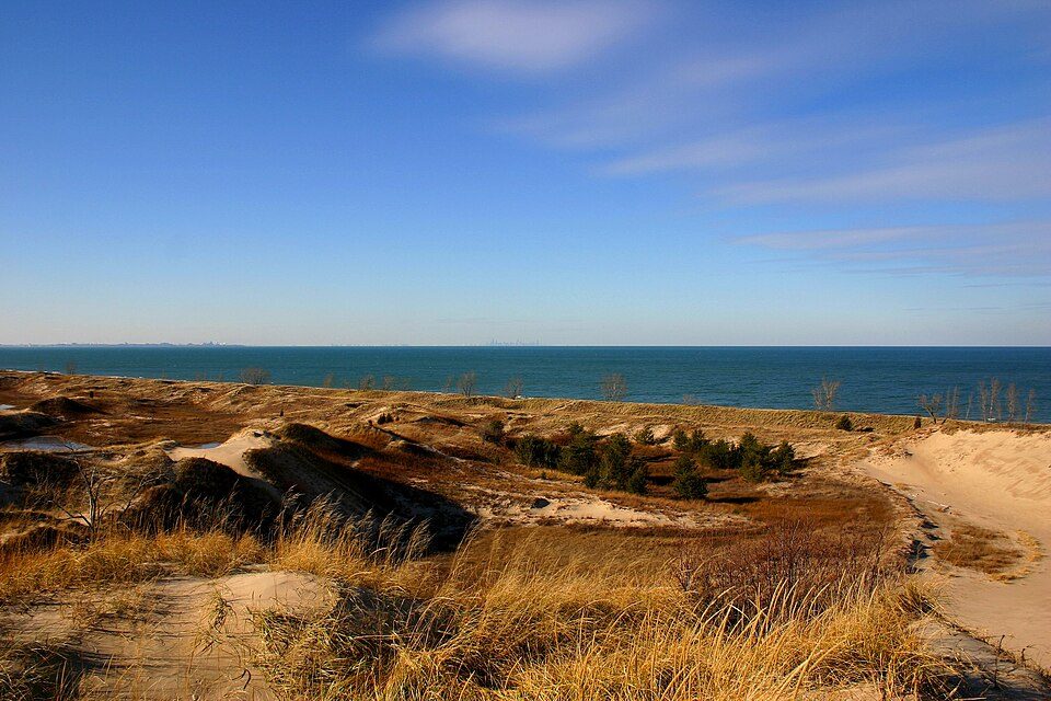
2 mi National ParkIndiana Dunes National Park2.6M visitors a year
Big draw26 mi Stadium & arenaUnited CenterSoldier Field: Photo by Joon Han Contact: [email protected], CC BY-SA 3.0 · Wrigley Field: Ryan Dickey, CC BY 2.0 · Barack Obama Presidential Center: AlphaBeta135, CC0 · Rate Field: User Enoch Lai on en.wikipedia, CC BY-SA 3.0 · Indiana Dunes National Park: J. Crocker, Attribution · United Center: User:JeremyA, CC BY-SA 2.5
Who provides power, water and the rest in Calumet Township, and how to reach them.
EPA SDWIS (Oct 9, 2026) · HIFLD + EIA-861 2025 · Census 2020 ZCTAs · NCES 2024–25 · registration: vote.gov, updated Nov 18, 2024.
Ordered by what stands out in Calumet Township.
Calumet Township sends many workers across the state line to Chicago and is one of Indiana’s best towns for the outdoors, but it has poverty well above the Indiana rate.
Its A for the outdoors ranks #16 of 593 in Indiana.
Across 64 parks and preserves: 51 miles of trail. In Calumet Township, the trail network density is 0.8 miles per square mile.
| Calumet Township | Indiana towns | U.S. towns | |
|---|---|---|---|
| Miles of trail per square mile | 0.8 miles per square mile | 0.2 | 0.4 |
| Conserved land | 8.8% | 1.9% | 4.3% |
| Biggest places to walk | Trails | Acres |
|---|---|---|
| 1. Indiana Dunes National Park | 6.8 mi | 1,892 |
| 2. Marquette Park | 2.2 mi | 241 |
| 3. Pine Station Nature Preserve | 1.5 mi | 258 |
Trails & parks © OpenStreetMap contributors · Conserved land: USGS PAD-US
Two of its 31 schools are shown below, with the reason for each. 6 public schools serve Calumet Township, with 3,518 students in all.
| School | Level | Students | Letter |
|---|---|---|---|
| Charter School of the DunesLargest public elementary schoolGrades PK–8 | Grades PK–8 | 836 | D− |
| West Side Leadership AcademyLargest public high schoolGrades 9–12 | Grades 9–12 | 1,232 | C− |
NCES · EDFacts · graded within IN on state tests and graduation
In Calumet Township, 13% of adults binge drink. Only 2 of the 589 Indiana towns we compare have a higher share of adults who get no exercise outside work than Calumet Township. Among adults here, 25% smoke cigarettes and 50% have obesity. On the CDC’s 32 measures, Calumet Township is ahead of Indiana on 4 and behind on 22.
| Calumet Township | Indiana towns | U.S. towns | |
|---|---|---|---|
| Fair or poor health (CDC PLACES) | 35% | 21% | 19% |
| Smoke cigarettes (CDC PLACES) | 25% | 17% | 14% |
| Obesity (CDC PLACES) | 50% | 39% | 35% |
| Diabetes (CDC PLACES) | 23% | 13% | 12% |
| What stands out | Calumet Township | IN |
|---|---|---|
| Fewer adults who have had cancer | 6.2% | 8.3% |
| Fewer binge drinkers | 13.1% | 16.6% |
| More adults facing a utility shut-off | 23.4% | 8.4% |
CDC PLACES 2025 · modeled estimates for adults · CMS · HRSA
FEMA puts 41% of Calumet Township’s expected hazard losses down to inland flooding, and 27% to cold waves. Paid flood insurance claims here since 1979: 293. Its risk rating from FEMA stands at 26 of 100.
FEMA flood insurance claims · FEMA National Risk Index · OpenFEMA
Calumet Township’s typical July afternoon high comes in at 83°F.
NOAA U.S. Climate Normals, 1991–2020
20% of working residents cross a state line to work, Chicago among the top destinations. Jobs based here fell from 37,035 in 2013 to 27,013.
Calumet Township had 27,013 jobs in 2023, down 10,022 from 2013. The middle household income for Calumet Township comes to $47,000. Half commute less than 10 miles. 17% of working residents work locally in the town.
| Calumet Township | Indiana towns | U.S. towns | |
|---|---|---|---|
| Median household income | $47,000 | $71,000 | $80,000 |
| Working residents who work in town | 17% | 11% | 8% |
| Work from home | 6% | 7.8% | 11% |
| Average trip to work | 27 minutes | 24 minutes | 25 minutes |
Census LEHD 2023 · ACS
6 within 15 miles of the center of Calumet Township
About 3 of every 100 Calumet Township residents are enrolled in college, against 6 across Indiana.
104,258 counted in 2010 and 91,970 in 2020; an estimated 89,730 in 2025.
U.S. Census 2010 & 2020 counts · Census Bureau estimate, July 1, 2025
Township in Indiana, United States
Calumet Township is one of eleven townships in Lake County, Indiana. As of the 2020 census, its population was 91,970, containing 47,425 housing units, down from 104,258 at 2010.
From Wikipedia, licensed CC BY-SA 4.0 · facts via Wikidata (CC0)
10 towns share a border with Calumet Township.
St. John Township next door grades higher for schools (A to Calumet Township’s D−) and lower for cost of living (B− to A−).
| Town | IN rank | Overall | Cost | Safety | Schools | Health |
|---|---|---|---|---|---|---|
| Calumet Township | #573 | D | A− | — | D− | D− |
| Gary | #585 | D− | A− | D− | D− | D− |
| Hobart Township | #461 | C+ | A− | — | C+ | C− |
| North Township | #504 | C | A− | — | C− | D |
| Griffith | #60 | A | A− | B | A− | B− |
| Highland | #155 | A− | B+ | B− | B+ | B |
| St. John Township | #36 | A | B− | — | A | B+ |
| Lake Station | #527 | C− | A− | — | C− | D |
Calumet Township, Hobart Township, North Township, St. John Township and Lake Station report no FBI crime data of their own. Compare Calumet Township with a neighbor →
Short answers, built from the data on this page.
Calumet Township grades D overall, better than 12% of U.S. towns and #573 of 585 in Indiana. It grades D− for health and D− for schools. Health is its weak spot, with a D−.
Not for the area. Cost of living, which also weighs rents, property taxes and how many households pay 30% or more of their income for housing, grades A−.