Bainbridge dates to 1831, and 31% of its homes were built before 1940
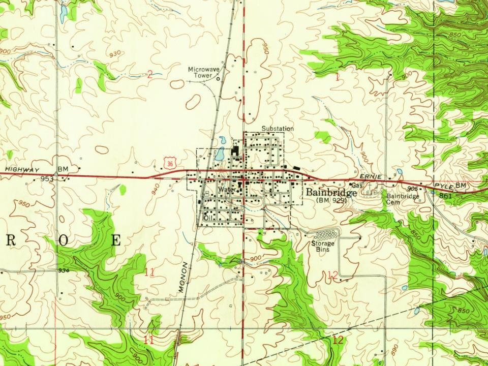
2 places in town are on the National Register, among them a historic district with 64 buildings. Below: 1 old photo or paper, maps from 1958 on, and the census since 1880.
Bainbridge was laid out in 1831. This town was named after the prominent war hero of the time, William Bainbridge. A post office has been in operation at Bainbridge since 1835. The town was incorporated in 1847. The nearby National Natural Landmark of Big Walnut Creek was designated in 1985.
Passages that mention Bainbridge, cut from the printed page as they were published.
Weik's history of Putnam County, Indiana1910 · page 527Read the page →
Read the text
Believing that merchandising offered special inducements for him, he accordinglv opened a dr}- goods store at Bainbridge, this county, in 1869, which he conducted in a very successful manner until 1879. becoming known during that decade as one of the leading merchants of this locality. In 1872 he erected a substantial brick block in Bainbridge.
Text read by machine from the scan; it may contain errors.
Weik's history of Putnam County, Indiana1910 · page 650Read the page →
Read the text
Doctor Starr received an excellent education in the home schools and, being ambitious to enter the medical profession, he began studying to that end, first entering the drug business in Bainbridge in 1870, building up a verv satis factorv business which continued to increase from year to year. In point of resistance he is the oldest citizen in Bainbridge and he has done much for the town's advancement along all lines.
Text read by machine from the scan; it may contain errors.
Scans and text from the Internet Archive. Books published in 1930 or earlier, which are in the public domain.
Founding dates: Wikidata, Wikipedia, the U.S. post office records of Blevins & Helbock (CC0) and the Census. Homes by year built: Census ACS 2020–24. National Register of Historic Places: National Park Service (list of May 22, 2026). Old photos, postcards and papers: Wikimedia Commons, the Library of Congress and other public archives, credited on each item’s page. Maps: U.S. Geological Survey historical topographic maps (via Esri) and Sanborn fire-insurance maps (Library of Congress). History text and census tables: Wikipedia (CC BY-SA 4.0). Places that used to be: USGS Geographic Names Information System (2021). How TownRatings grades history →
From Wikimedia Commons (1), the Library of Congress (2), the National Register of Historic Places (2), Wikipedia, U.S. Geological Survey historical maps, U.S. Census counts (via Wikipedia), the US Post Offices dataset (Blevins & Helbock), the USGS Geographic Names Information System and old county and town histories (Internet Archive). Archive images are copied here with their credits and licenses, shown on each photo’s page. Refreshed monthly.



 Date?
 2016
 2016