Aurora’s post office opened in 1819, and 39% of its homes were built before 1940
More historic than 98% of U.S. towns · #30 of 593 in Indiana. What drives it
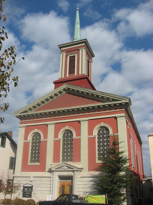
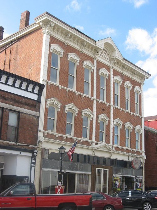
11 places in town are on the National Register, among them the Hillforest (Forest Hill), a National Historic Landmark, and a historic district with 272 buildings. Below: 11 old photos and papers, maps from 1887 on, and the census since 1850.
The Aurora post office opened in 1819, the earliest record of the town by name. Another post office, Cochran (1858), opened inside today’s city and later closed.
First census: 1,954 in 18502020 census: 3,479207 years
How did Aurora get its name?
Aurora was named for Aurora, the goddess of dawn in Roman mythology.
How historic is Aurora?
A+
More historic than 98% of U.S. towns, on its age, its old homes and the National Register.
On its age, its old homes and the National Register, Aurora is more historic than 98% of U.S. towns, #30 of 593 in Indiana. All 3 inputs are above most U.S. towns; its National Register listings ranks highest and its age lowest.
A+
HistoryA character grade: shown, never part of Aurora’s overall grade.
Indiana towns list more on the Register than most of the country (a typical Indiana town has 7.9 per 10,000 residents, the U.S. 2.4), so Aurora’s 779 sits above most of its state (98% of Indiana towns have fewer) while its 284 historic buildings outnumber those of 95% of U.S. towns.
How sure. Graded on any two of the three inputs instead, the letter would range from A to A+. The pre-1940 share is a Census survey estimate (±11.1 points). The founding year is the first post office, not a stated founding date.
Founding year: the first post office (other dates in Quick answers). Homes: Census ACS 2020–24. National Register: National Park Service, May 2026 list; each listing counted once (boundary changes and added documentation belong to their listing), and a historic district counts its contributing buildings. How TownRatings grades history →
What stands out about Aurora’s past
Read from the archive, the National Register and the record. The page puts what stands out first.
National Park Service, National Register of Historic Places. Photos from Wikimedia Commons, credited on each place’s page.
Every building
Aurora, building by building, 1887–1917
Fire insurance maps drew every building, what it was made of and what it was used for, so insurers could price the risk of fire. Pick a year, then a sheet.
Aurora was platted in 1819. It was named for Aurora, the goddess of dawn in Roman mythology. Aurora was incorporated as a town in 1822 and became a city in 1848, though some sources say 1845.
Aurora is known for its historic downtown area and the ornate Hillforest mansion built for Thomas Gaff who earned his fortune shipping goods on the Ohio River by steamboat. The mansion was designed by architect Isaiah Rogers and was completed in 1855 in the Italian Renaissance style. The design is symmetrical. Details include deep overhangs, arched windows and balconies and porches. Hillforest was declared a National Historic Landmark in 1992.
Passages that mention Aurora, cut from the printed page as they were published.
History of Dearborn County Indiana1915 · page 158Read the page →
Read the text
The town of Cochran, now incorporated with Aurora, on the right bank of South Hogan creek, joins the city of Aurora. The Baltimore & Ohio Southwestern railway passes through it and the main street is the Aurora and Laughery turnpike. On account of the car shops of the railway company being erected here when the road was first constructed the town owes its origin. The town was laid out in section 31, township 5, range 1 west, and was platted and filed in the recorder's office of the county on August 25, i860. The postoffice was established in 1878, on July 4, with A. P. Shutts
Text read by machine from the scan; it may contain errors.
History of Dearborn County Indiana1915 · page 686Read the page →
Read the text
at Aurora, subsequently being engaged in the restaurant business for a period of seven years, at the end of which time he engaged in the livery business and still owns a livery bam in Aurora, having operated this barn for a period of six years before his election as sheriff. He prospered in this business and became, during his residence in Aurora, a well-known citizen, not only of Aurora, but of all Dearborn county.
Text read by machine from the scan; it may contain errors.
Scans and text from the Internet Archive. Books published in 1930 or earlier, which are in the public domain.
Timeline
Aurora, 1819 to 1992
Woven from the archive, old maps, post office records, the National Register and the people born here.
Nothing in the archives for these yearsWeddings on Main Street, storms, parades, school pictures, the old store. If it’s in your family album, it belongs here.
Nothing in the archives for these yearsWeddings on Main Street, storms, parades, school pictures, the old store. If it’s in your family album, it belongs here.
The Aurora post office opened in 1819, the earliest record of the town by name (U.S. post office records).
How does Aurora rank for history?
Aurora is more historic than 98% of U.S. towns, #30 of 593 in Indiana. The History grade combines the town’s founding era, the share of homes built before 1940 and its National Register listings. It’s a character grade, so it isn’t part of the overall grade. How it works.
What is on the National Register in Aurora?
11 listings: 9 buildings, among them the Hillforest (Forest Hill) (a National Historic Landmark since 1992), 1 historic district, the Downtown Aurora Historic District, with 272 contributing buildings, and 1 structure. 284 historic buildings in all.
How old are the homes in Aurora?
39% of Aurora’s homes were built before 1940 (Census estimate, ±11.1 points), against a typical 14% for an Indiana town; the median home was built in 1952.
Founding dates: Wikidata, Wikipedia, the U.S. post office records of Blevins & Helbock (CC0) and the Census. Homes by year built: Census ACS 2020–24. National Register of Historic Places: National Park Service (list of May 22, 2026). Old photos, postcards and papers: Wikimedia Commons, the Library of Congress and other public archives, credited on each item’s page. Maps: U.S. Geological Survey historical topographic maps (via Esri) and Sanborn fire-insurance maps (Library of Congress). History text and census tables: Wikipedia (CC BY-SA 4.0). Places that used to be: USGS Geographic Names Information System (2021).
From Wikimedia Commons (13), Wikidata (5), the National Register of Historic Places (11), Wikipedia, Wikidata and Wikipedia for famous people, U.S. Geological Survey historical maps, U.S. Census counts (via Wikipedia), the US Post Offices dataset (Blevins & Helbock), the USGS Geographic Names Information System, Sanborn fire insurance maps (Library of Congress) and old county and town histories (Internet Archive). Archive images are copied here with their credits and licenses, shown on each photo’s page. Refreshed monthly.


 ★ Landmark






 1875
 1875
 1875
 1875
 1875
 1875
 1875
 1875
 2018
 2017


