The Abington Township post office opened in 1824, the earliest record of the town by name. Another post office, Abington (1824), opened inside today’s town and later closed.
2020 census: 786202 years
Founding year: the first Abington Township post office (Blevins & Helbock, CC0).The full story ↓
What stands out about Abington Township’s past
Read from the archive, the National Register and the record. The page puts what stands out first.
A post office was established at Abington in 1824, and remained in operation until it was discontinued in 1903. The name of this Quaker settlement recalled the Abington Monthly Meeting of the Society of Friends located in Pennsylvania.
In 1890, the population was estimated as around 200 residents. In 1900, the population was 186.
By 1920, the population was 150. The population was 80 in 1940.
Passages that mention Abington Township, cut from the printed page as they were published.
History of Wayne County, Indiana1884 · page 764Read the page →
Read the text
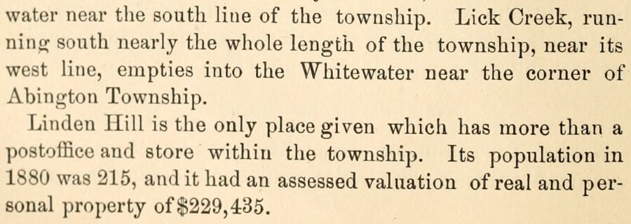
water near the south line of the township. Lick Creek, running south nearly the whole length of the township, near its west line, empties into the Whitewater near the corner of Abington Township. Linden Hill is the only place given which has more than a postoffice and store within the township. Its population in 1880 was 216, and it had an assessed valuation of real and personal property of $229,435.
Text read by machine from the scan; it may contain errors.
Scans and text from the Internet Archive. Books published in 1930 or earlier, which are in the public domain.
Every edition of the U.S. Geological Survey’s map of Abington Township. Tap a year, or press play to watch the town change.
1960Liberty sheet · 1:24,000
U.S. Geological Survey historical topographic maps (public domain), via Esri’s collection of the scans. The red ring marks the center of Abington Township.
Places that used to be
Lost post offices, old corners, places now gone and burying grounds
Another post office, Abington, opened and closed inside today’s town.
Hamlets and corners on the map
Abington
Gone or out of use
Squires Airportairport
1cemetery inside Abington Township
Locust Grove Methodist Episcopal
US Post Offices dataset (Blevins & Helbock, CC0). Places and cemeteries from the USGS Geographic Names Information System (2021).
Stories next door
History across the town line
Each neighbor’s History grade, on the same three inputs.
Founding dates: Wikidata, Wikipedia, the U.S. post office records of Blevins & Helbock (CC0) and the Census. Homes by year built: Census ACS 2020–24. National Register of Historic Places: National Park Service (list of May 22, 2026). Old photos, postcards and papers: Wikimedia Commons, the Library of Congress and other public archives, credited on each item’s page. Maps: U.S. Geological Survey historical topographic maps (via Esri) and Sanborn fire-insurance maps (Library of Congress). History text and census tables: Wikipedia (CC BY-SA 4.0). Places that used to be: USGS Geographic Names Information System (2021). How TownRatings grades history →
From Wikimedia Commons (2), Wikipedia, U.S. Geological Survey historical maps, the US Post Offices dataset (Blevins & Helbock), the USGS Geographic Names Information System and old county and town histories (Internet Archive). Archive images are copied here with their credits and licenses, shown on each photo’s page. Refreshed monthly.


 2016
 2011

