Guest, Sign inJoin

Post to Wheeling Township

We’ll email a one-tap link to publish your post. No password, and nothing is public until you click it.
Already a member? Sign in
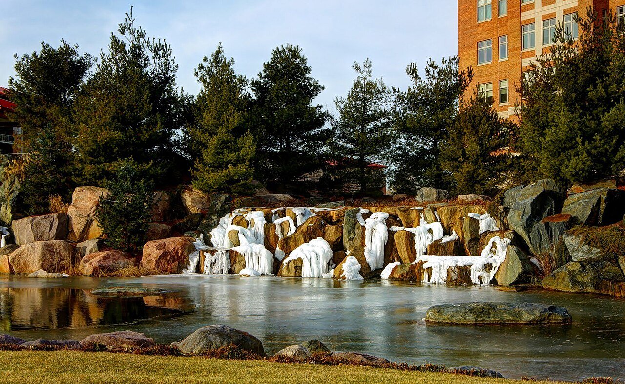
Wheeling, IL, USA - panoramioPhoto: bogdanstepniak · CC BY 3.0
B+Outdoors
Outdoors in Wheeling Township

5% of Wheeling Township’s land is conserved, and 98% of residents live within a half mile of a park

The biggest trail networks: Heritage Park (2.5 mi), Potawatomi Woods Preserve (1.4 mi), Frontier Park (0.9 mi). 19 miles of mapped trail cross Wheeling Township, 0.5 per square mile of land. 5% of Wheeling Township’s land is conserved, about 1,179 acres.

Ahead of 71% of U.S. towns · #291 of 768 in Illinois. What drives it

Conserved land
5%
1,179 acres · of 35.9 sq mi of land
Trails
19 mi
0.5 per sq mi of land
Park land
1,315 ac
8.5 acres per 1,000 residents
Near a park
98%
of residents within ½ mile
Bike routes
51 mi
6.8 mi lanes · 39 mi paths
Lakes & rivers
5
1 beach · 1 boat launch

What kind of outdoors town is Wheeling Township?

Read from the map. The page puts what stands out first.

Outdoors grade

How much outdoors does Wheeling Township have?

On conserved land, trails, park land and how close residents live to a park, Wheeling Township is ahead of 71% of U.S. towns, #291 of 768 in Illinois. The share of residents near a park holds the grade up; park acres per resident pull it down.

B+
OutdoorsA character grade: shown, never part of Wheeling Township’s overall grade.
All U.S. towns we grade (21,298)Ahead of 71%
LessMore
Illinois towns of 2,500+ (768)Ahead of 62%

Among the 400 U.S. cities of 100,000 or more, Wheeling Township ranks #265 on Outdoors.

How sure. Graded on any three of the four inputs instead, the letter would range from B to A−. Trails and many small parks come from OpenStreetMap, mapped by volunteers, so coverage varies from town to town; the half mile is a straight line from each census block, so a river or highway in the way isn’t counted against it.

PAD-US, OpenStreetMap (© OpenStreetMap contributors), Census 2025 Gazetteer and 2020 blocks; details in Sources below. How TownRatings grades the outdoors →

The map

Conserved land, trails & bike routes

Tap a number to zoom to a park. Tap a layer to hide it.

12345678
Easements protect land from building but are usually private.© OpenStreetMap contributors · USGS PAD-US
Places to walk

Pick a walk

The longest trail network is Heritage Park, with 2.5 miles. Directions go to the nearest trailhead or public parking.

Heritage Park

Managed by Wheeling Park District
121 acres2.5 mi of trail
Dog rules not recorded
Directionsto the parking lot

Potawatomi Woods Preserve

Managed by Forest Preserve District of Cook County
333 acres1.4 mi of trail
Des Plaines River Trail
Dog rules not recorded
Directionsto the trailhead

Frontier Park

Managed by Arlington Heights Park District
31 acres0.9 mi of trail
Dog rules not recorded
No trailhead mapped yet

Hasbrook Park

Managed by Arlington Heights Park District
13 acres0.9 mi of trail
Dog rules not recorded
Directionsto the parking lot

Centennial Park

Managed by Arlington Heights Park District
23 acres0.6 mi of trail
Dog rules not recorded
No trailhead mapped yet

Camelot Park

Managed by Arlington Heights Park District
12 acres0.6 mi of trail
Dog rules not recorded
No trailhead mapped yet

Lake Arlington Park

Managed by Arlington Heights Park District
94 acres0.5 mi of trail
Dog rules not recorded
No trailhead mapped yet

Willow Trails Park

Managed by River Trails Park District
12 acres0.5 mi of trail
Dog rules not recorded
Directionsto the parking lot
All 93 parks & preserves
Heritage Park121 acres · 2.5 mi of trail · Wheeling Park District
Directions
Potawatomi Woods Preserve333 acres · 1.4 mi of trail · Forest Preserve District of Cook County
Directions
Frontier Park31 acres · 0.9 mi of trail · Arlington Heights Park District
Hasbrook Park13 acres · 0.9 mi of trail · Arlington Heights Park District
Directions
Centennial Park23 acres · 0.6 mi of trail · Arlington Heights Park District
Camelot Park12 acres · 0.6 mi of trail · Arlington Heights Park District
Lake Arlington Park94 acres · 0.5 mi of trail · Arlington Heights Park District
Willow Trails Park12 acres · 0.5 mi of trail · River Trails Park District
Directions
Husky Park11 acres · 0.4 mi of trail · Wheeling Park District
Raven Park10 acres · 0.4 mi of trail · Arlington Heights Park District
Wildwood Park8 acres · 0.4 mi of trail · Arlington Heights Park District
Hill Street Nature Center5 acres · 0.4 mi of trail · Mount Prospect Park District
Directions
Arlington Greens Park5 acres · 0.4 mi of trail · Arlington Heights Park District
Directions
Dam Number 1 Woods Preserve607 acres · 0.3 mi of trail · Forest Preserve District of Cook County
Directions
Recreation Park18 acres · 0.3 mi of trail · Arlington Heights Park District
Directions
Chamber Park6 acres · 0.3 mi of trail
Directions
Volz Park5 acres · 0.3 mi of trail · Arlington Heights Park District
Directions
Green Slopes Park4 acres · 0.3 mi of trail · Arlington Heights Park District
Directions
Creekside Park15 acres · 0.2 mi of trail · Arlington Heights Park District
Flentle Park4 acres · 0.2 mi of trail · Arlington Heights Park District
Carriage Walk Park4 acres · 0.2 mi of trail · Arlington Heights Park District
Virginia Terrace Park3 acres · 0.2 mi of trail · Arlington Heights Park District
North School Park2 acres · 0.2 mi of trail · Arlington Heights Park District
Directions
Dam Number 2 Woods101 acres · 0.1 mi of trail · Forest Preserve District of Cook County
Directions
Camelot Connector Parkway13 acres · 0.1 mi of trail · Arlington Heights Park District
Childerley Park12 acres · 0.1 mi of trail · Wheeling Park District
Directions
Rand-Berkley Park12 acres · 0.1 mi of trail · Arlington Heights Park District
Directions
Mill Creek Park12 acres · 0.1 mi of trail · Buffalo Grove Park District
Busse Park7 acres · 0.1 mi of trail · Mount Prospect Park District
Directions
Bison Park7 acres · 0.1 mi of trail · Buffalo Grove Park District
Aspen Trails Park5 acres · 0.1 mi of trail · River Trails Park District
Directions
Fairview Park5 acres · 0.1 mi of trail · Mount Prospect Park District
Lake Terramere Park4 acres · 0.1 mi of trail · Arlington Heights Park District
Hickory Meadows Park3 acres · 0.1 mi of trail · Arlington Heights Park District
Directions
Prospect Meadows Park3 acres · 0.1 mi of trail · Mount Prospect Park District
Sunset Ridge Park3 acres · 0.1 mi of trail · Arlington Heights Park District
Emerson Park2 acres · 0.1 mi of trail · Mount Prospect Park District
Westgate Park2 acres · 0.1 mi of trail · Arlington Heights Park District
Portwine Preserve197 acres · Forest Preserve District of Cook County
Directions
Lake Avenue Woods Preserves90 acres · Forest Preserve District of Cook County
Directions
Melas Park69 acres · Mount Prospect Park District
Directions
Woodland Trails Park50 acres · River Trails Park District
Directions
Camp Pine Woods Preserve47 acres · Forest Preserve District of Cook County
Directions
Willow-Sanders Preserve43 acres · Forest Preserve District of Cook County
Directions
Sunset Meadows Park36 acres
Directions
Patriots Park35 acres · Arlington Heights Park District
Directions
Forest Preserve District of Cook County23 acres · Forest Preserve District of Cook County
Directions
Pioneer Park21 acres · Arlington Heights Park District
Directions
Willow Park20 acres
Sycamore Trails Park18 acres · River Trails Park District
Directions
Emmerich Park18 acres · Buffalo Grove Park District
Directions
Lions Park18 acres · Buffalo Grove Park District
Meadows Park15 acres · Mount Prospect Park District
Directions
Gregory Park12 acres · Mount Prospect Park District
Directions
Nickol Knoll Park12 acres
Directions
Tamarack Trails Park11 acres · River Trails Park District
Horizon Park11 acres · Wheeling Park District
Burning Bush Park9 acres · River Trails Park District
Methodist Park9 acres · Arlington Heights Park District
Greenbrier Park9 acres · Arlington Heights Park District
Directions
Cambridge Park7 acres · Buffalo Grove Park District
Directions
Carousel Park6 acres · Arlington Heights Park District
Windsor Parkway Park6 acres · Arlington Heights Park District
Allison Woods Preserve5 acres · Forest Preserve District of Cook County
Directions
Windsor Ridge Park5 acres · Buffalo Grove Park District
Ridge Park5 acres · Arlington Heights Park District
Directions
Kiwanis Park4 acres
Directions
Bluett Park4 acres · Mount Prospect Park District
Northside Park4 acres · Wheeling Park District
Directions
Weidner Park4 acres · Buffalo Grove Park District
Directions
Dryden Park4 acres · Arlington Heights Park District
Directions
Salceda Park3 acres
Directions
Happiness Park3 acres · Arlington Heights Park District
School Street Park3 acres
Directions
Evergreen Park3 acres · Arlington Heights Park District
Kylemore Greens Park2 acres · Des Plaines Park District
Klehm Park2 acres · Arlington Heights Park District
Rand Connector Parkway2 acres · Arlington Heights Park District
Directions
Maple Trails Park2 acres · River Trails Park District
Directions
Craig Manor Park2 acres · Des Plaines Park District
Berbecker Park2 acres · Arlington Heights Park District
Cronin Park2 acres · Arlington Heights Park District
Directions
Rose Garden Park2 acres · Arlington Heights Park District
Sandpebble Drive Park1 acres
Directions
Gloria Dei Presbyterian Church Walking Ground and Park1 acres
Shaag Park1 acres · Arlington Heights Park District
Jaycee Park1 acres · Mount Prospect Park District
Roth Park1 acres · Mount Prospect Park District
Banta Park1 acres · Arlington Heights Park District
Memorial Park1 acres · Arlington Heights Park District
Directions
Claire Lane Park1 acres · Prospect Heights Park District
East Wedgewood Park1 acres · Mount Prospect Park District
Harmony Park1 acres
Directions
Who protects it

1,179 conserved acres

5% of Wheeling Township’s land. Who manages Wheeling Township’s conserved land, from the USGS Protected Areas Database. Approximate, because parcels can overlap.

Town or city641 ac
Regional agency536 ac
State natural resources9 ac
Local Park · 951 acUnknown · 226 acConservation Easement · 9 ac
The biggest protected parcels
Parcel (PAD-US)Managed byAcresPublic access
Old Orchard Country Club
Unknown
Town or city103Open
Heritage Park
Local Park
Regional agency98Open
Lake Arlington Park
Local Park
Town or city92Open
Melas Park
Local Park
Regional agency69Open
Rob Roy Golf Course
Unknown
Town or city57Open
Woodland Trails Park
Local Park
Regional agency48Open
Sunset Meadows Park
Local Park
Town or city40Open
Aquadome Indoor Pool at BGHS
Unknown
Town or city33Open
Wheeling Park
Local Park
Regional agency26Open
Frontier Park
Local Park
Town or city24Open

5 smaller protected places aren’t shown.

Things to do

134 places to go in Wheeling Township

Beaches, playgrounds, peaks, falls and more. Pick a kind.

Picnic areas in Wheeling Township
Camp Pine Woods Grove #1In Camp Pine Woods Preserve
Directions
Dam No. 1 Woods-East Grove #1In Dam Number 1 Woods Preserve
Directions
Dam No. 1 Woods-East Grove #2In Dam Number 1 Woods Preserve
Directions
Dam No. 2 Woods Grove #1In Dam Number 2 Woods
Directions
Lake Avenue Woods-West Grove #2In Lake Avenue Woods Preserves
Directions
Massasauga Family Picnic AreaHours: sunrise-sunset · In Dam Number 1 Woods Preserve
Directions
Potawatomi Woods Grove #1In Potawatomi Woods Preserve
Directions

Plus 1 picnic area without a name on the map.

Trails & water

3 named trails and 5 lakes & rivers

Named trails
Open to bikes · 2.8 miUnpaved · 0.9 mi
St. Peter Cross-Country Course and Exer-Trail0.3 mi
Des Plaines River Trail0.1 mi
Busse Park Path0.1 mi
Lakes & rivers tap for directions
Biking & sports

51 miles of bike routes

Bike lanes are often missing from the map in smaller towns, so that number is likely low.

6.8 mi
painted or protected bike lanes
39 mi
off-road bike paths
5.2 mi
shoulders & shared lanes
Courts & fields
131Tennis
101Baseball
52Basketball
48Soccer
19Football
10Pickleball
6Field hockey
4Volleyball

Includes school and college facilities, which aren’t always open to the public.

When to get out

September is the best month for walking in Wheeling Township

NOAA’s 1991–2020 normals for the town and the daylight at its latitude. Outlined months have long days, highs of 59 to 86 °F and little rain for the place.

JanFebMarAprMayJunJulAugSepOctNovDec
Daylight (h)9.410.511.813.314.615.215.013.912.411.09.79.1
High (°F)313546587079848275624836
Rain (in)1.91.82.33.84.44.63.93.93.33.32.42.1

February is the driest month (1.8 in) and July the warmest (highs of 84 °F). 4.6 inches fall in June, the wettest month. The climate in Wheeling Township →

Next door

Wheeling Township and its neighbors

Tap a town to see its outdoors.

TownConserved
of land
Trail mi
per sq mi
Park acres
per 1,000
Near a park
½ mile
Outdoors
Wheeling Township5%0.5998%B+
Northfield Township9%1.71591%A
Palatine Township10%1.4897%A−
Vernon Township18%1.24797%A+
Arlington Heights5%0.6899%B+
Wheeling3%0.5695%B
Palatine5%0.5899%B+
Rolling Meadows4%0.4793%B

The four inputs of the Outdoors grade, from the engine; shares are of land, not water.

Questions about parks and trails in Wheeling Township

Where can I hike in Wheeling Township?

The longest trail networks: Heritage Park, 2.5 miles; Potawatomi Woods Preserve, 1.4 miles; Frontier Park, 0.9 miles; Hasbrook Park, 0.9 miles. Each one is on the map above, with directions to the nearest trailhead or parking.

How much of Wheeling Township is conserved land?

5% of its land, against a typical 4% for an Illinois town and 4% nationally (PAD-US). Conserved doesn’t always mean open to visitors: easements are usually private land.

Are dogs allowed on Wheeling Township’s trails?

Heritage Park and Potawatomi Woods Preserve don’t have dog rules recorded on the map; check the signs at the trailhead.

Where can I bike in Wheeling Township?

51 miles of bike routes are on the map: 6.8 of painted or protected lanes, 39 of off-road paths and 5.2 of shoulders and shared lanes.

Is there public land near Wheeling Township?

19,403 acres of parks and open public land lie inside Wheeling Township or within 10 miles of it (PAD-US), 1,364 of them inside the town line.

How much outdoors does Wheeling Township have?

Ahead of 71% of U.S. towns on the Outdoors grade, #291 of 768 in Illinois. The grade combines the share of land that is conserved, miles of mapped trail per square mile of land, park acres per 1,000 residents and the share of residents within a half mile of a park. It’s a character grade, so it isn’t part of the overall grade. How it works.

Trail talk

Conditions, parking and favorite walks from Wheeling Township neighbors.

Town Square →
Share a tip
Sources

Where this page comes from

Conserved and public land: USGS Protected Areas Database of the United States (PAD-US), service updated July 2026. Parks, trails, playgrounds, beaches and other places: OpenStreetMap (© OpenStreetMap contributors, ODbL), map data as of 2026-10-28. Land and water area: Census 2025 Gazetteer. Residents near a park: 2020 Census blocks. National Register: National Park Service. How TownRatings grades the outdoors →