Wapella was founded in 1854, but settlers were arriving in Wapella as early as 1829 due to the dense timber and rich soil. The name of the village comes from Chief Wapello of the Meskwaki people. A group of settlers from Kentucky were the first Europeans to call Wapella home. A short time later a substantial group of Irish immigrants moved to Wapella to build and work on the Illinois Central Railroad. Wapella was laid out by David Augustus Neal, vice president and a surveyor of the Illinois Central Railroad Line. The village population was approximately 500 residents by the beginning of the Civil War.
Passages that mention Wapella, cut from the printed page as they were published.
... History of De Witt county, Illinois. With illustrations descriptive of the scenery, and biographical sketches of some of the prominent men and pioneers1882 · page 105Read the page →
Read the text
This school-house was located in what is now Wapella township, about a mile and a half north of the town of Wapella. It was a little, rqugh log cabin, and was used but one year, when a larger and better house was erected nearer the centre of the present district and on the same hill where Liberty school-house now stands. This was the first school-house to have a floor and a glass window. For several years subsequent to this, however, the school-rooms were lighted by removing a log the full length
Text read by machine from the scan; it may contain errors.
... History of De Witt county, Illinois. With illustrations descriptive of the scenery, and biographical sketches of some of the prominent men and pioneers1882 · page 106Read the page →
Read the text
school fund is (S108.'i.38.) Their prf-sont trustee is Wm. Gambrel, Sr , and their present treasurer, William Cantrell, who has served in that capacity about sixteen years Wapella. —The earliest school history of what is now Wapella township has been referred to above. In 1848 the first frame f chool house was built in the township, and Trustum Hull taught the first school in it. He continued to teach very succe.s.sfully in the schools of different townships for several years. Since his
Text read by machine from the scan; it may contain errors.
Scans and text from the Internet Archive. Books published in 1930 or earlier, which are in the public domain.
Timeline
Wapella, 1854 to 1980
Woven from the archive, old maps, post office records, the National Register and the people born here.
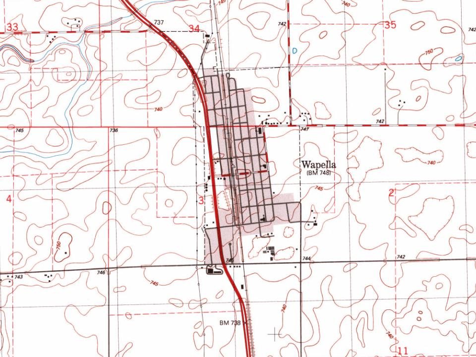
Every edition of the U.S. Geological Survey’s map of Wapella. Tap a year, or press play to watch the town change.
1953Clinton sheet · 1:24,000
U.S. Geological Survey historical topographic maps (public domain), via Esri’s collection of the scans. The red ring marks the center of Wapella.
Questions about Wapella’s history
What year was Wapella founded?
In 1854, according to Wikidata and Wikipedia’s history of the town. Wapella’s post office opened in 1855, and the census of 1880 counted 369 people here.
Founding dates: Wikidata, Wikipedia, the U.S. post office records of Blevins & Helbock (CC0) and the Census. Homes by year built: Census ACS 2020–24. National Register of Historic Places: National Park Service (list of May 22, 2026). Old photos, postcards and papers: Wikimedia Commons, the Library of Congress and other public archives, credited on each item’s page. Maps: U.S. Geological Survey historical topographic maps (via Esri) and Sanborn fire-insurance maps (Library of Congress). History text and census tables: Wikipedia (CC BY-SA 4.0). Places that used to be: USGS Geographic Names Information System (2021). How TownRatings grades history →
From Wikimedia Commons (1), Wikipedia, U.S. Geological Survey historical maps, U.S. Census counts (via Wikipedia), the US Post Offices dataset (Blevins & Helbock), the USGS Geographic Names Information System and old county and town histories (Internet Archive). Archive images are copied here with their credits and licenses, shown on each photo’s page. Refreshed monthly.


 2006