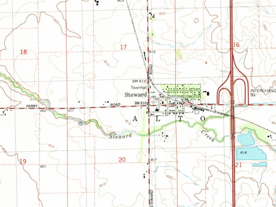
Steward, Illinois, was named for Wesley Steward, who in 1855 came to this area in Alto Township to settle the land owned by his father, Marcus Steward. John Grimes built the first house in Alto Township in Plum Thicket in 1847, located east on the outskirts of the village as it is today. In 1861, Mr. Steward married and built the first farm house in the location of Steward, which is still standing. The town is located in the west central part of Alto Township and the northeast part of Lee County. Mr. Steward was influential in getting the Chicago and Iowa Railroad, now known as the Burlington Northern, through the township extending from Hinckley, Illinois to Rochelle, Illinois completed in 1870. The Village Hall on Main Street is one of the oldest buildings in existence and the jail cells bought in 1903 and housed in the building are still one of the few reminders of the early days (no…
Passages that mention Steward, cut from the printed page as they were published.
History of Lee County, Illinois1914 · page 263Read the page →
Read the text
The village of Steward stands upon the corners of four sections, 16, 17, 20 and 21, and Main and Dewey streets form the dividing lines. The town site was selected by Wesley Steward, on his lands, and he platted the village in 1870. William McMahan, the then coimty surveyor, made the survey of the plat, and S. O. Barnett, still a resident of Steward, assisted him in the performance of that job, as chainman.
Text read by machine from the scan; it may contain errors.
The village of Steward is situated a trifle west of the center of the town of Alto. Its location is excellently drained, the water supply is bountiful, easily obtained, and is justly celebrated for its purity. The town is located on the Chicago & Iowa railroad, just halfway between its termini, Aurora and Forreston. It was surveyed and platted just subsequent to the completion of the above named road, in the year 1870, and although its growth has not been rapid it has been of a healthy and substantial character. The village derives its name from
Text read by machine from the scan; it may contain errors.
The village of Steward is ouly six uiiles from Rochelle aud very naturally trade at Rochelle, the larger place, would gravitate that way, but Steward has some spleudid stocks of geueral merchandise and the merchauts enjo}' a splendid trade, running as high as hftytive thousand dollars in a single year, 1 have been told, with one of them, Mr. John P. Yetter, the postmaster.
Text read by machine from the scan; it may contain errors.
Scans and text from the Internet Archive. Books published in 1930 or earlier, which are in the public domain.
Timeline
Steward, 1871 to 1996
Woven from the archive, old maps, post office records, the National Register and the people born here.
Founding dates: Wikidata, Wikipedia, the U.S. post office records of Blevins & Helbock (CC0) and the Census. Homes by year built: Census ACS 2020–24. National Register of Historic Places: National Park Service (list of May 22, 2026). Old photos, postcards and papers: Wikimedia Commons, the Library of Congress and other public archives, credited on each item’s page. Maps: U.S. Geological Survey historical topographic maps (via Esri) and Sanborn fire-insurance maps (Library of Congress). History text and census tables: Wikipedia (CC BY-SA 4.0). Places that used to be: USGS Geographic Names Information System (2021). How TownRatings grades history →
From Wikimedia Commons (4), the Library of Congress (6), Wikipedia, U.S. Geological Survey historical maps, U.S. Census counts (via Wikipedia), the US Post Offices dataset (Blevins & Helbock), the USGS Geographic Names Information System and old county and town histories (Internet Archive). Archive images are copied here with their credits and licenses, shown on each photo’s page. Refreshed monthly.


 1996
 1996
 2020
 2020
 2020
 2020
 2020
 2020
 2008