Peaked at 701 in 1980; 498 people lived here in 2020.
14 censuses, 1880–2020.
U.S. Census Bureau decennial counts, from the census table on Reynolds’ Wikipedia page.
On the map
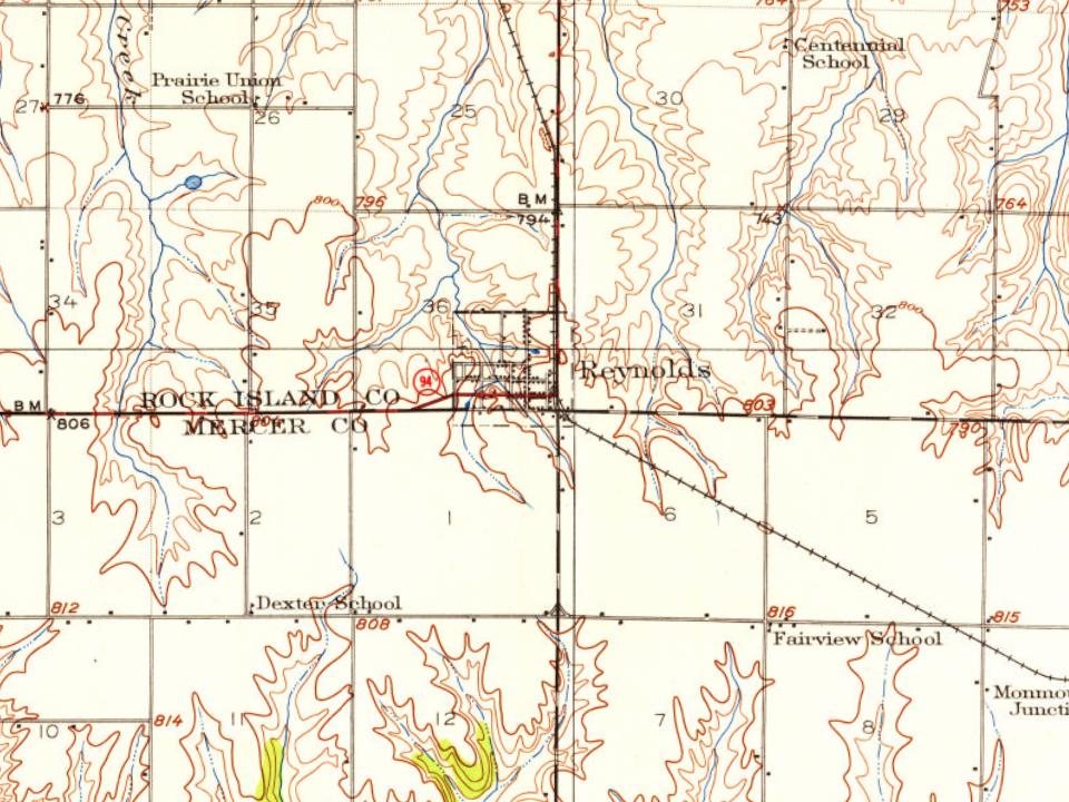
Reynolds on the map, 1912 to 1991
Every edition of the U.S. Geological Survey’s map of Reynolds. Tap a year, or press play to watch the town change.
1912Milan sheet · 1:62,500
U.S. Geological Survey historical topographic maps (public domain), via Esri’s collection of the scans. The red ring marks the center of Reynolds.
The story so far
Reynolds, in brief
Wikipedia doesn’t have a history of Reynolds yet. The photos, dates and memories neighbors add here are how it gets written.
Reynolds is a village mainly in Rock Island County in the U.S. state of Illinois. The population was 498 at the 2020 census. A small portion on the south side is in Mercer County. The village was founded in 1876.
Reynolds was established in 1876. Between the 2010 and 2020 censuses its population fell from 539 to 498 (-8%).
Intro from Wikipedia. Population: U.S. Census Bureau.
From the old history books
What they wrote about Reynolds, 1877–1908
Passages that mention Reynolds, cut from the printed page as they were published.
Past and present of Rock Island County, Ill., containing a history of the county--its cities, towns, etc., a biographical directory of its citizens, war record of its volunteers in the late Rebellion, portraits of early settlers and prominent men ..1877 · page 318Read the page →
Read the text
Wait & Wagner, Proprietors of the town of Reynolds, situated on the Rock Island and Mercer Co. Railroad, in Edgington township; it is one of the most beautiful sites for a town in the State; the first building was erected in Oct., 1876; five stores, lumber yards, black-
Text read by machine from the scan; it may contain errors.
Railroad Company, ilr. Walker ran a general store furnishing supplies during that same year. They also purchased the land where the village of Reynolds now stands, and laid out that town, later going into the lumber business there, and continuing in that business until the winter of 1887. In February, 1882, Mr. Walker moved from Rock Island to
Text read by machine from the scan; it may contain errors.
Portrait and biographical album of Rock Island County, Illinois1885 · page 799Read the page →
Read the text
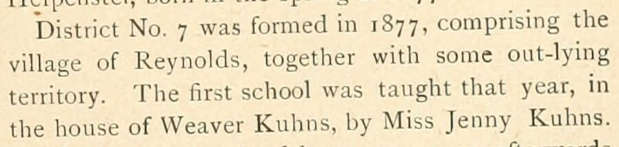
District No. 7 was formed in 1877, comprising the village of Reynolds, together with some out-lying territory. The first school was taught that year, in the house of Weaver Kuhns, by Miss Jenny Kuhns.
Text read by machine from the scan; it may contain errors.
Portrait and biographical album of Rock Island County, Illinois1885 · page 378Read the page →
Read the text
chased 160 acres of land on section 36, Edgington Township, and 80 acres adjoining the same, located in Mercer County. On the 160-acre purchase they platted the present village of Reynolds, the original plat and subsequent additions comprising the entire original purchase, and established a grain and hay market at that place. Mr. Walker started the first store at Reynolds, which he kept in the depot. He
Text read by machine from the scan; it may contain errors.
Scans and text from the Internet Archive. Books published in 1930 or earlier, which are in the public domain.
Timeline
Reynolds, 1876 to 1980
Woven from the archive, old maps, post office records, the National Register and the people born here.
In 1876, according to Wikidata and Wikipedia’s history of the town. Reynolds’ post office opened in 1877, and the census of 1880 counted 192 people here.
Founding dates: Wikidata, Wikipedia, the U.S. post office records of Blevins & Helbock (CC0) and the Census. Homes by year built: Census ACS 2020–24. National Register of Historic Places: National Park Service (list of May 22, 2026). Old photos, postcards and papers: Wikimedia Commons, the Library of Congress and other public archives, credited on each item’s page. Maps: U.S. Geological Survey historical topographic maps (via Esri) and Sanborn fire-insurance maps (Library of Congress). History text and census tables: Wikipedia (CC BY-SA 4.0). Places that used to be: USGS Geographic Names Information System (2021). How TownRatings grades history →
From Wikimedia Commons (1), U.S. Geological Survey historical maps, U.S. Census counts (via Wikipedia), the US Post Offices dataset (Blevins & Helbock), the USGS Geographic Names Information System, Sanborn fire insurance maps (Library of Congress) and old county and town histories (Internet Archive). Archive images are copied here with their credits and licenses, shown on each photo’s page. Refreshed monthly.




 2006


