Before 1837, the area was occupied by Native Americans who utilized it for hunting grounds; the Sioux tribe had a camp near Oneco. Game that populated the Orangeville area included buffalo and deer. John H. Curtis purchased the 80 acres (32 ha) of land, which included the area that would eventually become Orangeville, on January 1, 1838, at the United States General Land Office in Dixon. Curtis constructed a dam on Richland Creek, and on the creek's west bank erected a gristmill and a saw mill. Curtis died in 1843 and both mills stood idle until John Bower arrived in 1846, with his family, after having visited the area the year before. Bower purchased the 80 acres (32 ha) and the mills.
Passages that mention Orangeville, cut from the printed page as they were published.
History of Stephenson County, Illinois1910 · page 401Read the page →
Read the text
In the year 1888 the Madison branch of the Illinois Central Railroad built its tracks through Orangeville and the village at once became a place of great importance. Numerous brick stores and office buildings were built on the main street, known as High street, and the community became a prosperous, thrifty little town. And so it remains. There will never be any great additional development in Orangeville, for the time for that is past. If Orangeville was ever to be a city, it must have become one long ago, and it never reached that status. However, its existence as a thriving village is quite assured. Orange-
Text read by machine from the scan; it may contain errors.
History of Stephenson County, Illinois1910 · page 407Read the page →
Read the text
On leaving Orangeville, he disposed of his business to L. I. Hutchins, a brother of Dr. I. N. Hutchins, who is at present practising medicine in Orangeville. Mr. Hutchins ran the "Courier" for two years and. then sold it to Joseph Upp. Mr. Hutchins is now engaged in the printing business in Monmouth, Illinois.
Text read by machine from the scan; it may contain errors.
The History of Stephenson County, Illinois1880 · page 712Read the page →
Read the text
Church JOHN BOWER, retired farmer, Orangeville ; born in Union Co., Penn., June 30, 1805; visited Stephenson Co. in 1843, and returned for his family; on coming West then, he settled in Oneco, in April, 1846 ; while in Pennsylvania, he learned the carpenter trade, which he followed until comins West ; in the spring of 1846, he located on Sec. 36, and built not four rods from where the Orangeville tavern now stands; he had also bought the water-power, and in 1848, started Bower's grist mill, now called White Hall Mills ; he laid out the village of Orangeville, then called
Text read by machine from the scan; it may contain errors.
The History of Stephenson County, Illinois1880 · page 555Read the page →
Read the text
country, the departure of volunteers, and other causes producing similar effects elsewhere. The last half of the decade beginning with 1860, however, witnessed an improved state of public feeling, producing a better market for commodities and correspondingly prosperous times. Orangeville of course participated in these benefits, and so pronounced was the success which attended her development and building-up, that in 1867 the village was incorporated as a town, with such prerogatives and privileges appertaining thereto as by law are conferred, including town officers, the following being the roster of those
Text read by machine from the scan; it may contain errors.
Scans and text from the Internet Archive. Books published in 1930 or earlier, which are in the public domain.
Timeline
Orangeville, 1851 to 1939
Woven from the archive, old maps, post office records, the National Register and the people born here.
Founding dates: Wikidata, Wikipedia, the U.S. post office records of Blevins & Helbock (CC0) and the Census. Homes by year built: Census ACS 2020–24. National Register of Historic Places: National Park Service (list of May 22, 2026). Old photos, postcards and papers: Wikimedia Commons, the Library of Congress and other public archives, credited on each item’s page. Maps: U.S. Geological Survey historical topographic maps (via Esri) and Sanborn fire-insurance maps (Library of Congress). History text and census tables: Wikipedia (CC BY-SA 4.0). Places that used to be: USGS Geographic Names Information System (2021). How TownRatings grades history →
From Wikimedia Commons (7), Wikidata (1), the National Register of Historic Places (4), Wikipedia, Wikidata and Wikipedia for famous people, U.S. Geological Survey historical maps, U.S. Census counts (via Wikipedia), the US Post Offices dataset (Blevins & Helbock), the USGS Geographic Names Information System, Sanborn fire insurance maps (Library of Congress) and old county and town histories (Internet Archive). Archive images are copied here with their credits and licenses, shown on each photo’s page. Refreshed monthly.


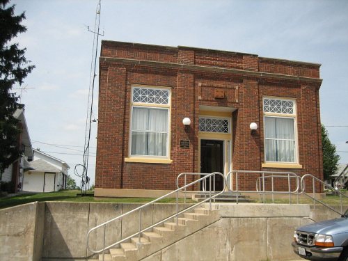


 2007
 2007
 2007
 2007
 2007
 2007
 2005


