Normal Township dates to 1854, and 8 of its places are on the National Register
Most of Normal Township was built recently: 5% of its homes predate 1940 and the median home dates from 1988. Below: 9 old photos and papers, maps from 1926 on, and the census since 1860.
The town was laid out with the name North Bloomington on June 7, 1854, by Joseph Parkinson. From its founding, it was generally recognized that Jesse W. Fell was the force behind the creation of the town. He had arranged for the new railroad, which would soon become the Chicago and Alton Railroad, to pass west of Bloomington and then curve to cross the Illinois Central Railroad at a point where he owned or controlled land. Most of the original town lies south of these tracks, with Beaufort Street as its northern limit, and some blocks west of the Illinois Central and north of the tracks. Fell, his brothers, and associates quickly laid out many additions to the original town.
Passages that mention Normal Township, cut from the printed page as they were published.
History of Bloomington and Normal, in McLean County, Illinois1879 · page 115Read the page →
Read the text
For the sake of greater clearness, we shall here omit any particular mention of the first settlers in Normal Township, and insert that information in another chapter by itself. We might state, that in 1857, the township was generally occupied by farmers, the village of North Bloomington having been platted and a few houses built, but to all practical intents, the entire township was simply an agricultural district.
Text read by machine from the scan; it may contain errors.
History of McLean County, Illinois1924 · page 113Read the page →
Read the text
Normal Township. — The boundaries of Normal Township and the city of Bloomington formerly overlapped each other, that part of the city of Bloomington between Empire and Division Streets being located within Normal Township. This made a confusing state of affairs especially in election precincts. This was remedied in the year when the voters of Bloomington organized the township of the city of Bloomington, whose boundaries were co-extensive with the city limits. Normal Township thus lost some of its territory and population.
Text read by machine from the scan; it may contain errors.
History of Bloomington and Normal, in McLean County, Illinois1879 · page 131Read the page →
Read the text
All that portion of Normal Township included within the limits of the city of Bloomington was settled and improved, of course, with the city, and its history is included in that of the city proper ; just outside of this territory we shall find its history is also nearly identical. As we go further north, the land was early improved, the settlements extending northward quite gradually from the center to the northern edge, wbere in the northern half there was considerable Government land as late as in 1850, when the Illinois Central charter granted all such tracts to that corporation. Between 1850 and 1856, nearly all this northern portion was purchased by farmers, and improve-
Text read by machine from the scan; it may contain errors.
The History of McLean County, Illinois1879 · page 442Read the page →
Read the text
The world-renowned nurseries of Mr. F. K. Phoenix were also in Normal Township. These are described elsewhere in this work. A.t one time the different nurserymen in Normal Township cultivated over one thousand acres of land in trees and small fruit. Even now, notwithstanding the falling-off in the trade, there is probably no town in this State that has as much ground devoted to nurseries as has Normal. Several of these are devoted almost wholly to raspberries, blackberries and small fruits. Among those who are interested both in trees and fruit, in addition to the ones mentioned, are H. K. Vickroy and others.
Text read by machine from the scan; it may contain errors.
Scans and text from the Internet Archive. Books published in 1930 or earlier, which are in the public domain.
Timeline
Normal Township, 1854 to 1926
Woven from the archive, old maps, post office records, the National Register and the people born here.
Nothing in the archives for these yearsWeddings on Main Street, storms, parades, school pictures, the old store. If it’s in your family album, it belongs here.
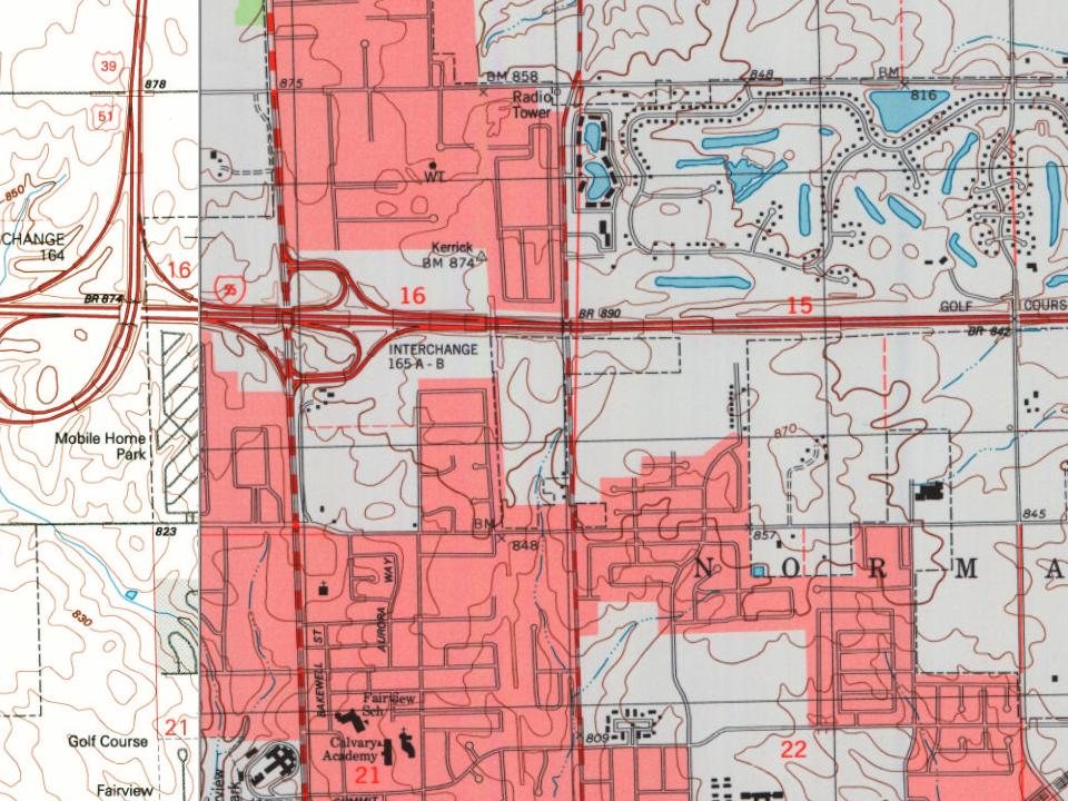
Every edition of the U.S. Geological Survey’s map of Normal Township. Tap a year, or press play to watch the town change.
1926Normal sheet · 1:62,500
U.S. Geological Survey historical topographic maps (public domain), via Esri’s collection of the scans. The red ring marks the center of Normal Township.
Then & now
Stand where they stood
No then-and-now pairs yet. Take a photo from the same spot as an old one and they appear here side by side.
Retake this view1940 Census Enumeration District Maps - Illinois - McLean County - Normal - ED 57-69, ED 57-70, ED 57-71, ED 57-72, ED …, 1880
Find the spot, match the angle, and add your photo. It becomes the first then-and-now pair on Normal Township’s page.
Founding dates: Wikidata, Wikipedia, the U.S. post office records of Blevins & Helbock (CC0) and the Census. Homes by year built: Census ACS 2020–24. National Register of Historic Places: National Park Service (list of May 22, 2026). Old photos, postcards and papers: Wikimedia Commons, the Library of Congress and other public archives, credited on each item’s page. Maps: U.S. Geological Survey historical topographic maps (via Esri) and Sanborn fire-insurance maps (Library of Congress). History text and census tables: Wikipedia (CC BY-SA 4.0). Places that used to be: USGS Geographic Names Information System (2021). How TownRatings grades history →
From Wikimedia Commons (10), the Library of Congress (6), Wikipedia, U.S. Geological Survey historical maps, U.S. Census counts (via Wikipedia), the US Post Offices dataset (Blevins & Helbock), the USGS Geographic Names Information System and old county and town histories (Internet Archive). Archive images are copied here with their credits and licenses, shown on each photo’s page. Refreshed monthly.


 1880
 1890
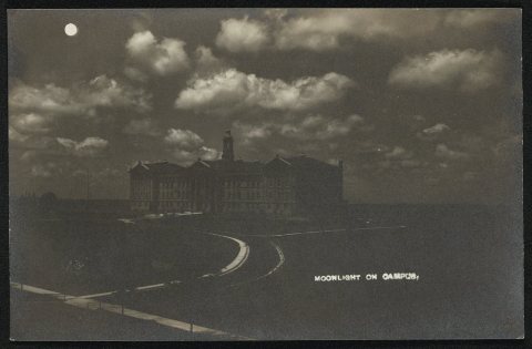 1909
 1914
 1917
 2011
 2011
 2010
 2008
 2008
 2007
 2007