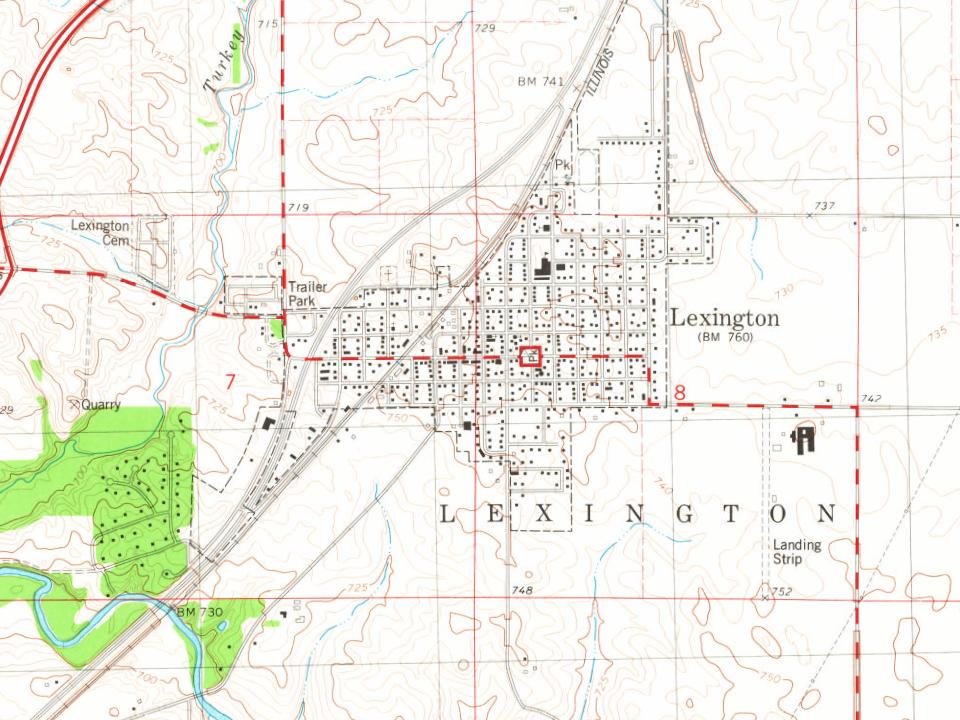
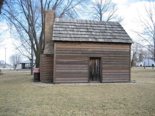
Its Register listings are the Patton, John, Log Cabin and the David Hyatt Van Dolah House. Below: 8 old photos and papers, maps from 1885 on, and the census since 1880.
Founding year: Wikidata; Wikipedia’s history section gives the same year. First post office: 1837.The full story ↓
History grade
What drives Lexington’s History grade
On its age, its old homes and the National Register, Lexington is more historic than 84% of U.S. towns. All 3 inputs are above most U.S. towns; its age ranks highest and its share of homes from before 1940 lowest.
A−
HistoryA character grade: shown, never part of Lexington’s overall grade.
Few Illinois towns list much on the Register (a typical Illinois town has 0.5 per 10,000 residents, the U.S. 2.4), so Lexington’s 14.1 sits above most of its state (85% of Illinois towns have fewer) while its 3 historic buildings outnumber those of 65% of U.S. towns.
How sure. Graded on any two of the three inputs instead, the letter would still be A−. The pre-1940 share is a Census survey estimate (±4.5 points). Two sources give 1836.
Founding year: Wikidata (other dates in Quick answers). Homes: Census ACS 2020–24. National Register: National Park Service, May 2026 list; each listing counted once (boundary changes and added documentation belong to their listing), and a historic district counts its contributing buildings. How TownRatings grades history →
What stands out about Lexington’s past
Read from the archive, the National Register and the record. The page puts what stands out first.
Fire insurance maps drew every building, what it was made of and what it was used for, so insurers could price the risk of fire. Pick a year, then a sheet.
Lexington was laid out on 4 January 1836 by Asahel Gridley (1810–1881) and James Brown (c. 1802- ?). Gridley was a lawyer and banker from Bloomington who would eventually become the richest man in McLean County; Brown was born in Lexington, Kentucky, and Lexington, Illinois, seems to have been his only attempt at founding a town. Its founding was part of a great real estate boom that swept across the nation. Within a few months of the founding of the town seven other new towns were laid out in McLean County: Concord (now Danvers), Hudson, Le Roy, Livingston, Lytleville, Mt. Hope and Wilksborough. In common with other towns founded during the 1836 boom, and unlike many later towns, Lexington was designed around a central public square with streets running true north–south and east–west. In the case of Lexington, the original town consisted of 36 blocks, each containing six lots. Like mos…
Passages that mention Lexington, cut from the printed page as they were published.
History of McLean County, Illinois1924 · page 107Read the page →
Read the text
Lexington Township had two villages, one of which survived, the other passed away. The village of Lexington was laid out by James Brown and Asahel Gridley in 1837, taking its name from Lexington, Ky.
Text read by machine from the scan; it may contain errors.
The History of McLean County, Illinois1879 · page 856Read the page →
Read the text
JACOB C. MAHAN, flour, feed and grain, Lexington; born in Highland Co., Ohio, July 21, 1826, where he resided till the fall of 1842, then removing with his father's family to Illinois, locating near Lexington, wnich at that time was a town of rather small proportions — three or four dwellings and a blacksmith shop. In 1847, he engaged in merchandising at Lexington, which he followed for several years, and, in 1865, with others, established the banking firm of J. C. Mahan & Co., which is still operated under the same firm name. In 1867, he built the first brick block erected in the town of Lexington ; he has served as Supervisor, member of the Town Council and Justice of the Peace. In 1849, he was married to Miss Ann E,
Text read by machine from the scan; it may contain errors.
History of McLean County, Illinois1924 · page 108Read the page →
Read the text
108 History of McLean County favorite stopping place for lawyers and others going from one countycourt to another, and among the other guests at the place was Abraham Lincoln on several occasions. The village of Lexington began its prosperity when the Chicago & St. Louis Railroad was built through the place. Noah Franklin and his bride rode to Bloomington on the first train that ran through the village. Franklin and Long built a hotel, and among the early merchants were J. C. Mahan, George Dement, and men by the name
Text read by machine from the scan; it may contain errors.
Scans and text from the Internet Archive. Books published in 1930 or earlier, which are in the public domain.
By decade
Lexington, decade by decade
One decade in the archive so far: the 1970s. Scroll each row; tap a photo for its story.
Nothing in the archives for these yearsWeddings on Main Street, storms, parades, school pictures, the old store. If it’s in your family album, it belongs here.
In 1836, according to Wikidata and Wikipedia’s history of the town. Lexington’s post office opened in 1837, and the census of 1880 counted 1,254 people here.
How does Lexington rank for history?
Lexington is more historic than 84% of U.S. towns. The History grade combines the town’s founding era, the share of homes built before 1940 and its National Register listings. It’s a character grade, so it isn’t part of the overall grade. How it works.
What is on the National Register in Lexington?
Two places: the Patton, John, Log Cabin (listed 1986) and the David Hyatt Van Dolah House (2015).
How old are the homes in Lexington?
18% of Lexington’s homes were built before 1940 (Census estimate, ±4.5 points), against a typical 11% for an Illinois town; the median home was built in 1974.
Founding dates: Wikidata, Wikipedia, the U.S. post office records of Blevins & Helbock (CC0) and the Census. Homes by year built: Census ACS 2020–24. National Register of Historic Places: National Park Service (list of May 22, 2026). Old photos, postcards and papers: Wikimedia Commons, the Library of Congress and other public archives, credited on each item’s page. Maps: U.S. Geological Survey historical topographic maps (via Esri) and Sanborn fire-insurance maps (Library of Congress). History text and census tables: Wikipedia (CC BY-SA 4.0). Places that used to be: USGS Geographic Names Information System (2021).
From Wikimedia Commons (12), Wikidata (1), the National Register of Historic Places (2), Wikipedia, Wikidata and Wikipedia for famous people, U.S. Geological Survey historical maps, U.S. Census counts (via Wikipedia), the US Post Offices dataset (Blevins & Helbock), the USGS Geographic Names Information System, Sanborn fire insurance maps (Library of Congress) and old county and town histories (Internet Archive). Archive images are copied here with their credits and licenses, shown on each photo’s page. Refreshed monthly.


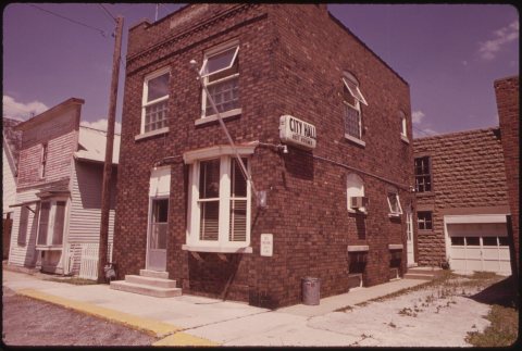


 1973
 Date?
 Date?
 Date?
 Date?
 Date?
 Date?
 2026
 2016
 2015
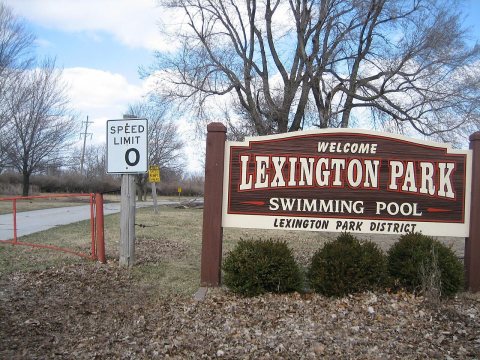 2007