Harrisburg dates to 1847, and 15% of its homes were built before 1940
More historic than 79% of U.S. towns · #189 of 768 in Illinois. What drives it
2 places in town are on the National Register, among them a historic district with 2 buildings. Below: 14 old photos and papers, maps from 1886 on, and the census since 1860.
Founding year: Wikidata. First post office: 1856.The full story ↓
History grade
What drives Harrisburg’s History grade
On its age, its old homes and the National Register, Harrisburg is more historic than 79% of U.S. towns, #189 of 768 in Illinois. All 3 inputs are above most U.S. towns; its age ranks highest and its share of homes from before 1940 lowest.
A−
HistoryA character grade: shown, never part of Harrisburg’s overall grade.
Few Illinois towns list much on the Register (a typical Illinois town has 0.5 per 10,000 residents, the U.S. 2.4), so Harrisburg’s 3.6 sits above most of its state (72% of Illinois towns have fewer) while its 3 historic buildings outnumber those of 65% of U.S. towns.
How sure. Graded on any two of the three inputs instead, the letter would range from B+ to A−. The pre-1940 share is a Census survey estimate (±4.2 points). Two sources give 1847.
Founding year: Wikidata (other dates in Quick answers). Homes: Census ACS 2020–24. National Register: National Park Service, May 2026 list; each listing counted once (boundary changes and added documentation belong to their listing), and a historic district counts its contributing buildings. How TownRatings grades history →
What stands out about Harrisburg’s past
Read from the archive, the National Register and the record. The page puts what stands out first.
Peaked at 15,659 in 1930; 8,219 people lived here in 2020.
17 censuses, 1860–2020.
U.S. Census Bureau decennial counts, from the census table on Harrisburg’s Wikipedia page.
Places that used to be
Lost post offices and old corners
Harrisburg’s post office has been open since 1856. Another post office, Dorrisville, opened and closed inside today’s town.
Harrisburg
1856–today
Dorrisville
1905–1926
18501940today
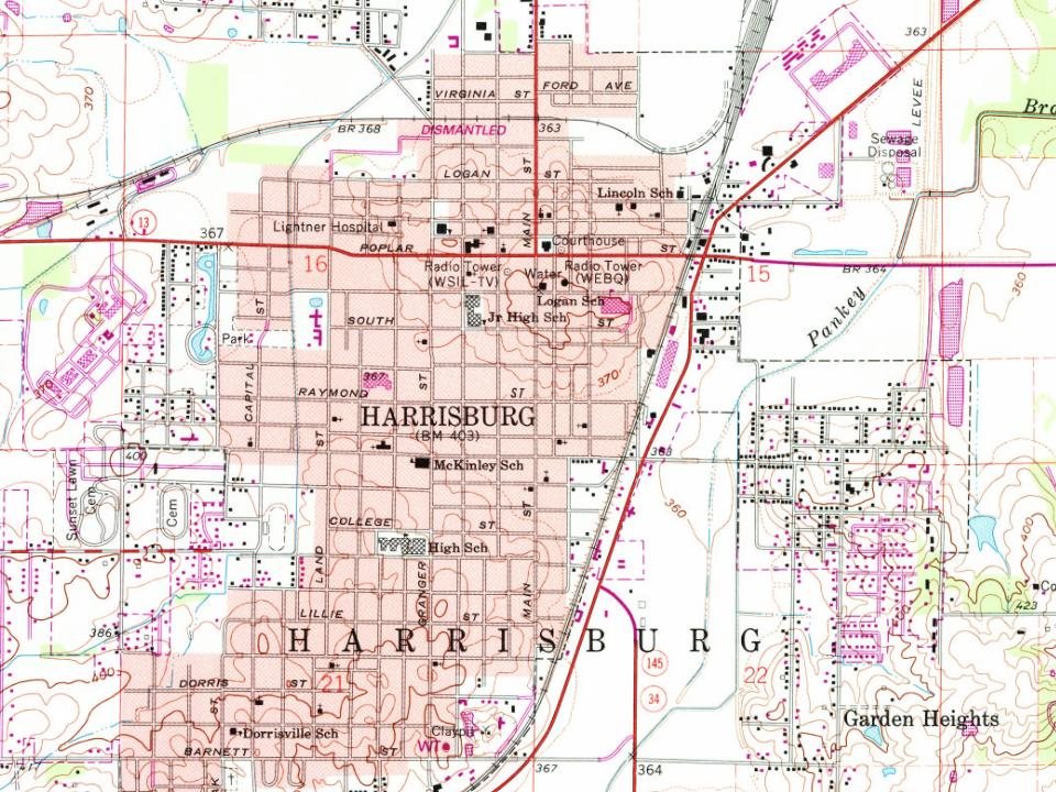
Hamlets and corners on the map
Buena VistaDorris HeightsDorrisvilleGarden HeightsGaskins City
US Post Offices dataset (Blevins & Helbock, CC0). Places and cemeteries from the USGS Geographic Names Information System (2021).
Every building
Harrisburg, building by building, 1886–1913
Fire insurance maps drew every building, what it was made of and what it was used for, so insurers could price the risk of fire. Pick a year, then a sheet.
At the beginning of recorded American history, the Harrisburg area was inhabited by several Algonquian tribes, including the Shawnee and Piankashaw, who lived in the dense inland forests. Prior to the arrival of European settlers, the Piankashaw tribe was driven out by the more aggressive Shawnee. European settlement in Illinois began with the French from 1690 and reached its peak about 1750, mainly along the Mississippi River. American settlers arrived in 1790. The French came as merchants and missionaries, with farming supplementing the need for trade. The result had benefited both the settlers and the Native Americans. The American migration, however, followed treaties which resulted in land being distributed through American Law, ignoring previous indigenous rights. Encroachment ensued and caused hard feelings between the Native Americans and the settlers who moved into the interior…
Passages that mention Harrisburg, cut from the printed page as they were published.
History and evidence of the passage of Abraham Lincoln--1906 · page 39Read the page →
Read the text
formed me that a plot had been discovered in Baltimore to assassinate the President-elect on his passage through that city, and it had been arranged that Mr. Lincoln should go through from Harrisburg to Washington privately on the night of the 22d, and it was desired to prevent any possibility of the fact of the President's departure from Harrisburg being telegraphed from Harrisburg to Baltimore; that the telegraph wires on the line of the Northern Central Railroad, from Harrisburg to Balti-
Text read by machine from the scan; it may contain errors.
History and evidence of the passage of Abraham Lincoln--1906 · page 31Read the page →
Read the text
way of business as General Superintendent of the Pennsylvania Railroad, to arrange for the movement of Mr. Lincoln, then President-elect of the United States, by special train from Philadelphia to Harrisburg, on the 226. inst. ; it being understood that he was to proceed on the 23d from Harrisburg, by the Northern Central Railroad to Baltimore and thence to Washington. On that evening (the 21st), I met Mr. Judd in Philadelphia by appointment, in company with Mr. G. C. Franciscus, Superintend-
Text read by machine from the scan; it may contain errors.
Scans and text from the Internet Archive. Books published in 1930 or earlier, which are in the public domain.
Timeline
Harrisburg, 1847 to 1971
Woven from the archive, old maps, post office records, the National Register and the people born here.
Nothing in the archives for these yearsWeddings on Main Street, storms, parades, school pictures, the old store. If it’s in your family album, it belongs here.
In 1847, according to Wikidata. Harrisburg’s post office opened in 1856, and the census of 1860 counted 453 people here.
How does Harrisburg rank for history?
Harrisburg is more historic than 79% of U.S. towns, #189 of 768 in Illinois. The History grade combines the town’s founding era, the share of homes built before 1940 and its National Register listings. It’s a character grade, so it isn’t part of the overall grade. How it works.
What is on the National Register in Harrisburg?
Two places: the Harrisburg City Hall (listed 1998) and the Saline County Poor Farm (2001).
How old are the homes in Harrisburg?
15% of Harrisburg’s homes were built before 1940 (Census estimate, ±4.2 points), against a typical 11% for an Illinois town; the median home was built in 1968.
Founding dates: Wikidata, Wikipedia, the U.S. post office records of Blevins & Helbock (CC0) and the Census. Homes by year built: Census ACS 2020–24. National Register of Historic Places: National Park Service (list of May 22, 2026). Old photos, postcards and papers: Wikimedia Commons, the Library of Congress and other public archives, credited on each item’s page. Maps: U.S. Geological Survey historical topographic maps (via Esri) and Sanborn fire-insurance maps (Library of Congress). History text and census tables: Wikipedia (CC BY-SA 4.0). Places that used to be: USGS Geographic Names Information System (2021).
From Wikimedia Commons (13), the Library of Congress (5), the National Register of Historic Places (2), Wikipedia, Wikidata and Wikipedia for famous people, U.S. Geological Survey historical maps, U.S. Census counts (via Wikipedia), the US Post Offices dataset (Blevins & Helbock), the USGS Geographic Names Information System, Sanborn fire insurance maps (Library of Congress) and old county and town histories (Internet Archive). Archive images are copied here with their credits and licenses, shown on each photo’s page. Refreshed monthly.


 1920
 1929
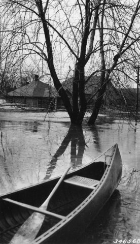 1937
 1937
 1937
 1940
 1955
 1967
 2007
 2007
 2007
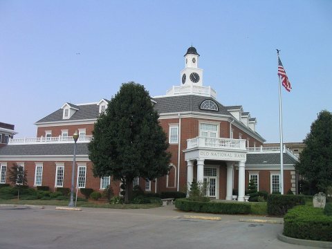 2006