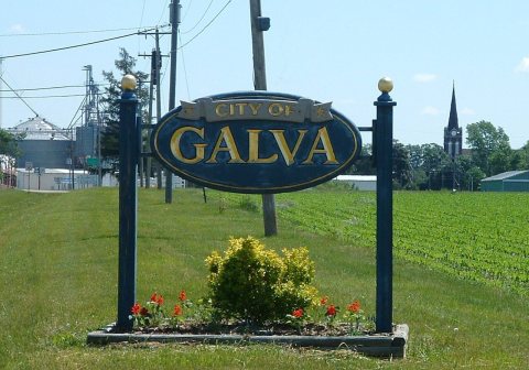
Cousins William L. Wiley (1820–1900) and James Wiley (1817–1886) founded Galva in 1854. The name Galva honors the Swedish immigrants of nearby Bishop Hill and refers to Gävle, Sweden which is the town's sister city. Today around 80% of the town has Scandinavian ancestry.
Passages that mention Galva Township, cut from the printed page as they were published.
Portrait and biographical album of Henry County, Illinois1885 · page 504Read the page →
Read the text
by the month, in Montgomery Co., Pa. He next came to Belvidere, Boone Co., 111., where he went to farming, engaging in the same until the spring of 1857, when he emigrated to Galva Township, this county, and has resided here ever since. Mr. Herbner is the proprietor of 40 acres of land in Galva Township, and 80 acres in Burns Township.
Text read by machine from the scan; it may contain errors.
Portrait and biographical album of Henry County, Illinois1885 · page 374Read the page →
Read the text
At the age of 13 years, John H. Everett was orphaned by the death of his father. He worked on farms in his native State until 1868, when he came to Galva Township, this county, where he has constantly resided until the present time, engaged in the occupation of farming. He has a farm of 80 acres of improved land and four acres of timber located on section 25, Galva Township, and is meeting with
Text read by machine from the scan; it may contain errors.
Scans and text from the Internet Archive. Books published in 1930 or earlier, which are in the public domain.
Every edition of the U.S. Geological Survey’s map of Galva Township. Tap a year, or press play to watch the town change.
1940Galva sheet · 1:62,500
U.S. Geological Survey historical topographic maps (public domain), via Esri’s collection of the scans. The red ring marks the center of Galva Township.
On the National Register
2 historic places in Galva Township
The country’s official list of buildings and places worth saving.
places listed
2
National Historic Landmarks
0
none yet
historic buildings protected
2
each building in a district counts
National Park Service, National Register of Historic Places. Photos from Wikimedia Commons, credited on each place’s page.
People over time
Galva Township, census by census
Between 1,005 and 3,185 people in every census since 1860.
17 censuses, 1860–2020.
U.S. Census Bureau decennial counts, from the census table on Galva Township’s Wikipedia page.
Places that used to be
Places now gone and burying grounds
Gone or out of use
Burdoff SchoolschoolCalhoun SchoolschoolCromien SchoolschoolDeem SchoolschoolHickory Grove SchoolschoolMaple Grove SchoolschoolNasslund SchoolschoolWest Galva Schoolschool
1cemetery inside Galva Township
Saint Johns
Places and cemeteries from the USGS Geographic Names Information System (2021).
Stories next door
History across the town line
Each neighbor’s History grade, on the same three inputs.
Founding dates: Wikidata, Wikipedia, the U.S. post office records of Blevins & Helbock (CC0) and the Census. Homes by year built: Census ACS 2020–24. National Register of Historic Places: National Park Service (list of May 22, 2026). Old photos, postcards and papers: Wikimedia Commons, the Library of Congress and other public archives, credited on each item’s page. Maps: U.S. Geological Survey historical topographic maps (via Esri) and Sanborn fire-insurance maps (Library of Congress). History text and census tables: Wikipedia (CC BY-SA 4.0). Places that used to be: USGS Geographic Names Information System (2021). How TownRatings grades history →
From Wikimedia Commons (11), the Library of Congress (3), Wikidata (2), Wikipedia, U.S. Geological Survey historical maps, U.S. Census counts (via Wikipedia), the USGS Geographic Names Information System and old county and town histories (Internet Archive). Archive images are copied here with their credits and licenses, shown on each photo’s page. Refreshed monthly.


 Date?
 2020
 2020
 2019
 2019
 2019
 2015
 2015
 2013
 2012
 2006
 2006
 2003
 2003


