Fairbury dates to 1857, and 22% of its homes were built before 1940
More historic than 66% of U.S. towns · #287 of 768 in Illinois. What drives it
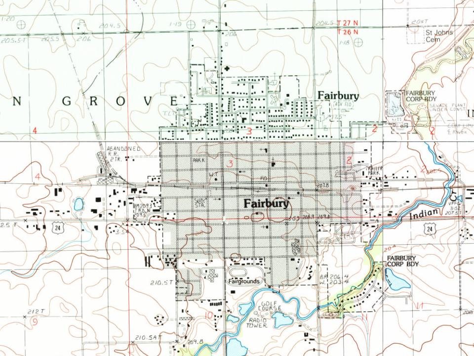
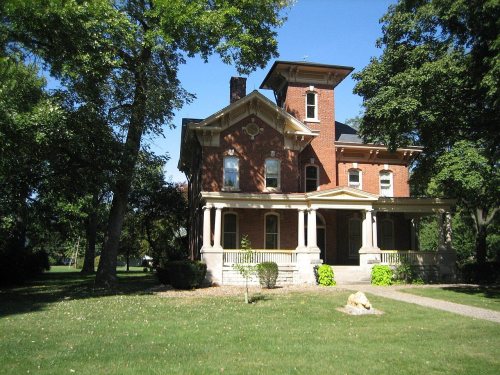
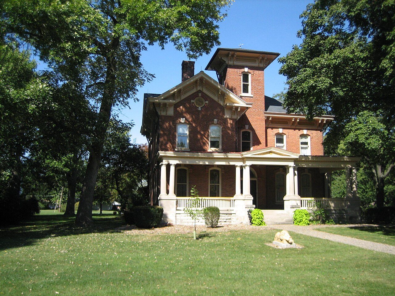
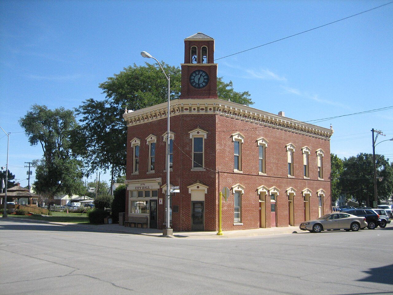
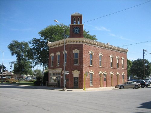
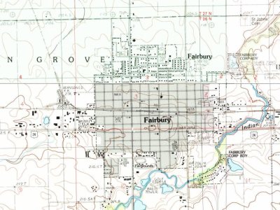
Its Register listings are the Thomas A. Beach House and the Fairbury City Hall. Its Register listings are the Thomas A. Beach House and the Fairbury City Hall. Below: maps from 1885 on and the census since 1860.
Founding year: Wikidata; Wikipedia’s history section gives the same year. First post office: 1858.The full story ↓
History grade
What drives Fairbury’s History grade
On its age, its old homes and the National Register, Fairbury is more historic than 66% of U.S. towns, #287 of 768 in Illinois. Its share of homes from before 1940 holds the grade up; its age pulls it down.
B+
HistoryA character grade: shown, never part of Fairbury’s overall grade.
Few Illinois towns list much on the Register (a typical Illinois town has 0.5 per 10,000 residents, the U.S. 2.4), so Fairbury’s 5.4 sits above most of its state (76% of Illinois towns have fewer) while its 2 listings outnumber those of 60% of U.S. towns.
How sure. Graded on any two of the three inputs instead, the letter would range from B− to A−. The pre-1940 share is a Census survey estimate (±6.8 points). Two sources give 1857.
Founding year: Wikidata (other dates in Quick answers). Homes: Census ACS 2020–24. National Register: National Park Service, May 2026 list; each listing counted once (boundary changes and added documentation belong to their listing), and a historic district counts its contributing buildings. How TownRatings grades history →
What stands out about Fairbury’s past
Read from the archive, the National Register and the record. The page puts what stands out first.
Fire insurance maps drew every building, what it was made of and what it was used for, so insurers could price the risk of fire. Pick a year, then a sheet.
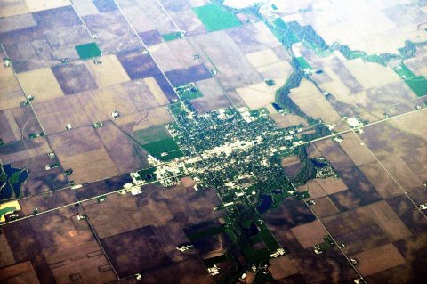
Fairbury was laid out on November 10, 1857, by Caleb L. Patton and Octave Chanute. Like most Illinois towns of the 1850s, the original town of Fairbury was centered on a depot ground. It consisted of twenty-six blocks, each divided into fourteen to sixteen lots. There was no central public square, but one was later included in Marsh's addition. The plan used was virtually identical to that at Chatsworth, Illinois, including the street names, and the plan was similar to that at Gridley and El Paso on the same railroad.
Passages that mention Fairbury, cut from the printed page as they were published.
The History of Livingston County, Illinois1878 · page 338Read the page →
Read the text
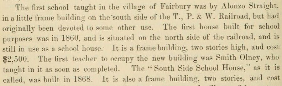
The first school taught in the village of Fairbury was by Alonzo Straight, in a little frame building on the'south side of the T., P. & W. Railroad, but had originally been devoted to some other use. The first house built for school purposes was in 1860, and is situated on the north side of the railroad, and is still in use as a school house. It is a frame building, two stories high, and cost $2,500. The first teacher to occupy the new building was Smith Olney, who taught in it as soon as completed. The " South Side School House," as it is called, was built in 1868. It is also a frame building, two stories, and cost
Text read by machine from the scan; it may contain errors.
The History of Livingston County, Illinois1878 · page 336Read the page →
Read the text
The first house in the village of Fairbury was built by John Coomer, who came here from Vermont, the old Green Mountain State, in 1857. The house stands on the corner, just across the street from the Fairbury Hotel, and is a good, comfortable residence at the present day. Coomer finished his house and moved into it on the last day of the year ; says he came very near not getting into it in 1857 any way. The first store house was built by A. L. Pogue, David Thomas and R. B. Amsbury, Avho opened a store in it in the early part of 1858, and for a number of years did an extensive business. At length Thomas sold
Text read by machine from the scan; it may contain errors.
Scans and text from the Internet Archive. Books published in 1930 or earlier, which are in the public domain.
Timeline
Fairbury, 1857 to 1986
Woven from the archive, old maps, post office records, the National Register and the people born here.
Lost post offices, places now gone and burying grounds
Fairbury’s post office has been open since 1866. Another post office, Fairburgh, opened and closed inside today’s town.
Fairburgh
1858–1866
Fairbury
1866–today
18501940today
Gone or out of use
Bee Hive SchoolschoolEdison Public SchoolschoolFairbury HospitalhospitalGospel Army ChurchchurchIsaac Walton Public Schoolschool
1cemetery inside Fairbury
Graceland
US Post Offices dataset (Blevins & Helbock, CC0). Places and cemeteries from the USGS Geographic Names Information System (2021).
Questions about Fairbury’s history
What year was Fairbury founded?
In 1857, according to Wikidata and Wikipedia’s history of the town. Fairbury’s post office opened in 1858, and the census of 1860 counted 269 people here.
How does Fairbury rank for history?
Fairbury is more historic than 66% of U.S. towns, #287 of 768 in Illinois. The History grade combines the town’s founding era, the share of homes built before 1940 and its National Register listings. It’s a character grade, so it isn’t part of the overall grade. How it works.
What is on the National Register in Fairbury?
Two places: the Thomas A. Beach House (listed 1983) and the Fairbury City Hall (1996).
How old are the homes in Fairbury?
22% of Fairbury’s homes were built before 1940 (Census estimate, ±6.8 points), against a typical 11% for an Illinois town; the median home was built in 1965.
Founding dates: Wikidata, Wikipedia, the U.S. post office records of Blevins & Helbock (CC0) and the Census. Homes by year built: Census ACS 2020–24. National Register of Historic Places: National Park Service (list of May 22, 2026). Old photos, postcards and papers: Wikimedia Commons, the Library of Congress and other public archives, credited on each item’s page. Maps: U.S. Geological Survey historical topographic maps (via Esri) and Sanborn fire-insurance maps (Library of Congress). History text and census tables: Wikipedia (CC BY-SA 4.0). Places that used to be: USGS Geographic Names Information System (2021).
From Wikimedia Commons (12), the National Register of Historic Places (2), Wikipedia, Wikidata and Wikipedia for famous people, U.S. Geological Survey historical maps, U.S. Census counts (via Wikipedia), the US Post Offices dataset (Blevins & Helbock), the USGS Geographic Names Information System, Sanborn fire insurance maps (Library of Congress) and old county and town histories (Internet Archive). Archive images are copied here with their credits and licenses, shown on each photo’s page. Refreshed monthly.




 2014
 2012
 2012
 2007
 2007
 2007
 2007
 2007
 2007
 2007
 2007
 2007