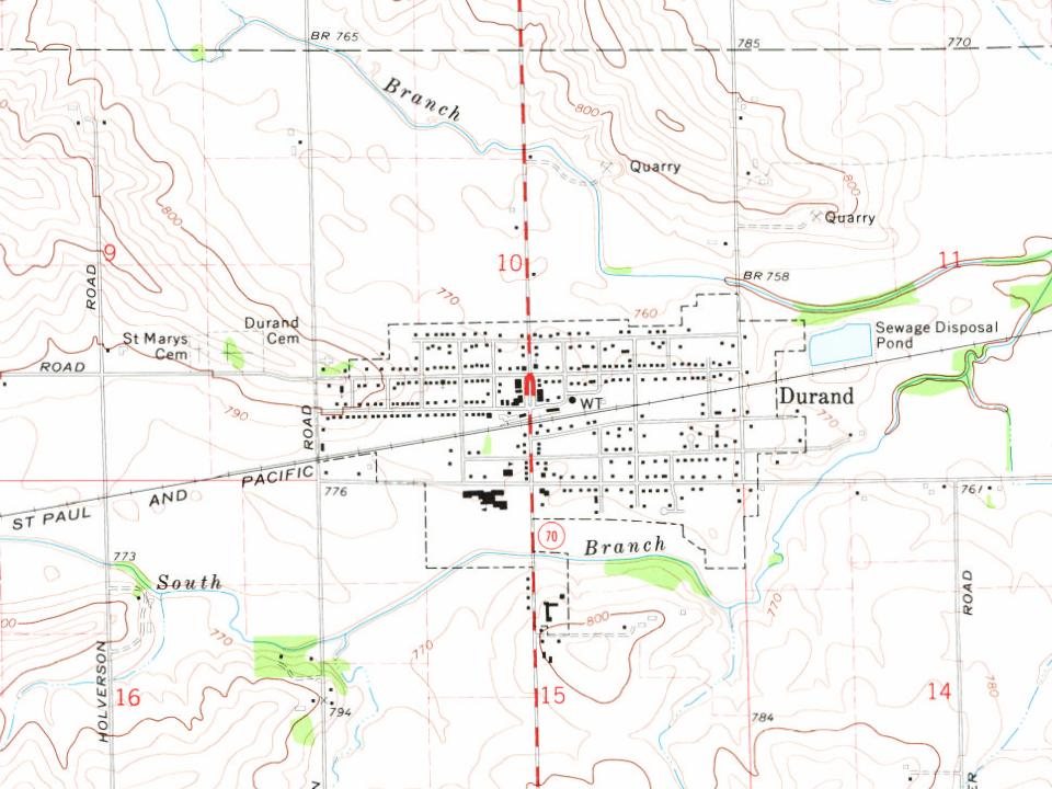
Durand first appears in the census in 1880. Two smaller post offices, Howard (1851) and Durand Station (1858), opened inside today’s town and later closed.
First census: 530 in 18802020 census: 1,390146 years
How historic is Durand?
C+
More historic than 40% of U.S. towns, on its age, its old homes and the National Register.
On its age, its old homes and the National Register, Durand is more historic than 40% of U.S. towns. Its share of homes from before 1940 holds the grade up; its National Register listings pull it down.
C+
HistoryA character grade: shown, never part of Durand’s overall grade.
Few Illinois towns list much on the Register (a typical Illinois town has 0.5 per 10,000 residents, the U.S. 2.4), so Durand’s 0.0 sits below most of its state (28% of Illinois towns have fewer) while its 0 listings outnumber those of 23% of U.S. towns.
How sure. Graded on any two of the three inputs instead, the letter would range from C− to B−. The pre-1940 share is a Census survey estimate (±5.1 points).
Founding year: the first census (other dates in Quick answers). Homes: Census ACS 2020–24. National Register: National Park Service, May 2026 list; each listing counted once (boundary changes and added documentation belong to their listing), and a historic district counts its contributing buildings. How TownRatings grades history →
What stands out about Durand’s past
Read from the archive, the National Register and the record. The page puts what stands out first.
Its township's beginnings initiated originally in a no longer existing settlement called Elton, an area South of Durand and including parts of the Pecatonica and Rock Run townships and settled in 1835 by Nelson Salisbury, Harvey Lower, and Scott Robb. They and nine other families settled the Southwest portion of modern Durand, Pecatonica, and Rock Run area. Durand gave birth to Illinois' first tax-supported volunteer fire department. Since its settlement, Durand has been prone to devastating fires. Durand's early flourishings were closely linked to the development of the Racine-Mississippi Railroad later absorbed into Western Union. The line reached Durand in 1857, en route to Freeport, paving the shift from the Elton community into modern Durand and deriving its name from the railroad's first president, H.S. Durand. At this time, Durand saw the beginning of its prosperity which en…
Passages that mention Durand, cut from the printed page as they were published.
The History of Winnebago County, Illinois1877 · page 450Read the page →
Read the text
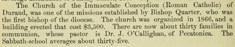
The Church of the Immaculate Conception (Roman Catholic) of Durand, was one of the missions established by Bishop Quarter, who was the first bishop of the diocese. The church was organized in 1866, and a building erected that cost $3,500. There are now about thirty families in communion, whose pastor is Dr. J. O'Callighan, of Pecatonica. The Sabbath-school averages about thirty-five.
Text read by machine from the scan; it may contain errors.
Scans and text from the Internet Archive. Books published in 1930 or earlier, which are in the public domain.
Timeline
Durand, 1851 to 1932
Woven from the archive, old maps, post office records, the National Register and the people born here.
Nothing in the archives for these yearsWeddings on Main Street, storms, parades, school pictures, the old store. If it’s in your family album, it belongs here.
Between 489 and 1,443 people in every census since 1880.
15 censuses, 1880–2020.
U.S. Census Bureau decennial counts, from the census table on Durand’s Wikipedia page.
Questions about Durand’s history
What year was Durand founded?
The Durand post office opened in 1880, the earliest record of the town by name (U.S. post office records).
How does Durand rank for history?
Durand is more historic than 40% of U.S. towns. The History grade combines the town’s founding era, the share of homes built before 1940 and its National Register listings. It’s a character grade, so it isn’t part of the overall grade. How it works.
How old are the homes in Durand?
19% of Durand’s homes were built before 1940 (Census estimate, ±5.1 points), against a typical 11% for an Illinois town; the median home was built in 1974.
Founding dates: Wikidata, Wikipedia, the U.S. post office records of Blevins & Helbock (CC0) and the Census. Homes by year built: Census ACS 2020–24. National Register of Historic Places: National Park Service (list of May 22, 2026). Old photos, postcards and papers: Wikimedia Commons, the Library of Congress and other public archives, credited on each item’s page. Maps: U.S. Geological Survey historical topographic maps (via Esri) and Sanborn fire-insurance maps (Library of Congress). History text and census tables: Wikipedia (CC BY-SA 4.0). Places that used to be: USGS Geographic Names Information System (2021).
From Wikimedia Commons (9), Wikipedia, U.S. Geological Survey historical maps, U.S. Census counts (via Wikipedia), the US Post Offices dataset (Blevins & Helbock), the USGS Geographic Names Information System and old county and town histories (Internet Archive). Archive images are copied here with their credits and licenses, shown on each photo’s page. Refreshed monthly.



 Date?
 2007
 2007
 2007
 2007
 2007
 2007
 2005