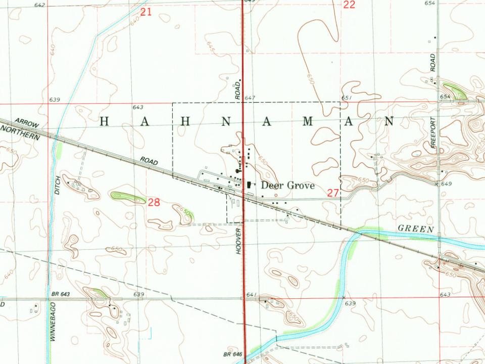
A man named William Renner and his family are believed to have been the first to settle in the area now known as Hahnaman Township, arriving from Pennsylvania in 1841. A post office was established in 1873. Many small schools served the area before they were all ultimately closed by the 1950s. The earliest of which, only known as the Advance School, was located at the intersection of IL-40 and Bell Rd.
Passages that mention Deer Grove, cut from the printed page as they were published.
History of Whiteside county, Illinois, from its first settlement to the present time1877 · page 235Read the page →
Read the text
made as to whether strange horses and men had not passed along the route going southward. The first legally laid out road was the one commencing at the north line of the town, between sections 3 and 4, and running in a direct line to Deer Grove, known as the Sterling and Deer Grove road. This road was laid out in 1856. The next legally laid out road commences also at the north line of the town, between sections 5 and 6, and runs south in a direct line to the southeast corner of section 19; thence west to the town line. This road was laid out in 1857. Other roads followed as the town became settled and
Text read by machine from the scan; it may contain errors.
1877 history of whiteside county illinois1877 · page 235Read the page →
Read the text
made as to whether strange horses and men had not passed along the route going southward. The first legally laid out road was the one commencing at the north line of the town, between sections 3 and 4, and running in a direct line to Deer Grove, known as the Sterling and Deer Grove road. This road was laid out in 1856. The next legally laid out road commences also at the north line of the town, between sections 5 and 6, and runs south in a direct line. to the southeast corner of section 19; thence west to the town line. This road was laid out in 1857. Other roads followed as the town became settled and
Text read by machine from the scan; it may contain errors.
History of Whiteside county, Illinois, from its first settlement to the present time1877 · page 233Read the page →
Read the text
The first house, or rather cabin, was built of logs at Deer Grove, by William Renner, in 1841, and the few that were built previous to 1857, were of that material, or as near to it as could be had. In 1857 the first frame buildings were erected.
Text read by machine from the scan; it may contain errors.
1877 history of whiteside county illinois1877 · page 233Read the page →
Read the text
The first house, or rather cabin, was built of logs at Deer Grove, by Wil liam Renner, in 1841, and the few that were built previous to 1857, were of that material, or as near to it as could be had. In 1857 the first frame buildings were erected. uf The first school house was built in 1857 in what is known as Brakey's set- : tlement. It was sixteen feet square and seven feet high. Mr. Amos Reeves, the present Supervisor of the town, taught sehool there in the winter of 1857— '58, and was consequently the first school teacher in the town. He had an at-
Text read by machine from the scan; it may contain errors.
Scans and text from the Internet Archive. Books published in 1930 or earlier, which are in the public domain.
By decade
No old photos in the archives yet
Weddings on Main Street, storms, parades, school pictures, the old store. If it’s in your family album, it belongs here.
Be the first to add onePhotograph a print flat, in daylight, no flash.
Founding dates: Wikidata, Wikipedia, the U.S. post office records of Blevins & Helbock (CC0) and the Census. Homes by year built: Census ACS 2020–24. National Register of Historic Places: National Park Service (list of May 22, 2026). Old photos, postcards and papers: Wikimedia Commons, the Library of Congress and other public archives, credited on each item’s page. Maps: U.S. Geological Survey historical topographic maps (via Esri) and Sanborn fire-insurance maps (Library of Congress). History text and census tables: Wikipedia (CC BY-SA 4.0). Places that used to be: USGS Geographic Names Information System (2021). How TownRatings grades history →
From Wikipedia, U.S. Geological Survey historical maps, U.S. Census counts (via Wikipedia), the US Post Offices dataset (Blevins & Helbock), the USGS Geographic Names Information System and old county and town histories (Internet Archive). Archive images are copied here with their credits and licenses, shown on each photo’s page. Refreshed monthly.