Founding year: the first Colchester post office (Blevins & Helbock, CC0).The full story ↓
History grade
What drives Colchester’s History grade
On its age, its old homes and the National Register, Colchester is more historic than 52% of U.S. towns. Its share of homes from before 1940 holds the grade up; its National Register listings pull it down.
B−
HistoryA character grade: shown, never part of Colchester’s overall grade.
Few Illinois towns list much on the Register (a typical Illinois town has 0.5 per 10,000 residents, the U.S. 2.4), so Colchester’s 0.0 sits below most of its state (28% of Illinois towns have fewer) while its 0 listings outnumber those of 23% of U.S. towns.
How sure. Graded on any two of the three inputs instead, the letter would range from C− to B+. The pre-1940 share is a Census survey estimate (±12.5 points). The founding year is the first post office, not a stated founding date.
Founding year: the first post office (other dates in Quick answers). Homes: Census ACS 2020–24. National Register: National Park Service, May 2026 list; each listing counted once (boundary changes and added documentation belong to their listing), and a historic district counts its contributing buildings. How TownRatings grades history →
What stands out about Colchester’s past
Read from the archive, the National Register and the record. The page puts what stands out first.
Peaked at 1,747 in 1970; 1,108 people lived here in 2020.
15 censuses, 1880–2020.
U.S. Census Bureau decennial counts, from the census table on Colchester’s Wikipedia page.
Every building
Colchester, building by building, 1893–1912
Fire insurance maps drew every building, what it was made of and what it was used for, so insurers could price the risk of fire. Pick a year, then a sheet.
According to the North American Stratigraphic Code, rock units were given names that included the geographic name of a location where the rock unit was first described. If the rock unit consisted of a dominant rock type, the rock type was included in the name. In this case, when coal was first discovered and described in Colchester, Illinois, the rock unit was named "Colchester Coal". When this particular coal unit was encountered in a different location, the coal was correctly identified as Colchester Coal.
Passages that mention Colchester, cut from the printed page as they were published.
History of McDonough County, Illinois1878 · page 278Read the page →
Read the text
hundreds of men, some of whom work in the banks, while others are constantly engaged in hauling to our home markets and the towns surrounding. An average of twelve cars per day have been shipped from the town of Colchester, over the Chicago, Burlington and Quincy Railroad, during the last five years. This is exclusive of that shipped for the sole use of the railroad company, which amounts to several cars more. An average of two cars is consumed in Macomb, while surrounding towns use as much more,
Text read by machine from the scan; it may contain errors.
History of McDonough County, Illinois1878 · page 670Read the page →
Read the text
Fire Brick and Tile Works. — In 1858 A. Horrock came to the town of Colchester, in this county, and for one year labored in the coal mines iu that vicinity, when he was persuaded to go to Avon, in Fulton county, to serve in the employ of some party in the manufacture of fire brick, a business in which he had considerable experience in his native land. He only remained in Avon some nine mouths, when he returned to Colchester, again engaging as a laborer in the mines. Being of an observing nature, he
Text read by machine from the scan; it may contain errors.
History of McDonough county, Illinois1878 · page 670Read the page →
Read the text
Fire Brick and Tile Works. — lu 1858 A. Horrock came to the town of Colchester, in this county, and for one year labored in the coal mines in that vicinity, when he was persuaded to go to Avon, in Fulton county, to serve in the employ of some party in the manufacture of fire brick, a business in \vhich he had considerable experience in his native land. lie only remained in Avon some nine months, when he returned to Colchester, again engaging as a laborer in the mines. Being of an observing nature, he
Text read by machine from the scan; it may contain errors.
History of McDonough county, Illinois1878 · page 479Read the page →
Read the text
About this time an advertisement was inserted in a county paper for an experienced miner to work a coal mine near the present town of Colchester, which advertisement he answered in person, and engaged to mine coal on the shares. This he continued for some time, when he purchased eighty acres in the Welch settlement, and began to mine for himself. When he came west, not knowing where he should settle, or how he should like the country, he left his family in New Castle ; in November following he sent
Text read by machine from the scan; it may contain errors.
Scans and text from the Internet Archive. Books published in 1930 or earlier, which are in the public domain.
Timeline
Colchester, 1856 to 1970
Woven from the archive, old maps, post office records, the National Register and the people born here.
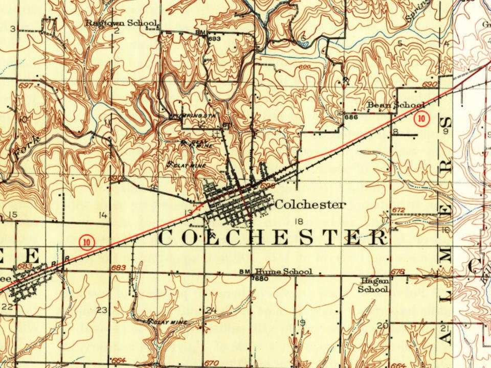
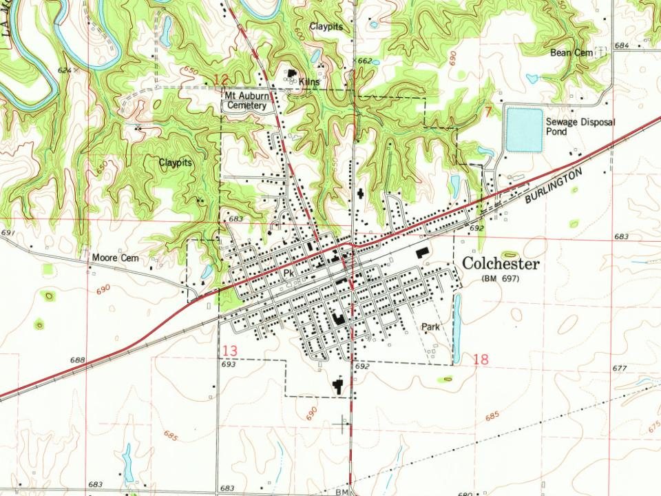
Every edition of the U.S. Geological Survey’s map of Colchester. Tap a year, or press play to watch the town change.
1913Colchester sheet · 1:62,500
U.S. Geological Survey historical topographic maps (public domain), via Esri’s collection of the scans. The red ring marks the center of Colchester.
Questions about Colchester’s history
What year was Colchester founded?
The Colchester post office opened in 1856, the earliest record of the town by name (U.S. post office records).
How does Colchester rank for history?
Colchester is more historic than 52% of U.S. towns. The History grade combines the town’s founding era, the share of homes built before 1940 and its National Register listings. It’s a character grade, so it isn’t part of the overall grade. How it works.
How old are the homes in Colchester?
34% of Colchester’s homes were built before 1940 (Census estimate, ±12.5 points), against a typical 11% for an Illinois town; the median home was built in 1960.
Founding dates: Wikidata, Wikipedia, the U.S. post office records of Blevins & Helbock (CC0) and the Census. Homes by year built: Census ACS 2020–24. National Register of Historic Places: National Park Service (list of May 22, 2026). Old photos, postcards and papers: Wikimedia Commons, the Library of Congress and other public archives, credited on each item’s page. Maps: U.S. Geological Survey historical topographic maps (via Esri) and Sanborn fire-insurance maps (Library of Congress). History text and census tables: Wikipedia (CC BY-SA 4.0). Places that used to be: USGS Geographic Names Information System (2021).
From Wikimedia Commons (3), Wikidata (1), Wikipedia, Wikidata and Wikipedia for famous people, U.S. Geological Survey historical maps, U.S. Census counts (via Wikipedia), the US Post Offices dataset (Blevins & Helbock), the USGS Geographic Names Information System, Sanborn fire insurance maps (Library of Congress) and old county and town histories (Internet Archive). Archive images are copied here with their credits and licenses, shown on each photo’s page. Refreshed monthly.


 2015
 2009
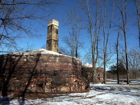 2007