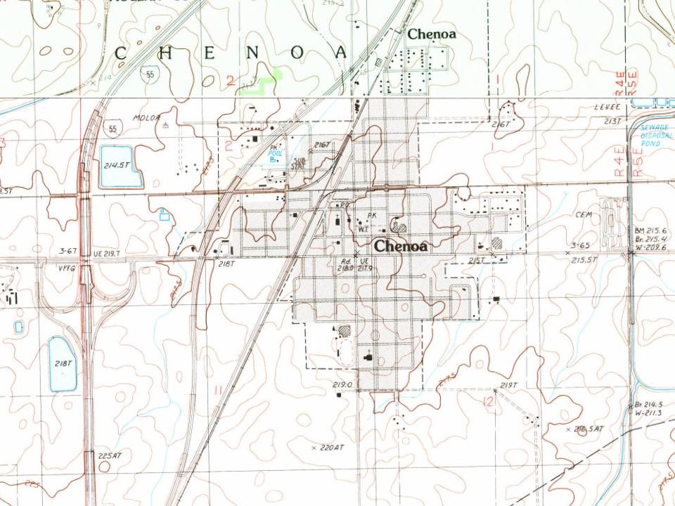
Its Register listings are the Matthew T. Scott House and the Route 66, Cayuga to Chenoa. Its Register listings are the Matthew T. Scott House and the Route 66, Cayuga to Chenoa. Below: 7 old photos and papers, maps from 1885 on, and the census since 1880.
Founding year: Wikidata. First post office: 1856.The full story ↓
History grade
What drives Chenoa’s History grade
On its age, its old homes and the National Register, Chenoa is more historic than 76% of U.S. towns. Its share of homes from before 1940 holds the grade up; its age pulls it down.
A−
HistoryA character grade: shown, never part of Chenoa’s overall grade.
Few Illinois towns list much on the Register (a typical Illinois town has 0.5 per 10,000 residents, the U.S. 2.4), so Chenoa’s 12.1 sits above most of its state (85% of Illinois towns have fewer) while its 2 listings outnumber those of 60% of U.S. towns.
How sure. Graded on any two of the three inputs instead, the letter would range from B to A. The pre-1940 share is a Census survey estimate (±6.1 points). Two sources give 1854.
Founding year: Wikidata (other dates in Quick answers). Homes: Census ACS 2020–24. National Register: National Park Service, May 2026 list; each listing counted once (boundary changes and added documentation belong to their listing), and a historic district counts its contributing buildings. How TownRatings grades history →
What stands out about Chenoa’s past
Read from the archive, the National Register and the record. The page puts what stands out first.
Fire insurance maps drew every building, what it was made of and what it was used for, so insurers could price the risk of fire. Pick a year, then a sheet.
The Town of Chenoa was laid out on May 13, 1856, by Matthew T. Scott. At this time, the Chicago and Alton Railroad had been running trains for almost two years but the survey for the east-west Toledo, Peoria and Oquawka (soon to be the Toledo, Peoria and Western) had not reached McLean County. Scott anticipated the place where the railroads would cross and platted the town which he called Chenoa. Scott (February 24, 1828 - May 21, 1891) was the son of a Kentucky banker, and, by the time he reached Illinois, was an experienced land developer who led a group of well-financed investors. The European settlement history of Chenoa began in 1854 when Matthew T. Scott began buying thousands of acres of land in this area.
Passages that mention Chenoa, cut from the printed page as they were published.
The History of McLean County, Illinois1879 · page 507Read the page →
Read the text
There are five churches, viz., Presbyterian, Congregationalist, Baptist, Methodist and Roman Catholic. The first church organization was the Presbyterian (N. S.), which was about 1860. It, however, soon disbanded, its members going by letter to " the Chenoa Presbyterian Church " (0. S.), which was organized in 1862 by the Presbytery of Bloomington, March 6, in the old schoolhouse, Rev. D. A. Cornelison acting as Moderator. This meeting of Presbytery was duly called for the purpose of acting on a petition of the citizens to have a church formed here, and was the first permanent organization. The Church was organized with fourteen members — Rebecca Bush,
Text read by machine from the scan; it may contain errors.
History of McLean County, Illinois1924 · page 92Read the page →
Read the text
The township of Chenoa formerly comprised the territory now included in Yates Township, which was later separated and formed a separate organization. Being located within a mile of the Livingston County line, much of the trade of Chenoa is drawn from Livingston. The farms were taken up in large tracts in the early days, and even yet much of the
Text read by machine from the scan; it may contain errors.
The History of McLean County, Illinois1879 · page 498Read the page →
Read the text
The township of Chenoa is a full Congressional township, being six miles square, and is all prairie, sufficiently rolling to be capable of easy drainage. The soil is rbh and deep, adapted to raising corn, grass, small grains, fruits and all crops for which the State is so generally noted.
Text read by machine from the scan; it may contain errors.
History of McLean County, Illinois1924 · page 677Read the page →
Read the text
James E. Jontry has always lived at Chenoa. He was educated in the public schools there and then became engaged as a telegraph operator and agent for the Toledo, Peoria, and Western Railroad at Chenoa. Mr.
Text read by machine from the scan; it may contain errors.
Scans and text from the Internet Archive. Books published in 1930 or earlier, which are in the public domain.
Timeline
Chenoa, 1854 to 1986
Woven from the archive, old maps, post office records, the National Register and the people born here.
Nothing in the archives for these yearsWeddings on Main Street, storms, parades, school pictures, the old store. If it’s in your family album, it belongs here.
In 1854, according to Wikidata. Chenoa’s post office opened in 1856, and the census of 1880 counted 1,063 people here.
How does Chenoa rank for history?
Chenoa is more historic than 76% of U.S. towns. The History grade combines the town’s founding era, the share of homes built before 1940 and its National Register listings. It’s a character grade, so it isn’t part of the overall grade. How it works.
What is on the National Register in Chenoa?
Two places: the Matthew T. Scott House (listed 1983) and the Route 66, Cayuga to Chenoa (2003).
How old are the homes in Chenoa?
31% of Chenoa’s homes were built before 1940 (Census estimate, ±6.1 points), against a typical 11% for an Illinois town; the median home was built in 1957.
Founding dates: Wikidata, Wikipedia, the U.S. post office records of Blevins & Helbock (CC0) and the Census. Homes by year built: Census ACS 2020–24. National Register of Historic Places: National Park Service (list of May 22, 2026). Old photos, postcards and papers: Wikimedia Commons, the Library of Congress and other public archives, credited on each item’s page. Maps: U.S. Geological Survey historical topographic maps (via Esri) and Sanborn fire-insurance maps (Library of Congress). History text and census tables: Wikipedia (CC BY-SA 4.0). Places that used to be: USGS Geographic Names Information System (2021).
From Wikimedia Commons (13), the Library of Congress (5), the National Register of Historic Places (2), Wikipedia, Wikidata and Wikipedia for famous people, U.S. Geological Survey historical maps, U.S. Census counts (via Wikipedia), the US Post Offices dataset (Blevins & Helbock), the USGS Geographic Names Information System, Sanborn fire insurance maps (Library of Congress) and old county and town histories (Internet Archive). Archive images are copied here with their credits and licenses, shown on each photo’s page. Refreshed monthly.


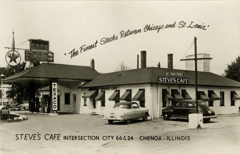


 1900
 Date?
 Date?
 Date?
 Date?
 2023
 2023
 2023
 2007
 2007
 2007
 2007
 2007
 2007
 2007
 2007