More historic than 19% of U.S. towns · #640 of 768 in Illinois. What drives it
Most of Braidwood was built recently: 3% of its homes predate 1940 and the median home dates from 1994. Below: 1 old photo or paper, maps from 1885 on, and the census since 1880.
Founding year: the first Braidwood post office (Blevins & Helbock, CC0).The full story ↓
History grade
What drives Braidwood’s History grade
On its age, its old homes and the National Register, Braidwood is more historic than 19% of U.S. towns, #640 of 768 in Illinois. Its age holds the grade up; its share of homes from before 1940 pulls it down.
C−
HistoryA character grade: shown, never part of Braidwood’s overall grade.
Few Illinois towns list much on the Register (a typical Illinois town has 0.5 per 10,000 residents, the U.S. 2.4), so Braidwood’s 0.0 sits below most of its state (28% of Illinois towns have fewer) while its 0 listings outnumber those of 23% of U.S. towns.
How sure. Graded on any two of the three inputs instead, the letter would still be C−. The pre-1940 share (±2.2 points) is firm at this size. The founding year is the first post office, not a stated founding date.
Founding year: the first post office (other dates in Quick answers). Homes: Census ACS 2020–24. National Register: National Park Service, May 2026 list; each listing counted once (boundary changes and added documentation belong to their listing), and a historic district counts its contributing buildings. How TownRatings grades history →
What stands out about Braidwood’s past
Read from the archive, the National Register and the record. The page puts what stands out first.
In 1864, a farmer digging for water at the site of the present city found coal instead. Deposits were substantial and the demand for coal in nearby Chicago was high, so companies rushed to acquire land and set up operations. A mining boomtown sprang up, a post office was established in 1867, and the community was called Keeversville. James Braidwood was an early member of the community, and in 1872 he was hired by one company to superintend the sinking of the first deep mine shaft. The addition of more deep-shaft mines followed, and on March 4, 1873, the city was incorporated
Passages that mention Braidwood, cut from the printed page as they were published.
Souvenir of settlement and progress of Will County, Ill. A review of the lives of our presidents, political, military and commercial history of the United States and of the state of Illinois ... Business directory of Joliet ... Comp. specially for the peo1884 · page 441Read the page →
Read the text
The town of Braidwood was platted in 1865 and named in honor of James Braidwood. Until 1873 it was governed by the township board. The question of incorporating the city of Braidwood was brought before the people, March 4, 1873, when
Text read by machine from the scan; it may contain errors.
History of Will County, Illinois1928 · page 1010Read the page →
Read the text
Thomas Shaunessy received his education in the public schools of Chicago and also attended school at Braidwood and Kankakee, 111. He spent seven years farming in Grundy and Will counties, and later was a stationary engineer in the coal mines at Braidwood, 111. He came to Braidwood in 1904 and established a meat business on Main Street.
Text read by machine from the scan; it may contain errors.
History of Will County, Illinois1928 · page 670Read the page →
Read the text
The boyhood of Charles Joseph Farley was spent at Braidwood, where he attended the parochial schools. He then learned telegraphy while in the employ of the Chicago & Alton Railroad. He worked at various points on this railroad and in 1907 was transferred to the accounting department, where he did special work on station accounts. Three years later he was sent to Joliet in charge of the ticket department of the Chicago & Alton. In 1910 he became associated with the Santa Fe Railroad as ticket clerk in this city. On Nov. 1, 1912, when the new
Text read by machine from the scan; it may contain errors.
Scans and text from the Internet Archive. Books published in 1930 or earlier, which are in the public domain.
Timeline
Braidwood, 1867 to 2020
Woven from the archive, old maps, post office records, the National Register and the people born here.
Nothing in the archives for these yearsWeddings on Main Street, storms, parades, school pictures, the old store. If it’s in your family album, it belongs here.
Fire insurance maps drew every building, what it was made of and what it was used for, so insurers could price the risk of fire. Pick a year, then a sheet.
A MinemineC MinemineCo-Operative MinemineD MinemineE MinemineEureka Number 1 MinemineEureka Number 2 MinemineF MinemineG MinemineL MinemineMatlby MinemineOswald And Young MineminePit 4 Northern MinemineSkinner Number 2 Minemine
US Post Offices dataset (Blevins & Helbock, CC0). Places and cemeteries from the USGS Geographic Names Information System (2021).
Stories next door
History across the town line
Each neighbor’s History grade, on the same three inputs.
The Braidwood post office opened in 1867, the earliest record of the town by name (U.S. post office records).
How does Braidwood rank for history?
Braidwood is more historic than 19% of U.S. towns, #640 of 768 in Illinois. The History grade combines the town’s founding era, the share of homes built before 1940 and its National Register listings. It’s a character grade, so it isn’t part of the overall grade. How it works.
How old are the homes in Braidwood?
3% of Braidwood’s homes were built before 1940 (Census estimate, ±2.2 points), against a typical 11% for an Illinois town; the median home was built in 1994.
Founding dates: Wikidata, Wikipedia, the U.S. post office records of Blevins & Helbock (CC0) and the Census. Homes by year built: Census ACS 2020–24. National Register of Historic Places: National Park Service (list of May 22, 2026). Old photos, postcards and papers: Wikimedia Commons, the Library of Congress and other public archives, credited on each item’s page. Maps: U.S. Geological Survey historical topographic maps (via Esri) and Sanborn fire-insurance maps (Library of Congress). History text and census tables: Wikipedia (CC BY-SA 4.0). Places that used to be: USGS Geographic Names Information System (2021).
From Wikimedia Commons (5), the Library of Congress (1), Wikipedia, U.S. Geological Survey historical maps, U.S. Census counts (via Wikipedia), the US Post Offices dataset (Blevins & Helbock), the USGS Geographic Names Information System, Sanborn fire insurance maps (Library of Congress) and old county and town histories (Internet Archive). Archive images are copied here with their credits and licenses, shown on each photo’s page. Refreshed monthly.


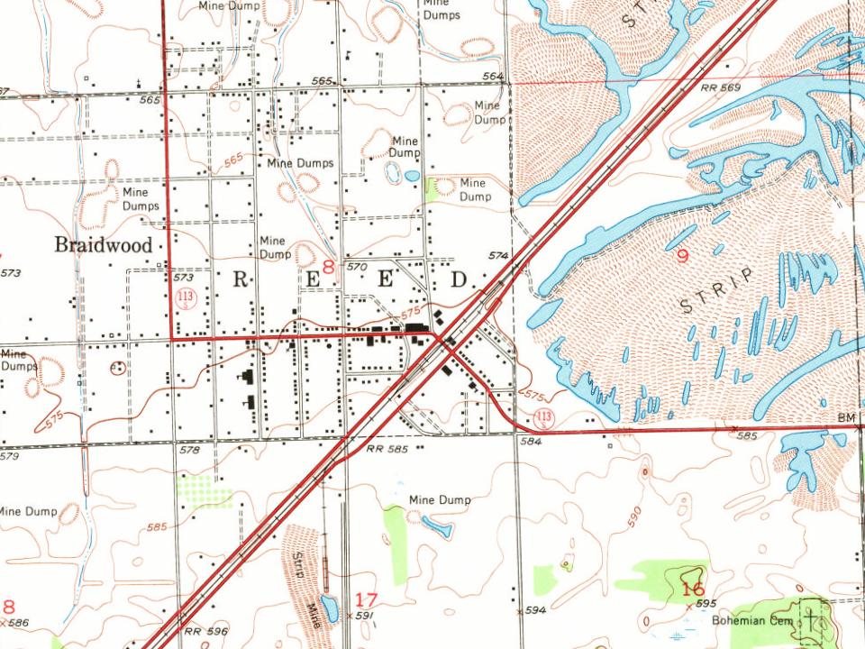
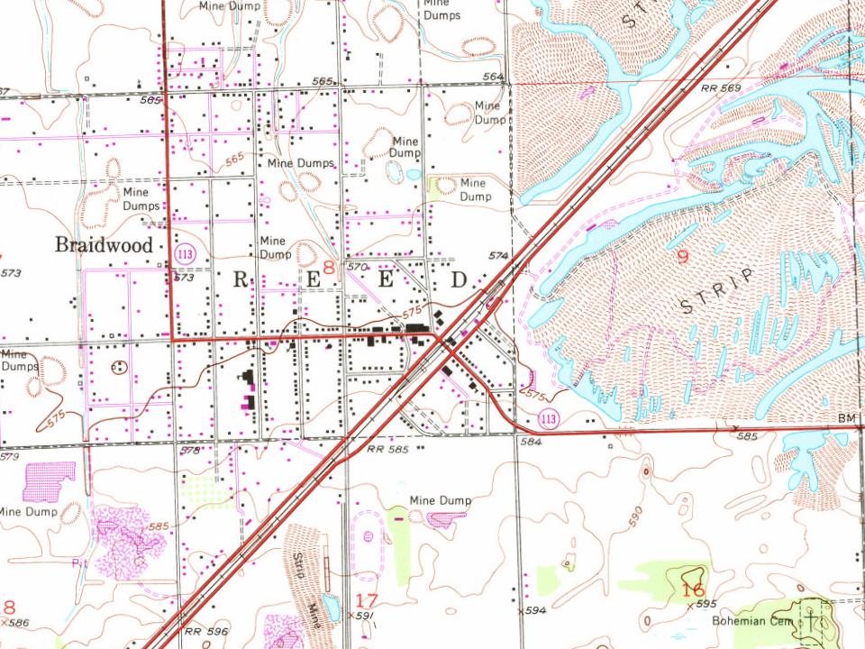
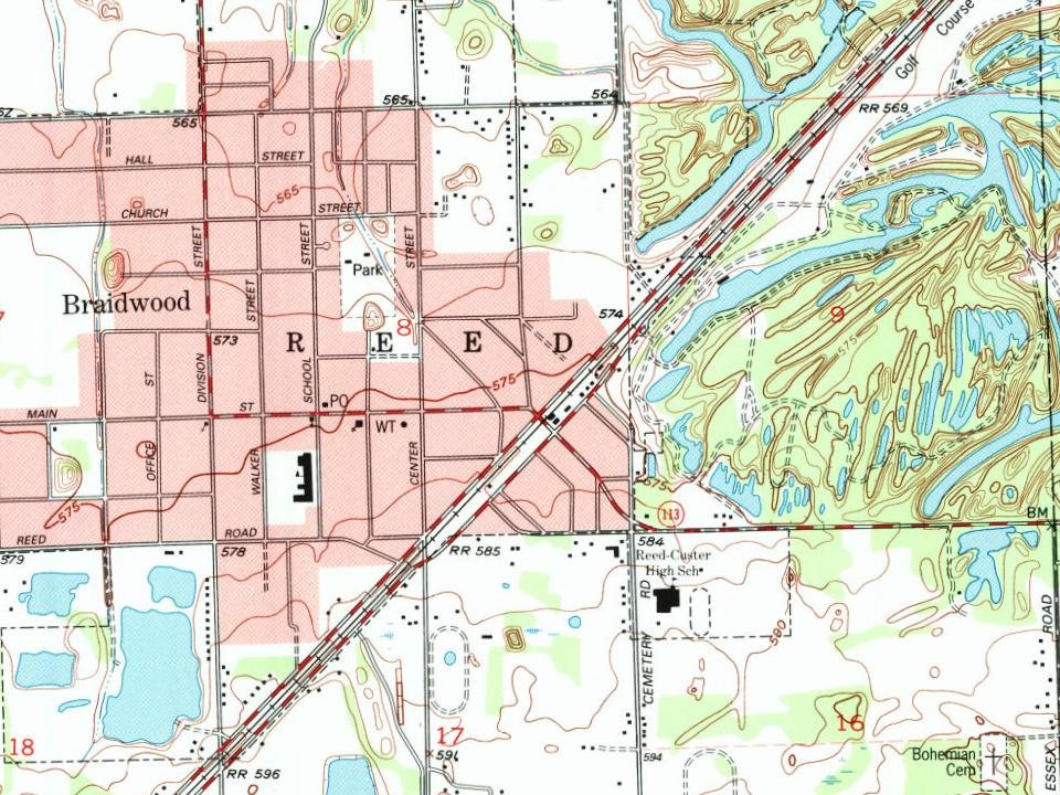




 2013
 2013
 2013
 2013
 2013
