In December 1836, surveyors platted the community of New Castle, located on the site of present-day Atlanta. The New Castle post office opened on November 26, 1847.
Passages that mention Atlanta Township, cut from the printed page as they were published.
History of Logan County, Illinois1886 · page 568Read the page →
Read the text
1868; Robert A., born October 23, 1836, died August 15, 1846, and Mary E., born June 30, 1845, died March 15, 1848. Zebulon Cantrall came to Logan County, Illinois, in 1834 and settled on section 36, Atlanta Township. He assisted in the organization of the Presbyterian church at Waynesville in 1836 and for twentytwo years served that church as ruling elder. He was justice of the peace of Atlanta Township for many years, and for several years served as associate judge of Logan County, being a wise
Text read by machine from the scan; it may contain errors.
Scans and text from the Internet Archive. Books published in 1930 or earlier, which are in the public domain.
The U.S. Geological Survey’s map of Atlanta Township.
1981McLean sheet · 1:24,000
U.S. Geological Survey historical topographic maps (public domain), via Esri’s collection of the scans. The red ring marks the center of Atlanta Township.
Then & now
Stand where they stood
No then-and-now pairs yet. Take a photo from the same spot as an old one and they appear here side by side.
Retake this viewJ. H. Hawes Elevator, Second Street
Find the spot, match the angle, and add your photo. It becomes the first then-and-now pair on Atlanta Township’s page.
Founding dates: Wikidata, Wikipedia, the U.S. post office records of Blevins & Helbock (CC0) and the Census. Homes by year built: Census ACS 2020–24. National Register of Historic Places: National Park Service (list of May 22, 2026). Old photos, postcards and papers: Wikimedia Commons, the Library of Congress and other public archives, credited on each item’s page. Maps: U.S. Geological Survey historical topographic maps (via Esri) and Sanborn fire-insurance maps (Library of Congress). History text and census tables: Wikipedia (CC BY-SA 4.0). Places that used to be: USGS Geographic Names Information System (2021). How TownRatings grades history →
From Wikimedia Commons (14), the Library of Congress (1), Wikidata (2), Wikipedia, U.S. Geological Survey historical maps, the USGS Geographic Names Information System and old county and town histories (Internet Archive). Archive images are copied here with their credits and licenses, shown on each photo’s page. Refreshed monthly.


 Date?
 2019
 2017
 2017
 2017
 2017
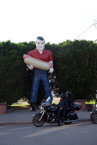 2017
 2017
 2014
 2008
 2008
 2008
 2007
 2007
 2007
