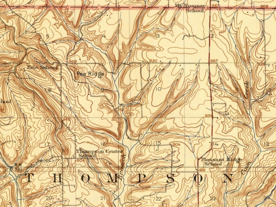
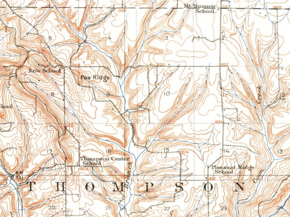
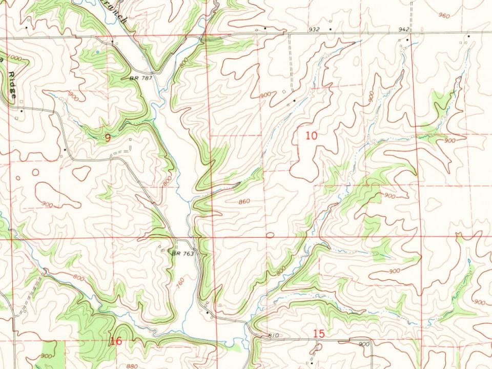
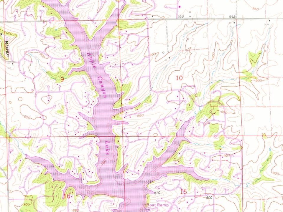
Every edition of the U.S. Geological Survey’s map of Apple Canyon Lake. Tap a year, or press play to watch the town change.
1911Elizabeth sheet · 1:62,500
U.S. Geological Survey historical topographic maps (public domain), via Esri’s collection of the scans. The red ring marks the center of Apple Canyon Lake.
Apple Canyon Lake is a planned vacation community developed in the late 1960s by the Branigar Organization of Medinah, Illinois. Branigar had developed similar vacation home projects in Wisconsin: Dutch Hollow Lake and Lake Redstone where Branigar built a dam along a stream and then sold water front vacation lots. Branigar assembled the 2,700 acres (1,100 ha) of land in Jo Daviess County, Illinois that was considered by farmers as marginal pasture land due to the steep inclines and rocky out croppings of limestone. An interesting aspect of the development is that 85 percent of the 15 miles of shore line is unsubdivided and is to remain green space. This provides lake access to those lots not on the shoreline. In addition, the main road is set back from the lake with lots accessible via cul de sacs.
Founding dates: Wikidata, Wikipedia, the U.S. post office records of Blevins & Helbock (CC0) and the Census. Homes by year built: Census ACS 2020–24. National Register of Historic Places: National Park Service (list of May 22, 2026). Old photos, postcards and papers: Wikimedia Commons, the Library of Congress and other public archives, credited on each item’s page. Maps: U.S. Geological Survey historical topographic maps (via Esri) and Sanborn fire-insurance maps (Library of Congress). History text and census tables: Wikipedia (CC BY-SA 4.0). Places that used to be: USGS Geographic Names Information System (2021). How TownRatings grades history →
From Wikipedia and U.S. Geological Survey historical maps. Archive images are copied here with their credits and licenses, shown on each photo’s page. Refreshed monthly.