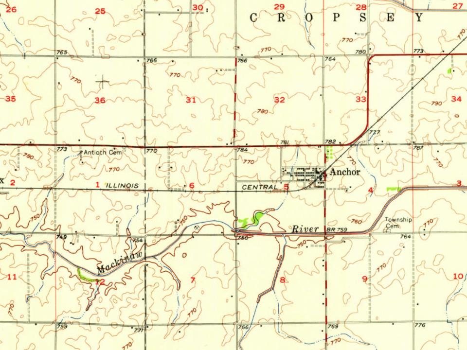
Anchor was laid out on April 28, 1880, by Daniel B. Stewart (1837 – 1920). Stewart was a large landowner in the area. He was born in New York and had come to Illinois in the early 1860s. With others Stewart donated $10,000 to build ten miles of the railroad. The town was created when the Clinton Bloomington and Northeastern Railroad was built. Colfax, Cropsey and Cooksville were laid out at the same time. This railroad was soon absorbed by the Illinois Central. The first trains passed through the town on July 4, 1880. The town takes its name from Anchor Township; early McLean County historians wrote that they did not know the source of the name Anchor.
The Christians have no church in Anchor, but have one just across the line in Martin, which is convenient to them. Dr. A. W. Green, of Potosi, preaches once a month in the Methodist Church near the iron bridge.
Text read by machine from the scan; it may contain errors.
Anchor is reasonably well supplied with churches, and the people seem to be interested in spiritual matters. " Prairie Chapel" (M. E.), a neat and plain structure, standing near the iron bridge is 30x40, and was built in 1874, at a cost of $1,300. Preaching had been held in the schoolhouse for some years quite regularly, when it was thought best to build the chapel. Messrs. 0. D. Butler, Alex. Shannon, J. C. Swatsley, Z. C. Worley and H. A. Thompson were selected to look after the work. It belongs to Fairbury Circuit, and the pulpit has been supplied by Revs. D. R. Dietch, Mr. Bealer and James Sanders,
Text read by machine from the scan; it may contain errors.
Anchor Township. — This township is practically all prairie land, and it remained unsettled for many years after other parts of the county were populated to more or less extent. R. M. Rankin entered the first lands in Anchor townshi pin August, 1850, and Robert Cunningham was the second claimant in 1851. Robert Stackpole settled in the township in 1853 and bought a tract of over 2,300 acres. He incurred large expenses for fencing and other improvements, and crops failed for a year or two after, her started farming, hence his lands were sold for debt about the
Text read by machine from the scan; it may contain errors.
Scans and text from the Internet Archive. Books published in 1930 or earlier, which are in the public domain.
By decade
No old photos in the archives yet
Weddings on Main Street, storms, parades, school pictures, the old store. If it’s in your family album, it belongs here.
Be the first to add onePhotograph a print flat, in daylight, no flash.
Founding dates: Wikidata, Wikipedia, the U.S. post office records of Blevins & Helbock (CC0) and the Census. Homes by year built: Census ACS 2020–24. National Register of Historic Places: National Park Service (list of May 22, 2026). Old photos, postcards and papers: Wikimedia Commons, the Library of Congress and other public archives, credited on each item’s page. Maps: U.S. Geological Survey historical topographic maps (via Esri) and Sanborn fire-insurance maps (Library of Congress). History text and census tables: Wikipedia (CC BY-SA 4.0). Places that used to be: USGS Geographic Names Information System (2021). How TownRatings grades history →
From Wikipedia, U.S. Geological Survey historical maps, U.S. Census counts (via Wikipedia), the US Post Offices dataset (Blevins & Helbock), the USGS Geographic Names Information System and old county and town histories (Internet Archive). Archive images are copied here with their credits and licenses, shown on each photo’s page. Refreshed monthly.