Blarney Castle and Gardens and more within reach of Kilbrin
None of the places to visit we list is in Kilbrin or within 5 km of its edge. Travel 36 km and you reach Blarney Castle and Gardens. The wider area, within 40 km, holds 12 places on our list, with 9 castles and 2 abbeys or priories among them.
Where they are
Numbered 1 to 6, the places follow the tiles below.
Kilbrin is the orange dot; the numbers match the places below. © OpenStreetMap contributors · CSO 2022 outline
Grouped by kind
All 12 are castles or historic places.
Green: inside Kilbrin. Grey: the rest, within 40 km.
The complete list
Everything here is within 40 km, 12 places in all.
What is in or close to Kilbrin comes first, then the best known within 40 km, close and well known first. Churches, protected structures and monuments belong to the History page, not here.
Monuments and historic buildings in Kilbrin → · Parks, footpaths and green space in Kilbrin →
Days out from Kilbrin
A day out within 40 km offers 12 places; these are the best known.
 1CastleBlarney Castle and Gardens36 km southeast
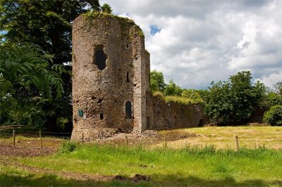 2CastleKilbolane Castle14 km north
 3CastleKanturk Castle7.3 km southwest
 4CastleDromaneen Castle12 km southeast
 5CastleLiscarroll Castle5.6 km north
 6Abbey or prioryMourne Abbey15 km southeast
 CastleMallow Castle16 km southeast
 Abbey or prioryBallybeg Priory St. Thomas11 km east
 CastleDrishane Castle21 km southwest
 CastleBlackwater Castle26 km east
 CastleCastlepook19 km east
 Historic houseDoneraile Estate17 km east
The best known within 40 km, the closest and best known first.
The nearest town with more to see: Buttevant →
Asked about places to visit in Kilbrin
Does Kilbrin have a museum?
No museum or gallery is mapped in or within 5 km of Kilbrin.
Is there a Heritage Ireland (OPW) or national park property near Kilbrin?
None is recorded within 5 km of Kilbrin.
What are the best-known days out near Kilbrin?
Within 40 km: Blarney Castle and Gardens (36 km), Kilbolane Castle (14 km), Kanturk Castle (7.3 km), Dromaneen Castle (12 km).
How is this list made?
From Fáilte Ireland’s open data on attractions (museums, castles, historic houses, abbeys, gardens, national parks, landscapes, islands, zoos and visitor farms: restaurants, pubs, shops and tour operators are left out), OpenStreetMap (places open to visitors; a ruined castle on farmland needs a sign it can be visited) and Wikidata (what each place is, who looks after it, its Wikipedia articles), merged into one list and placed in the town’s CSO 2022 outline or within 5 km of its edge.
Places to visit: Fáilte Ireland open data (CC BY 4.0), © OpenStreetMap contributors (ODbL) and Wikidata (CC0), placed in each town’s CSO 2022 outline. Visitor counts are the latest Wikidata gives, with their year.
Photos: each place’s Wikidata image, from Wikimedia Commons under the licence below (our copy, resized).
Photo credits (6)
- Blarney Castle and Gardens: Gerd Eichmann, CC BY-SA 4.0, Wikimedia Commons
- Kilbolane Castle: Mike Searle, CC BY-SA 2.0, Wikimedia Commons
- Kanturk Castle: The Speckled Bird, CC BY-SA 4.0, Wikimedia Commons
- Dromaneen Castle: Mike Searle, CC BY-SA 2.0, Wikimedia Commons
- Liscarroll Castle: Mike Searle, CC BY-SA 2.0, Wikimedia Commons
- Mourne Abbey: JohnArmagh, Public domain, Wikimedia Commons
Contains Central Statistics Office (CSO) data, Census 2022, and Tailte Éireann boundaries (CSO Urban Areas, Small Areas, local electoral areas, constituencies), under Creative Commons Attribution 4.0 (CC BY 4.0).