Swea City was platted in 1892; it was then called Reynolds. In February 1893, the name was officially changed to Swea City. Swea City was petitioned for incorporation on December 11, 1894 with a population of 161. Several objections were filed with the reasons for objection listed as, "One, the judges of the election administered the oath to themselves swearing in each other; and Two, the words 'for incorporation' were written on one ballot while 'against corporation' was written on another ballot." It was implied that the choice needed to be available on a single ballot in order to be valid. Later a second petition was filed this time on April 19, 1895 and the election was held at a schoolhouse. Each ballot had "For incorporation" and "Against incorporation" printed on them. The vote was 34 in favor of incorporation and 1 against, and the city was incorporated.
Passages that mention Swea City, cut from the printed page as they were published.
History of Kossuth County, Iowa1913 · page 703Read the page →
Read the text
The town of Swea City was called at first by the name of Reynolds. The site was surveyed by order of the Northern Iowa Land & Town Lot Company, and the plat was filed on record July 23, 1892. Sixteen blocks, having the streets running north and south and the avenues east and west, made up the original site. On Third street the principal business houses have been erected.
Text read by machine from the scan; it may contain errors.
History of Kossuth County, Iowa1913 · page 705Read the page →
Read the text
The election for the incorporation of Swea City was held April 19, 1895. R. M. Richmond, X. Ganfield and Peter Severson being the judges, and W. R. Pcet and C. F. Buker the clerks. All told 35 ballots were cast, and all but one were in favor of the measure. W. R. Pect became the first mayor and those since his retirement have been R. M. Richmond, 1896; C. J. Johnson, 1899; A.
Text read by machine from the scan; it may contain errors.
Scans and text from the Internet Archive. Books published in 1930 or earlier, which are in the public domain.
Timeline
Swea City, 1892 to 1980
Woven from the archive, old maps, post office records, the National Register and the people born here.
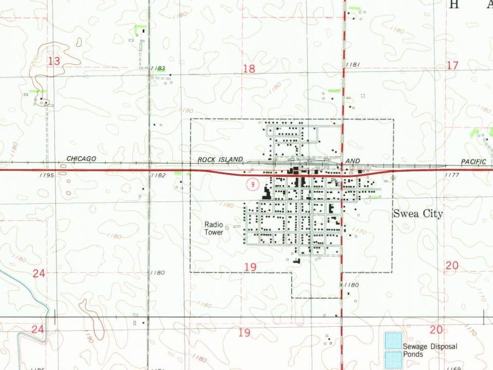
U.S. Geological Survey historical topographic maps (public domain), via Esri’s collection of the scans. The red ring marks the center of Swea City.
Questions about Swea City’s history
What year was Swea City founded?
In 1892, according to Wikidata and Wikipedia’s history of the town. Swea City’s post office opened in 1893, and the census of 1900 counted 322 people here.
Founding dates: Wikidata, Wikipedia, the U.S. post office records of Blevins & Helbock (CC0) and the Census. Homes by year built: Census ACS 2020–24. National Register of Historic Places: National Park Service (list of May 22, 2026). Old photos, postcards and papers: Wikimedia Commons, the Library of Congress and other public archives, credited on each item’s page. Maps: U.S. Geological Survey historical topographic maps (via Esri) and Sanborn fire-insurance maps (Library of Congress). History text and census tables: Wikipedia (CC BY-SA 4.0). Places that used to be: USGS Geographic Names Information System (2021). How TownRatings grades history →
From Wikipedia, U.S. Geological Survey historical maps, U.S. Census counts (via Wikipedia), the US Post Offices dataset (Blevins & Helbock), the USGS Geographic Names Information System and old county and town histories (Internet Archive). Archive images are copied here with their credits and licenses, shown on each photo’s page. Refreshed monthly.