Ottumwa’s post office opened in 1844, and 29% of its homes were built before 1940
More historic than 94% of U.S. towns · #15 of 140 in Iowa. What drives it
24 places in town are on the National Register, among them seven historic districts with 245 buildings between them. Below: 6 old photos and papers, maps from 1885 on, and the census since 1860.
The Ottumwa post office opened in 1844, the earliest record of the town by name. Two smaller post offices, Port Richmond (1858) and Rutledge (1905), opened inside today’s city and later closed.
First census: 1,632 in 18602020 census: 25,529182 years
How historic is Ottumwa?
A
More historic than 94% of U.S. towns, on its age, its old homes and the National Register.
Founding year: the first Ottumwa post office (Blevins & Helbock, CC0).The full story ↓
History grade
What drives Ottumwa’s History grade
On its age, its old homes and the National Register, Ottumwa is more historic than 94% of U.S. towns, #15 of 140 in Iowa. All 3 inputs are above most U.S. towns; its National Register listings ranks highest and its age lowest.
A
HistoryA character grade: shown, never part of Ottumwa’s overall grade.
Iowa towns list more on the Register than most of the country (a typical Iowa town has 9.1 per 10,000 residents, the U.S. 2.4), so Ottumwa’s 103 sits above most of its state (83% of Iowa towns have fewer) while its 262 historic buildings outnumber those of 95% of U.S. towns.
How sure. Graded on any two of the three inputs instead, the letter would still be A. The pre-1940 share (±2.7 points) is firm at this size. The founding year is the first post office, not a stated founding date.
Founding year: the first post office (other dates in Quick answers). Homes: Census ACS 2020–24. National Register: National Park Service, May 2026 list; each listing counted once (boundary changes and added documentation belong to their listing), and a historic district counts its contributing buildings. How TownRatings grades history →
What stands out about Ottumwa’s past
Read from the archive, the National Register and the record. The page puts what stands out first.
The city's name derives from Fox, an Algonquian language of the native Meskwaki people, translating to 'tumbling waters' in reference to the Appanoose Rapids on the Des Moines River.
In May 1843, several investors formed the Appanoose Rapids Company and staked claim to 467 acres (189 ha) of land in the present site of Ottumwa. Their colonization involved claiming land supporting three indigenous settlements. The first official cabin was built in May 1843 after the area was opened to settlement (an earlier cabin built in defiance of this date was destroyed by Army troops at that time). The original platt was titled Louis Ville. In 1844 the city was named as the county seat.
Passages that mention Ottumwa, cut from the printed page as they were published.
The history of Wapello County, Iowa, containing a history of the county, its cities, towns, &c., a biographical directory of citizens, war record of its volunteers in the late rebellion, general and local statistics ... history of the Northwest, history o1878 · page 504Read the page →
Read the text
schemes proposed, attention was speedily turned to other methods of obtaining means of exit to the centers of national trade. A plankroad was the first plan offered, and for a time the enterprise bid fair to win. It was designed to lay a plankroad from Burlington to the "Bjg Muddy," via Ottumwa, and thereby divert business from the interior of the State, through the town of Ottumwa. The introduction of railroad projects at that time entirely dissipated the plankroad fever, and prepared the way for the only really beneficial means of transit ever suggested.
Text read by machine from the scan; it may contain errors.
History of Wapello County, Iowa1901 · page 301Read the page →
Read the text
j\Ir. Wood has been a busy man all his life; he was deputy sheriff of Wapello county in 1856; city marshal of Ottumwa in 1867-68-69, and from 1871 to 1874 was in the employ of the Chicago, Burlington & Quincy Railroad, as adjusting agent. He was appointed agent .of the Blackfeet and Piegan Indians, with headcjuarters at Teton, on the Teton River, 60
Text read by machine from the scan; it may contain errors.
History of Wapello County, Iowa1914 · page 606Read the page →
Read the text
and in March, 1875, he went to Wilton Junction as train dispatcher for the Chicago, Rock Island & Pacific Railroad, there remaining until July, 1876, when he accepted a similar position on the Chicago, Burlington & Quincy Railroad at Ottumwa, remaining with the road for two decades. He continued here for only a short time, however, for in the same month he was transferred to Burlington, where he remained as dispatcher until January i, 1880. He was next chief dispatcher of the St. Louis
Text read by machine from the scan; it may contain errors.
History of Wapello County, Iowa1914 · page 352Read the page →
Read the text
Third United States Cavalry in the capacity of teamster, spending the year 1866 there. In 1867-68 he rode the pony express from Fort Hays to Fort Dodge on the Indian reservation. In i86g he came to Ottumwa, but afterward returned again to the plains and was employed on the construction of the Kansas Pacific Railroad. Later he again came to Ottumwa and was in the employ of the Chicago, Burlington & Quincy Railroad in 1872. The following year was spent in the service of the Iron
Text read by machine from the scan; it may contain errors.
Scans and text from the Internet Archive. Books published in 1930 or earlier, which are in the public domain.
Timeline
Ottumwa, 1844 to 1986
Woven from the archive, old maps, post office records, the National Register and the people born here.
Nothing in the archives for these yearsWeddings on Main Street, storms, parades, school pictures, the old store. If it’s in your family album, it belongs here.
Every edition of the U.S. Geological Survey’s map of Ottumwa. Tap a year, or press play to watch the town change.
1956Ottumwa North sheet · 1:24,000
U.S. Geological Survey historical topographic maps (public domain), via Esri’s collection of the scans. The red ring marks the center of Ottumwa.
Every building
Ottumwa, building by building, 1885–1917
Fire insurance maps drew every building, what it was made of and what it was used for, so insurers could price the risk of fire. Pick a year, then a sheet.
The Ottumwa post office opened in 1844, the earliest record of the town by name (U.S. post office records).
How does Ottumwa rank for history?
Ottumwa is more historic than 94% of U.S. towns, #15 of 140 in Iowa. The History grade combines the town’s founding era, the share of homes built before 1940 and its National Register listings. It’s a character grade, so it isn’t part of the overall grade. How it works.
What is on the National Register in Ottumwa?
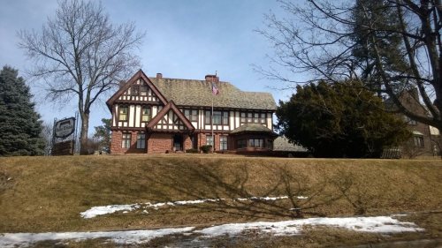
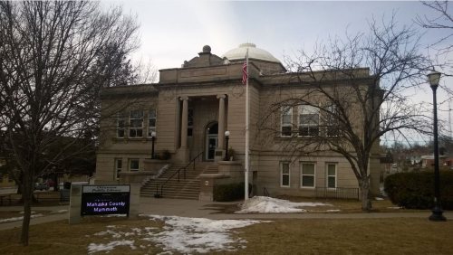
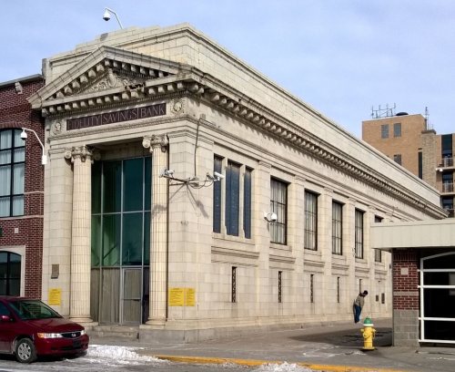
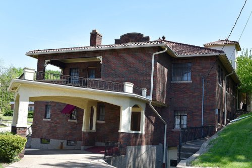
24 listings: 16 buildings, among them the U.S. Post Office (listed 1976, the first), 7 historic districts with 245 contributing buildings, and 1 structure. 262 historic buildings in all.
How old are the homes in Ottumwa?
29% of Ottumwa’s homes were built before 1940 (Census estimate, ±2.7 points), against a typical 22% for an Iowa town; the median home was built in 1955.
Founding dates: Wikidata, Wikipedia, the U.S. post office records of Blevins & Helbock (CC0) and the Census. Homes by year built: Census ACS 2020–24. National Register of Historic Places: National Park Service (list of May 22, 2026). Old photos, postcards and papers: Wikimedia Commons, the Library of Congress and other public archives, credited on each item’s page. Maps: U.S. Geological Survey historical topographic maps (via Esri) and Sanborn fire-insurance maps (Library of Congress). History text and census tables: Wikipedia (CC BY-SA 4.0). Places that used to be: USGS Geographic Names Information System (2021).
From Wikimedia Commons (4), the Library of Congress (2), the National Register of Historic Places (24), Wikipedia, Wikidata and Wikipedia for famous people, U.S. Geological Survey historical maps, U.S. Census counts (via Wikipedia), the US Post Offices dataset (Blevins & Helbock), the USGS Geographic Names Information System, Sanborn fire insurance maps (Library of Congress) and old county and town histories (Internet Archive). Archive images are copied here with their credits and licenses, shown on each photo’s page. Refreshed monthly.





 1907
 1907
 1907
 1909


