More historic than 85% of U.S. towns · #33 of 140 in Iowa. What drives it
7 places in town are on the National Register, among them a historic district with 41 buildings. Below: 2 old photos and papers, maps from 1886 on, and the census since 1870.
Osceola was named after a Seminole Indian leader of the same name.
More on the name
Osceola is an anglicised form of Asiyahola: assi, from a ceremonial yaupon holly tea or "black drink" and yaholi, the name of a Creek god intoned when the drink was served.
How historic is Osceola?
A
More historic than 85% of U.S. towns, on its age, its old homes and the National Register.
On its age, its old homes and the National Register, Osceola is more historic than 85% of U.S. towns, #33 of 140 in Iowa. All 2 inputs are above most U.S. towns; its National Register listings ranks highest and its share of homes from before 1940 lowest.
A
HistoryA character grade: shown, never part of Osceola’s overall grade.
Iowa towns list more on the Register than most of the country (a typical Iowa town has 9.1 per 10,000 residents, the U.S. 2.4), so Osceola’s 85.1 sits above most of its state (82% of Iowa towns have fewer) while its 47 historic buildings outnumber those of 84% of U.S. towns.
How sure. Graded on two of the three inputs, so a change in either one moves the letter more than it would with three. The pre-1940 share is a Census survey estimate (±6.8 points).
Founding year: our sources. Homes: Census ACS 2020–24. National Register: National Park Service, May 2026 list; each listing counted once (boundary changes and added documentation belong to their listing), and a historic district counts its contributing buildings. How TownRatings grades history →
What stands out about Osceola’s past
Read from the archive, the National Register and the record. The page puts what stands out first.
National Park Service, National Register of Historic Places. Photos from Wikimedia Commons, credited on each place’s page.
Every building
Osceola, building by building, 1886–1913
Fire insurance maps drew every building, what it was made of and what it was used for, so insurers could price the risk of fire. Pick a year, then a sheet.
In 1872, the Masonic Building was built on the public square in Osceola. The Italianate building was used by Osceola Lodge No. 77 of the Ancient Free & Accepted Masons, and the main floor was a bank and hardware store.
In December 2023, Osceola City Administrator Ty Wheeler urged residents to switch from using tap water to bottled water as extreme drought affected West Lake. In February 2024, the Clarke Community School District shut off drinking water in all its buildings due to a severe drought in Osceola.
Passages that mention Osceola, cut from the printed page as they were published.
History of Osceola county, Iowa, from its organization to the present time1892 · page 203Read the page →
Read the text
The Burlington, Cedar Rapids and Northern Railroad crossed Osceola County in the year 1884. The coming of this road brought into existence the Town of Ocheyedan, and in the fall of 1884 building commenced. The first building put up on the town site was a "shanty," which kind of a building is well understood, though the word itself is becoming obsolete. This was put up by James Wood, and he lived in it and stored his goods there, while a building was being pre-
Text read by machine from the scan; it may contain errors.
History of Osceola county, Iowa, from its organization to the present time1892 · page 115Read the page →
Read the text
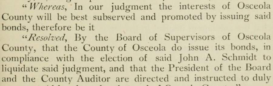
" Wliereas, In our judgment the interests of Osceola County will be best subserved and promoted by issuing said bonds, therefore be it "Resolved, By the Board of Supervisors of Osceola County, that the County of Osceola do issue its bonds, in compliance with the election of said John A. Schmidt to liquidate said judgment, and that the President of the Board and the County Auditor are directed and instructed to duly
Text read by machine from the scan; it may contain errors.
pany. Other prominent railroad men of St. Paul, are largely interested in’ the building of this railroad trom Sibley, in Osceola County, to Rock Rapids, in Lyon County, thence northwest to intersect the Northern Pacific Railroad. It is now expected that Sioux Falls, Dakota, will be line. We are assured by parties inter-
Text read by machine from the scan; it may contain errors.
Scans and text from the Internet Archive. Books published in 1930 or earlier, which are in the public domain.
Timeline
Osceola, 1851 to 1952
Woven from the archive, old maps, post office records, the National Register and the people born here.
Nothing in the archives for these yearsWeddings on Main Street, storms, parades, school pictures, the old store. If it’s in your family album, it belongs here.
US Post Offices dataset (Blevins & Helbock, CC0). Places and cemeteries from the USGS Geographic Names Information System (2021).
Questions about Osceola’s history
How does Osceola rank for history?
Osceola is more historic than 85% of U.S. towns, #33 of 140 in Iowa. The History grade combines the town’s founding era, the share of homes built before 1940 and its National Register listings. It’s a character grade, so it isn’t part of the overall grade. How it works.
What is on the National Register in Osceola?
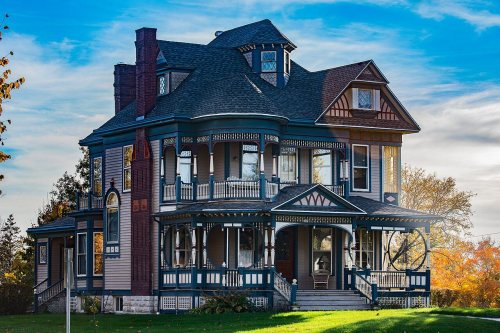
7 listings: 6 buildings, among them the Dickinson Webster House (listed 1977, the first), and 1 historic district, the Osceola Commercial Historic District, with 41 contributing buildings. 47 historic buildings in all.
How old are the homes in Osceola?
16% of Osceola’s homes were built before 1940 (Census estimate, ±6.8 points), against a typical 22% for an Iowa town; the median home was built in 1975.
Founding dates: Wikidata, Wikipedia, the U.S. post office records of Blevins & Helbock (CC0) and the Census. Homes by year built: Census ACS 2020–24. National Register of Historic Places: National Park Service (list of May 22, 2026). Old photos, postcards and papers: Wikimedia Commons, the Library of Congress and other public archives, credited on each item’s page. Maps: U.S. Geological Survey historical topographic maps (via Esri) and Sanborn fire-insurance maps (Library of Congress). History text and census tables: Wikipedia (CC BY-SA 4.0). Places that used to be: USGS Geographic Names Information System (2021).
From Wikimedia Commons (1), the Library of Congress (1), Wikidata (3), the National Register of Historic Places (7), Wikipedia, Wikidata and Wikipedia for famous people, U.S. Geological Survey historical maps, U.S. Census counts (via Wikipedia), the US Post Offices dataset (Blevins & Helbock), the USGS Geographic Names Information System, Sanborn fire insurance maps (Library of Congress) and old county and town histories (Internet Archive). Archive images are copied here with their credits and licenses, shown on each photo’s page. Refreshed monthly.






 1908


