Mount Pleasant’s post office opened in 1838, and 26% of its homes were built before 1940
More historic than 90% of U.S. towns · #26 of 140 in Iowa. What drives it
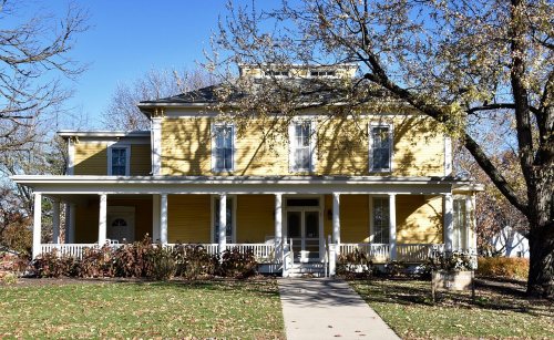
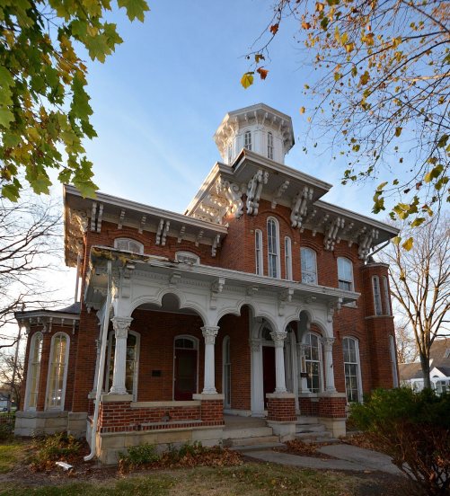
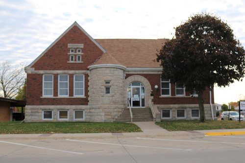
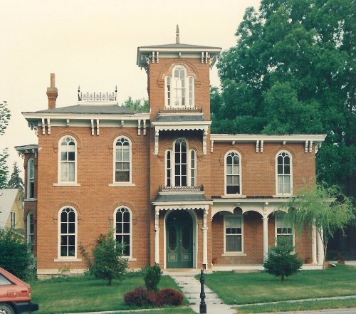
25 places in town are on the National Register, among them a historic district with 2 buildings. Below: 2 old photos and papers, maps from 1886 on, and the census since 1850.
From Mount Pleasant’s archive · credits on each photo
Quick answers
How Mount Pleasant began
When was Mount Pleasant founded?
1838
The Mount Pleasant post office opened in 1838, the earliest record of the town by name. Another post office, West Mount Pleasant (1837), opened inside today’s city and later closed.
First census: 758 in 18502020 census: 9,274188 years
How historic is Mount Pleasant?
A
More historic than 90% of U.S. towns, on its age, its old homes and the National Register.
Founding year: the first Mount Pleasant post office (Blevins & Helbock, CC0).The full story ↓
History grade
What drives Mount Pleasant’s History grade
On its age, its old homes and the National Register, Mount Pleasant is more historic than 90% of U.S. towns, #26 of 140 in Iowa. All 3 inputs are above most U.S. towns; its share of homes from before 1940 ranks highest and its age lowest.
A
HistoryA character grade: shown, never part of Mount Pleasant’s overall grade.
Iowa towns list more on the Register than most of the country (a typical Iowa town has 9.1 per 10,000 residents, the U.S. 2.4), so Mount Pleasant’s 29.0 sits above most of its state (72% of Iowa towns have fewer) while its 26 historic buildings outnumber those of 81% of U.S. towns.
How sure. Graded on any two of the three inputs instead, the letter would range from A− to A. The pre-1940 share is a Census survey estimate (±5.3 points). The founding year is the first post office, not a stated founding date.
Founding year: the first post office (other dates in Quick answers). Homes: Census ACS 2020–24. National Register: National Park Service, May 2026 list; each listing counted once (boundary changes and added documentation belong to their listing), and a historic district counts its contributing buildings. How TownRatings grades history →
What stands out about Mount Pleasant’s past
Read from the archive, the National Register and the record. The page puts what stands out first.
Fire insurance maps drew every building, what it was made of and what it was used for, so insurers could price the risk of fire. Pick a year, then a sheet.
The first permanent settlement at Mount Pleasant was made in 1833. Mount Pleasant was incorporated as a town in 1842, and again in 1851.
In 1869, Mount Pleasant was the site of a solar eclipse expedition, under the command of James Craig Watson and sponsored by National Almanac. The total solar eclipse occurred on August 7, 1869.
In the Union Block building in 1869, Arabella A. Mansfield became the first woman in the United States to be awarded a license to practice law. She had passed the bar exam with high scores and won a court case for entry to the bar. The legislature changed its statute.
Passages that mention Mount Pleasant, cut from the printed page as they were published.
The history of Henry county, Iowa, containing a history of the county, its cities, towns, &c., a biographical directory of citizens, war record of its volunteers in the late rebellion, general and local statistics ... history of the Northwest, history of1879 · page 504Read the page →
Read the text
The town of Mount Pleasant was first incorporated January 25, 1842. The charter provided for a government consisting of a President, four Councilmen and a Recorder, but in two years the government was abandoned, and on February 5, 1851, the town of Mount Pleasant was again incorporated. An election was held in April, 1851, which' resulted in the choice of Col. William Ihompson, Mayor; Harper Brigg^ T. V. Taft," John S. Green and Alvin baunders, Councilmen ; John F. Bartruff," Treasurer ; H. H. McMillan'^' Recorder, and M. C. Shaw, Marshal. This charter existed until 1857, when, by
Text read by machine from the scan; it may contain errors.
The history of Henry county, Iowa, containing a history of the county, its cities, towns, &c., a biographical directory of citizens, war record of its volunteers in the late rebellion, general and local statistics ... history of the Northwest, history of1879 · page 510Read the page →
Read the text
Not satisfied, another step was taken as follows : " An Act to amend an act, entitled ' An act to amend an act, entitled " An act for the incorporation of the town of Mount Pleasant, in Henry County,",' approved February 3, 1843 ; also an act entitled ' An act for the incorporation of the town of Mount Pleasant, in Henry County,' approved January 25, 1842.
Text read by machine from the scan; it may contain errors.
Scans and text from the Internet Archive. Books published in 1930 or earlier, which are in the public domain.
Timeline
Mount Pleasant, 1837 to 1981
Woven from the archive, old maps, post office records, the National Register and the people born here.
Nothing in the archives for these yearsWeddings on Main Street, storms, parades, school pictures, the old store. If it’s in your family album, it belongs here.
The U.S. Geological Survey’s map of Mount Pleasant.
1981Mount Pleasant sheet · 1:24,000
U.S. Geological Survey historical topographic maps (public domain), via Esri’s collection of the scans. The red ring marks the center of Mount Pleasant.
Then & now
Stand where they stood
No then-and-now pairs yet. Take a photo from the same spot as an old one and they appear here side by side.
Retake this viewMt. Pleasant, IA, 1907
Find the spot, match the angle, and add your photo. It becomes the first then-and-now pair on Mount Pleasant’s page.
Lost post offices, old corners and burying grounds
Mount Pleasant’s post office has been open since 1838. Another post office, West Mount Pleasant, opened and closed inside today’s town.
West Mount Pleasant
1837–1838
Mount Pleasant
1838–today
18301930today
Hamlets and corners on the map
Countryside Mobile Home CourtWoodside Mobile Estates
4cemeteries and burying grounds inside Mount Pleasant
Forest HomeMount Pleasant Old CitySaint AlphonsusWilliford
US Post Offices dataset (Blevins & Helbock, CC0). Places and cemeteries from the USGS Geographic Names Information System (2021).
Questions about Mount Pleasant’s history
What year was Mount Pleasant founded?
The Mount Pleasant post office opened in 1838, the earliest record of the town by name (U.S. post office records).
How does Mount Pleasant rank for history?
Mount Pleasant is more historic than 90% of U.S. towns, #26 of 140 in Iowa. The History grade combines the town’s founding era, the share of homes built before 1940 and its National Register listings. It’s a character grade, so it isn’t part of the overall grade. How it works.
What is on the National Register in Mount Pleasant?
25 listings: 24 buildings, among them the Old Main (listed 1973, the first), and 1 historic district, the Camp Harlan-Camp McKean Historic District, with 2 contributing buildings. 26 historic buildings in all.
How old are the homes in Mount Pleasant?
26% of Mount Pleasant’s homes were built before 1940 (Census estimate, ±5.3 points), against a typical 22% for an Iowa town; the median home was built in 1970.
Founding dates: Wikidata, Wikipedia, the U.S. post office records of Blevins & Helbock (CC0) and the Census. Homes by year built: Census ACS 2020–24. National Register of Historic Places: National Park Service (list of May 22, 2026). Old photos, postcards and papers: Wikimedia Commons, the Library of Congress and other public archives, credited on each item’s page. Maps: U.S. Geological Survey historical topographic maps (via Esri) and Sanborn fire-insurance maps (Library of Congress). History text and census tables: Wikipedia (CC BY-SA 4.0). Places that used to be: USGS Geographic Names Information System (2021).
From Wikimedia Commons (1), the Library of Congress (2), Wikidata (3), the National Register of Historic Places (25), Wikipedia, Wikidata and Wikipedia for famous people, U.S. Geological Survey historical maps, U.S. Census counts (via Wikipedia), the US Post Offices dataset (Blevins & Helbock), the USGS Geographic Names Information System, Sanborn fire insurance maps (Library of Congress) and old county and town histories (Internet Archive). Archive images are copied here with their credits and licenses, shown on each photo’s page. Refreshed monthly.






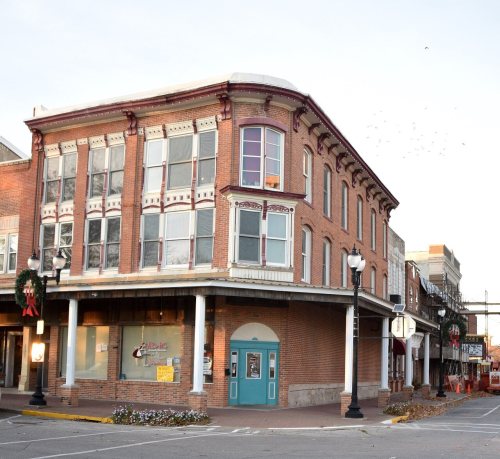
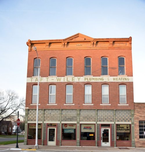


 1907
 2004


