Guest, Sign inJoin

Post to Marysville

We’ll email a one-tap link to publish your post. No password, and nothing is public until you click it.
Already a member? Sign in
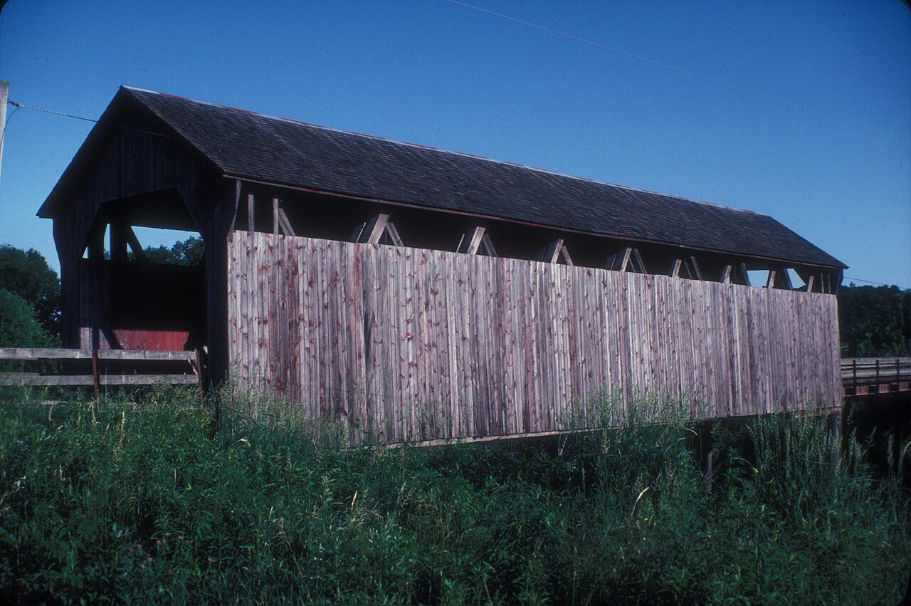
Hammond BridgeHammond Bridge · Photo: JERRYE & ROY KLOTZ MD · CC BY-SA 3.0
–Not graded
History · Marysville

Marysville’s post office opened in 1869, and 19% of its homes were built before 1940

Below: 1 old photo or paper, maps from 1929 on, and the census since 1860.

1869first post office
0on the National Register
19%homes built before 1940
1old photo or paper
Quick answers

How Marysville began

When was Marysville founded?

1869

The Marysville post office opened in 1869, the earliest record of the town by name. Another post office, Ely (1853), opened inside today’s city and later closed.

First census: 75 in 18602020 census: 44157 years
Founding year: the first Marysville post office (Blevins & Helbock, CC0).The full story ↓

What stands out about Marysville’s past

Read from the archive, the National Register and the record. The page puts what stands out first.

★ What stands out · Help out

Start Marysville’s collection

The first neighbors to add old photos shape how Marysville’s history is told.

Decades since 1900 with photos
00s10s20s30s40s50s60s70s80s90s
1 of 10 decades. The empty ones are waiting for someone’s album.
People over time

Marysville, census by census

0100200300190019502000Peak: 348

Peaked at 348 in 1890; 44 people lived here in 2020.

17 censuses, 1860–2020.

U.S. Census Bureau decennial counts, from the census table on Marysville’s Wikipedia page.

The story

How Marysville came to be

From Wikipedia’s history of Marysville.

Read it all →

There are numerous coal exposures on the banks of the branches of Cedar Creek both north and south of Marysville. In 1846, one exposure south of Marysville was found to be on fire, and this fire continued until June 1851, when heavy rains and flooding extinguished the fire.

ChaptersEverist

Text from Wikipedia, licensed CC BY-SA 4.0.

From the old history books

What they wrote about Marysville, 1872–1915

Passages that mention Marysville, cut from the printed page as they were published.

MARYSVILLE The Town of Marysville, in the southwestern part of Liberty Township, was surveyed by James A. Rousseau, county surveyor, for Joseph Brobst, on February 11, 1851, and the plat was filed on March 4,1851. It shows twenty-six lots with a public square in the center equal in size to four lot…
History of Marion County, Iowa, and its people1915Read the page →
Read the text

MARYSVILLE The Town of Marysville, in the southwestern part of Liberty Township, was surveyed by James A. Rousseau, county surveyor, for Joseph Brobst, on February 11, 1851, and the plat was filed on March 4,1851. It shows twenty-six lots with a public square in the center equal in size to four lots. In March, 1854, this public square was conveyed by the proprietor to Mathias Ulsh, who laid it out in lots under the name of Ulsh's addition. Since that time Ulsh &

Text read by machine from the scan; it may contain errors.
It is quite probable that Martin Neel was the first white man to establish a domicile within the present limits of the township. Just when he settled on Cedar Creek, not far from the present Town of Marysville, is not definitely known, but the date is supposed to have been before the Indian title t…
History of Marion County, Iowa, and its people1915 · page 114Read the page →
Read the text

It is quite probable that Martin Neel was the first white man to establish a domicile within the present limits of the township. Just when he settled on Cedar Creek, not far from the present Town of Marysville, is not definitely known, but the date is supposed to have been before the Indian title to the land was extinguished on May i, 1843. Mr. Neel was a Kentuckian by birth and in establishing his home so far in advance of the margin of civilization he invited a" the

Text read by machine from the scan; it may contain errors.
Marysville is situated on the south-west quarter of the southeast quarter of section 29, on the north side of South Cedar, in the beautiful vale that margins this stream. It was laid out by James Rousseau, Feb. 11, '57, on land then owned by Joseph Brobst and Josiah Brobst, the former owning the we…
Pioneers of Marion county, consisting of a general history of the county from its early settlement to the present date. Also, the geography and history of each township, including brief biographical sketches of some of the more prominent early settlers in1872 · page 287Read the page →
Read the text

Marysville is situated on the south-west quarter of the southeast quarter of section 29, on the north side of South Cedar, in the beautiful vale that margins this stream. It was laid out by James Rousseau, Feb. 11, '57, on land then owned by Joseph Brobst and Josiah Brobst, the former owning the west side and the latter the east side of what is now the main street of the village. The surveying was done by James Rousseau; John B. Ely and Jacob Stambach, chain carriers. The place

Text read by machine from the scan; it may contain errors.

Scans and text from the Internet Archive. Books published in 1930 or earlier, which are in the public domain.

Timeline

Marysville, 1853 to 1934

Woven from the archive, old maps, post office records, the National Register and the people born here.

  1. 19th century
  2. 1853Post officeThe Ely post office opens
  3. 1869Post officeThe Ely post office closes
  4. 1869Post officeThe Marysville post office opens
  5. 1890CensusPopulation peaks at 348
  6. 20th century
  7. 1909In the archiveMarysvilleMines
  8. 1929On the mapFirst mapped by the U.S. Geological Survey
  9. 1934Post officeThe Marysville post office closes
By decade

Marysville, decade by decade

One decade in the archive so far: the 1900s. Scroll each row; tap a photo for its story.

1910s–1990snothing yet
Nothing in the archives for these yearsWeddings on Main Street, storms, parades, school pictures, the old store. If it’s in your family album, it belongs here.
Add from your album
On the map

Marysville on the map, 1929 to 1982

Every edition of the U.S. Geological Survey’s map of Marysville. Tap a year, or press play to watch the town change.

Marysville on the 1929 USGS mapMarysville on the 1982 USGS map1929Albia sheet · 1:62,500

U.S. Geological Survey historical topographic maps (public domain), via Esri’s collection of the scans. The red ring marks the center of Marysville.

Then & now

Stand where they stood

No then-and-now pairs yet. Take a photo from the same spot as an old one and they appear here side by side.

MarysvilleMines
Retake this viewMarysvilleMines, 1909

Find the spot, match the angle, and add your photo. It becomes the first then-and-now pair on Marysville’s page.

Retake this view · +15
Famous people

Famous people close to Marysville

Nobody well known was born in Marysville itself, so here are the best known from just nearby.

See all →
Places that used to be

Lost post offices and burying grounds

Marysville had its own post office from 1869 to 1934. Another post office, Ely, opened and closed inside today’s town.

Ely
1853–1869
Marysville
1869–1934
18501940today
1cemetery inside Marysville
Marysville

US Post Offices dataset (Blevins & Helbock, CC0). Places and cemeteries from the USGS Geographic Names Information System (2021).

Questions about Marysville’s history

What year was Marysville founded?

The Marysville post office opened in 1869, the earliest record of the town by name (U.S. post office records).

Memory lane

What the archives can’t tell you, neighbors can.

Town Square →
Start a conversation
Sources

Where this page comes from

Founding dates: Wikidata, Wikipedia, the U.S. post office records of Blevins & Helbock (CC0) and the Census. Homes by year built: Census ACS 2020–24. National Register of Historic Places: National Park Service (list of May 22, 2026). Old photos, postcards and papers: Wikimedia Commons, the Library of Congress and other public archives, credited on each item’s page. Maps: U.S. Geological Survey historical topographic maps (via Esri) and Sanborn fire-insurance maps (Library of Congress). History text and census tables: Wikipedia (CC BY-SA 4.0). Places that used to be: USGS Geographic Names Information System (2021). How TownRatings grades history →

From Wikimedia Commons (3), Wikipedia, U.S. Geological Survey historical maps, U.S. Census counts (via Wikipedia), the US Post Offices dataset (Blevins & Helbock), the USGS Geographic Names Information System and old county and town histories (Internet Archive). Archive images are copied here with their credits and licenses, shown on each photo’s page. Refreshed monthly.