The Lone Tree post office opened in 1859, the earliest record of the town by name. Another post office, Seventy Seven (1848), opened inside today’s city and later closed.
First census: 217 in 18802020 census: 1,357167 years
How historic is Lone Tree?
C+
More historic than 45% of U.S. towns, on its age, its old homes and the National Register.
Founding year: the first Lone Tree post office (Blevins & Helbock, CC0).The full story ↓
History grade
What drives Lone Tree’s History grade
On its age, its old homes and the National Register, Lone Tree is more historic than 45% of U.S. towns. Its share of homes from before 1940 holds the grade up; its National Register listings pull it down.
C+
HistoryA character grade: shown, never part of Lone Tree’s overall grade.
Iowa towns list more on the Register than most of the country (a typical Iowa town has 9.1 per 10,000 residents, the U.S. 2.4), so Lone Tree’s 0.0 sits below most of its state (17% of Iowa towns have fewer) while its 0 listings outnumber those of 23% of U.S. towns.
How sure. Graded on any two of the three inputs instead, the letter would range from D to B. The pre-1940 share is a Census survey estimate (±8.6 points). The founding year is the first post office, not a stated founding date.
Founding year: the first post office (other dates in Quick answers). Homes: Census ACS 2020–24. National Register: National Park Service, May 2026 list; each listing counted once (boundary changes and added documentation belong to their listing), and a historic district counts its contributing buildings. How TownRatings grades history →
What stands out about Lone Tree’s past
Read from the archive, the National Register and the record. The page puts what stands out first.
Lone Tree was platted by John W. Jayne in 1872. Lone Tree derives its name from a giant elm that grew nearby in the pioneer era and served as a prairie landmark. This elm stood on a slight hill south of town. Local legend has it that the tree was so large, buffalo grazed under its expansive branches. It escaped prairie fires because of the lack of grass around the tree. The tree succumbed to the Dutch Elm disease of the 1960s, although valiant efforts were made to save it. The wood from the tree was used to make a sign denoting the tree's home on the hill southeast of the city limits.
Passages that mention Lone Tree, cut from the printed page as they were published.
Leading events in Johnson County, Iowa, history1912Read the page →
Read the text
he was elected clerk of the courts of Muscatine county and served in that capacity for six years. In the spring of 1870 he settled in Johnson county on a large farm, upon a part of which, in 1872, he laid out a portion of the town of Lone Tree. He continued the business of farming until 1889, when he reliKSIDKXCK (IF DAVID JAYN K tired. At that time he was appointed postmaster of Lone Tree, under President Harrison, and served four years. Fol-
Text read by machine from the scan; it may contain errors.
Leading events in Johnson County, Iowa, history1912 · page 268Read the page →
Read the text
John, in stock, feed, and poultry business at Lone Tree; Albert, residing at Lone Tree; Enid, living with her mother at Lone Tree.
Text read by machine from the scan; it may contain errors.
Scans and text from the Internet Archive. Books published in 1930 or earlier, which are in the public domain.
Timeline
Lone Tree, 1848 to 1969
Woven from the archive, old maps, post office records, the National Register and the people born here.
Lost post offices, places now gone and burying grounds
Lone Tree’s post office has been open since 1859. Another post office, Seventy Seven, opened and closed inside today’s town.
Seventy Seven
1848–1859
Lone Tree
1859–today
18401930today
Gone or out of use
Lone Treelocale
1cemetery inside Lone Tree
Lone Tree
US Post Offices dataset (Blevins & Helbock, CC0). Places and cemeteries from the USGS Geographic Names Information System (2021).
Questions about Lone Tree’s history
What year was Lone Tree founded?
The Lone Tree post office opened in 1859, the earliest record of the town by name (U.S. post office records).
How does Lone Tree rank for history?
Lone Tree is more historic than 45% of U.S. towns. The History grade combines the town’s founding era, the share of homes built before 1940 and its National Register listings. It’s a character grade, so it isn’t part of the overall grade. How it works.
How old are the homes in Lone Tree?
28% of Lone Tree’s homes were built before 1940 (Census estimate, ±8.6 points), against a typical 22% for an Iowa town; the median home was built in 1971.
Founding dates: Wikidata, Wikipedia, the U.S. post office records of Blevins & Helbock (CC0) and the Census. Homes by year built: Census ACS 2020–24. National Register of Historic Places: National Park Service (list of May 22, 2026). Old photos, postcards and papers: Wikimedia Commons, the Library of Congress and other public archives, credited on each item’s page. Maps: U.S. Geological Survey historical topographic maps (via Esri) and Sanborn fire-insurance maps (Library of Congress). History text and census tables: Wikipedia (CC BY-SA 4.0). Places that used to be: USGS Geographic Names Information System (2021).
From Wikimedia Commons (3), Wikipedia, Wikidata and Wikipedia for famous people, U.S. Geological Survey historical maps, U.S. Census counts (via Wikipedia), the US Post Offices dataset (Blevins & Helbock), the USGS Geographic Names Information System, Sanborn fire insurance maps (Library of Congress) and old county and town histories (Internet Archive). Archive images are copied here with their credits and licenses, shown on each photo’s page. Refreshed monthly.


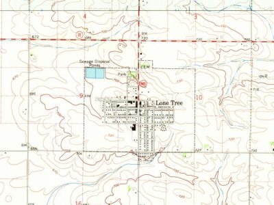
 2013
 2013
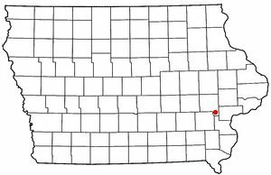 2004


