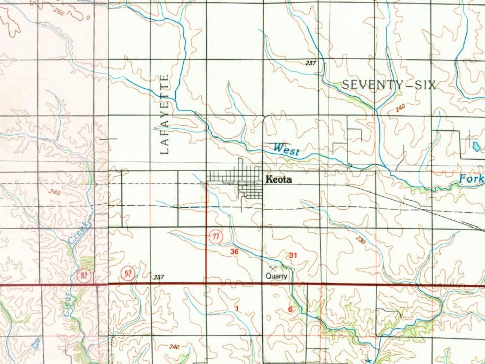
Keota was first counted by the census in 1880, and 38% of its homes were built before 1940
Its Register listings are the C.F. and Mary Singmaster House and the Ramsey Building. Below: 5 old photos and papers, maps from 1895 on, and the census since 1880.
Fire insurance maps drew every building, what it was made of and what it was used for, so insurers could price the risk of fire. Pick a year, then a sheet.
Keota is derived from an Indian name meaning "gone to visit" or "the fire is gone out".
A large part of historic downtown Keota was damaged by a fire on December 4, 2010. Five buildings on East Broadway were badly damaged or destroyed.
An EF4 tornado struck the northwest edge of Keota on the afternoon of March 31, 2023, causing extensive damage to numerous farms just outside of the city. Volunteers helped to clean up the debris in recovery efforts following the tornado.
Passages that mention Keota, cut from the printed page as they were published.
A genealogical and biographical history of Keokuk County, Iowa ..1903 · page 389Read the page →
Read the text
county. During the fall and winter Mr. Millhouse built a shop in Washington county, chopping down the timber with which to build the structure. He occupied that smithy for two years and when the town of Keota was established in 1872 he opened the first blacksmith shop in this town. He erected a little building eighteen by twenty-four feet and has added to this until he had a fine shop covering forty-seven by fifty-eight feet, which is equipped with all necessary machinery and implements for carrying on his work, and he has done a good business
Text read by machine from the scan; it may contain errors.
A genealogical and biographical history of Keokuk County, Iowa ..1903 · page 88Read the page →
Read the text
From 1866 until 1871 Mr. Smock was engaged in business in Sigourney and then came to what is now Keota, locating upon a farm known as Sunnyside. It was on a part of this farm which was owned by his brother that the town of Keota was built. There was no idea of this at the time and the foundation of the present thriving village had not then been laid. However, it was established in 1872, and Mr.
Text read by machine from the scan; it may contain errors.
The history of Keokuk County, Iowa, containing a history of the county, its cities, towns, &c., a biographical directory of its citizens, war record of its volunteers in the late rebellion, history of the Northwest, history of Iowa, map of Keokuk County .1880 · page 772Read the page →
Read the text
manufacture of cotton goods, but since coming west has principally engaged in farming, until the starting of the town of Keota; he was Keota's first postmaster, and still holds that position ; he is a man of strict integrity and good business qualifications, and has the
Text read by machine from the scan; it may contain errors.
The history of Keokuk County, Iowa, containing a history of the county, its cities, towns, &c., a biographical directory of its citizens, war record of its volunteers in the late rebellion, history of the Northwest, history of Iowa, map of Keokuk County .1880 · page 674Read the page →
Read the text
went into business on his own account at Talleyrand, this county;, there he remained until the railroad was built to Keota, when he built a store and moved his stock to that place and changed his stock to clothing, which he followed till 1875, when he went into
Text read by machine from the scan; it may contain errors.
Scans and text from the Internet Archive. Books published in 1930 or earlier, which are in the public domain.
Timeline
Keota, 1872 to 1981
Woven from the archive, old maps, post office records, the National Register and the people born here.
Nothing in the archives for these yearsWeddings on Main Street, storms, parades, school pictures, the old store. If it’s in your family album, it belongs here.
Founding dates: Wikidata, Wikipedia, the U.S. post office records of Blevins & Helbock (CC0) and the Census. Homes by year built: Census ACS 2020–24. National Register of Historic Places: National Park Service (list of May 22, 2026). Old photos, postcards and papers: Wikimedia Commons, the Library of Congress and other public archives, credited on each item’s page. Maps: U.S. Geological Survey historical topographic maps (via Esri) and Sanborn fire-insurance maps (Library of Congress). History text and census tables: Wikipedia (CC BY-SA 4.0). Places that used to be: USGS Geographic Names Information System (2021). How TownRatings grades history →
From Wikimedia Commons (4), the Library of Congress (5), Wikidata (1), the National Register of Historic Places (2), Wikipedia, Wikidata and Wikipedia for famous people, U.S. Geological Survey historical maps, U.S. Census counts (via Wikipedia), the US Post Offices dataset (Blevins & Helbock), the USGS Geographic Names Information System, Sanborn fire insurance maps (Library of Congress) and old county and town histories (Internet Archive). Archive images are copied here with their credits and licenses, shown on each photo’s page. Refreshed monthly.


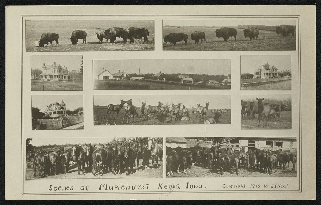


 1910
 1910
 1910
 1910
 2018
 2017
 2017
 2004