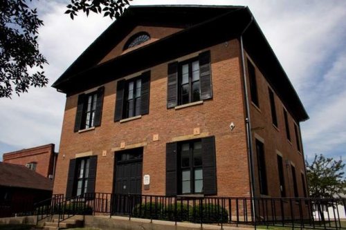
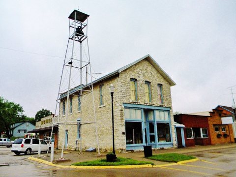
Franklin Pearson House · Photo: C.C. Woodburn · Public domain
–Not graded
History · Keosauqua
Keosauqua dates to 1832, and 26% of its homes were built before 1940
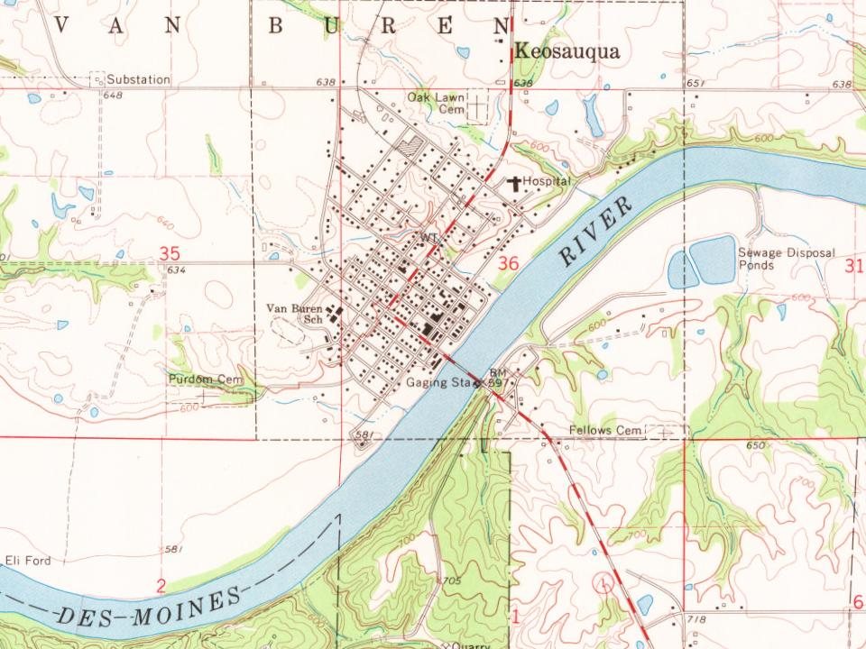
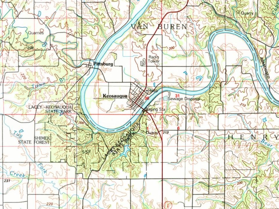
7 places in town are on the National Register, among them three historic districts with 11 buildings between them. Below: maps from 1883 on and the census since 1850.
Fire insurance maps drew every building, what it was made of and what it was used for, so insurers could price the risk of fire. Pick a year, then a sheet.
1883Sheet 1 of 1
Edition
Sheets
BrickWoodStone
Sanborn Map Company, via the Library of Congress. Editions published in 1930 or earlier, which are in the public domain.
On the National Register
7 historic places in Keosauqua
The country’s official list of buildings and places worth saving.
The word Keosauqua derives from the Meskwaki and Sauk name for the Des Moines River, "Ke-o-saw-qua", which literally translates as "Bend in the River", which accurately describes its position on the Des Moines.
After the Black Hawk War the United States' gained a large section of present-day Iowa in 1832 known as Black Hawk Purchase, including Keosauqua.
The 1839 Honey War, so named because three trees with beehives were cut down in the process, was fought south of Keosauqua in what is now Lacey-Keosauqua State Park. The event was a border disagreement between Iowa and Missouri. Before it was over, militias from both sides faced each other, though the dispute was ultimately resolved without a shot being fired.
Passages that mention Keosauqua, cut from the printed page as they were published.
The history of Van Buren County, Iowa, containing a history of the county, its cities, towns, &c, a biographical directory of citizens, war record of its volunteers in the late rebellion, general and local statistics ... history of the Northwest, history1878 · page 389Read the page →
Read the text
By an act approved February 17, 1842, all that tract of land recorded by James Hall & Co. as the town of Keosauqua, and described as the northwest quarter of Section 36, Town 69, Range 10, was duly incorporated as the "City of Keosauqua." It was the usual incorporating act, defining the powers of the Mayor and Councilmen.
Text read by machine from the scan; it may contain errors.
The history of Van Buren County, Iowa, containing a history of the county, its cities, towns, &c, a biographical directory of citizens, war record of its volunteers in the late rebellion, general and local statistics ... history of the Northwest, history1878 · page 385Read the page →
Read the text
Sec. 8. Be it further enacted, That the proprietors of the town of Keosauqua shall, on or before the 1st day of April next, enter into good and sufficient bonds, with security to be approved of by the County Commissioners, to the County Treasurer, for the benefit of the said county, for the sum of ^5,000, payable in town lots in the said town of Keosauqua, or other real estate, at a fair cash value, or cash, or such other materials as the County Commissioners may deem proper to receive, for the purpose of carrying on or completing the public buildings in said county.
Text read by machine from the scan; it may contain errors.
Scans and text from the Internet Archive. Books published in 1930 or earlier, which are in the public domain.
Timeline
Keosauqua, 1832 to 1968
Woven from the archive, old maps, post office records, the National Register and the people born here.
Lost post offices, old corners, places now gone and burying grounds
Keosauqua’s post office has been open since 1844. Another post office, Pleasant Hill, opened and closed inside today’s town.
Keosauqua
1844–today
Pleasant Hill
1851–1855
18401930today
Hamlets and corners on the map
Pleasant Hill
Gone or out of use
KeosauqualocalePleasant Hill Post Officepost office
2cemeteries and burying grounds inside Keosauqua
FellowsOak Lawn
US Post Offices dataset (Blevins & Helbock, CC0). Places and cemeteries from the USGS Geographic Names Information System (2021).
Questions about Keosauqua’s history
What year was Keosauqua founded?
In 1832, according to Wikipedia’s history of the town. Keosauqua’s post office opened in 1844, and the census of 1850 counted 705 people here.
What is on the National Register in Keosauqua?
7 listings: 4 buildings, among them the Hotel Manning (listed 1973, the first), and 3 historic districts, the Lacey-Keosauqua State Park, Bathing Area (Area C), the Lacey-Keosauqua State Park, Lodge and Picnic Area (Area A) and the Lacey-Keosauqua State Park, Picnic and Custodial Group (Area B), with 11 contributing buildings. 15 historic buildings in all.
Founding dates: Wikidata, Wikipedia, the U.S. post office records of Blevins & Helbock (CC0) and the Census. Homes by year built: Census ACS 2020–24. National Register of Historic Places: National Park Service (list of May 22, 2026). Old photos, postcards and papers: Wikimedia Commons, the Library of Congress and other public archives, credited on each item’s page. Maps: U.S. Geological Survey historical topographic maps (via Esri) and Sanborn fire-insurance maps (Library of Congress). History text and census tables: Wikipedia (CC BY-SA 4.0). Places that used to be: USGS Geographic Names Information System (2021). How TownRatings grades history →
From Wikimedia Commons (5), Wikidata (1), the National Register of Historic Places (7), Wikipedia, Wikidata and Wikipedia for famous people, U.S. Geological Survey historical maps, U.S. Census counts (via Wikipedia), the US Post Offices dataset (Blevins & Helbock), the USGS Geographic Names Information System, Sanborn fire insurance maps (Library of Congress) and old county and town histories (Internet Archive). Archive images are copied here with their credits and licenses, shown on each photo’s page. Refreshed monthly.




 2016
 2016
 2012
 2012
 2004