Keokuk’s post office opened in 1841, and 42% of its homes were built before 1940
More historic than 96% of U.S. towns · #11 of 140 in Iowa. What drives it
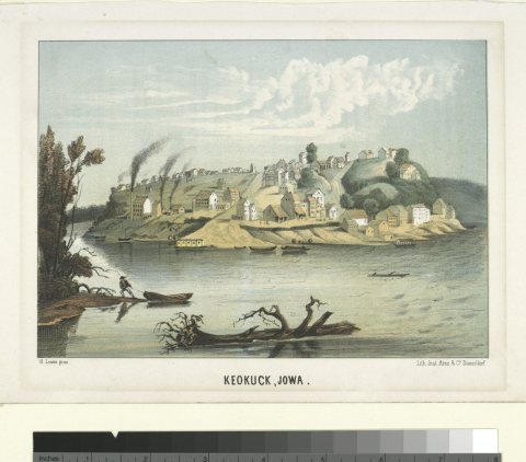
17 places in town are on the National Register, among them the Geo. M. Verity, a National Historic Landmark, and two historic districts with 67 buildings between them. 17 places in town are on the National Register, among them the Geo. M. Verity, a National Historic Landmark, and two historic districts with 67 buildings between them. Below: 5 old photos and papers, maps from 1888 on, and the census since 1850.
Founding year: the first Keokuk post office (Blevins & Helbock, CC0).The full story ↓
History grade
What drives Keokuk’s History grade
On its age, its old homes and the National Register, Keokuk is more historic than 96% of U.S. towns, #11 of 140 in Iowa. All 3 inputs are above most U.S. towns; its share of homes from before 1940 ranks highest and its age lowest.
A+
HistoryA character grade: shown, never part of Keokuk’s overall grade.
Iowa towns list more on the Register than most of the country (a typical Iowa town has 9.1 per 10,000 residents, the U.S. 2.4), so Keokuk’s 78.7 sits above most of its state (80% of Iowa towns have fewer) while its 76 historic buildings outnumber those of 88% of U.S. towns.
How sure. Graded on any two of the three inputs instead, the letter would range from A to A+. The pre-1940 share is a Census survey estimate (±4.8 points). The founding year is the first post office, not a stated founding date.
Founding year: the first post office (other dates in Quick answers). Homes: Census ACS 2020–24. National Register: National Park Service, May 2026 list; each listing counted once (boundary changes and added documentation belong to their listing), and a historic district counts its contributing buildings. How TownRatings grades history →
What stands out about Keokuk’s past
Read from the archive, the National Register and the record. The page puts what stands out first.
Situated between the Des Moines and Mississippi rivers, the area that became Keokuk had access to a large trading area and was an ideal location for settlers. In 1820, the US Army prohibited soldiers stationed along the Mississippi River from having wives who were Native American. Dr. Samuel C. Muir, a surgeon stationed at Fort Edwards (near present-day Warsaw, Illinois), resigned his commission rather than leave his Indian wife and crossed the river to resettle. He built a log cabin for them at the bottom of the bluff, and became the area's first white settler.
Passages that mention Keokuk, cut from the printed page as they were published.
Saint Peter's Parish, Keokuk, Iowa, 1832-1929. A history, dedicated to The Right Reverend Monsignor James W. Gillespie, D.P.V.F., October 27, 19291929Read the page →
Read the text
corner of Ninth and Bank streets, presently the property of Colonel Perry, in the City of Keokuk, Lee County, lowa, the purchase to be for the special benefit of the St. Peter’s Roman Catholic Congregation of the same city of Keokuk, said amount to be paid to Rev. A. Trevis or his agent in two installments, the first half on the 21st of September, 1872, and the second half the first day of December, 1872”.
Text read by machine from the scan; it may contain errors.
The history of Keokuk County, Iowa, containing a history of the county, its cities, towns, &c., a biographical directory of its citizens, war record of its volunteers in the late rebellion, history of the Northwest, history of Iowa, map of Keokuk County .1880 · page 40Read the page →
Read the text
At the time of Gen. Street's death, the Indians were occupying their reservation with their permanent, or spring and summer villages, as follows : Upon the banks of the Des Moines, opposite the mouth of Sugar Creek, was the village of Keokuk, and above were those of "Wapello and Appanoose. The village of Hardfish, or "Wish-e-co-me-que, as it is in the Indian tongue, was located in what is now the heart of Eddyville, whore J. P. Eddv was licensed by Maj. Beach, the agent, in the summer of 1840, to establish a trading post. Not far from the " Forks of Skunk " was a small village
Text read by machine from the scan; it may contain errors.
A genealogical and biographical history of Keokuk County, Iowa ..1903 · page 546Read the page →
Read the text
his parents on their removal to Hendricks county, Indiana, when he was eighteen years of age, and there he became identified with agricultural pursuits. Remaining in the Hoosier state until 1846, he then came with horse and ox teams to Keokuk county, Iowa, and the part which he took in founding and developing the county well entitled him to he inscribed high on the roll of Keokuk's honored pioneers and eminent men. During his first season here he farmed on rented land in Richland township, after which he purchased a farm east of the village of Rich-
Text read by machine from the scan; it may contain errors.
Saint Peter's Parish, Keokuk, Iowa, 1832-1929. A history, dedicated to The Right Reverend Monsignor James W. Gillespie, D.P.V.F., October 27, 19291929Read the page →
Read the text
An anecdote that has passed current in Keokuk for a long time has been put in writing by lather Larmer. “His (lather Alleman’s) untiring zeal and faithful labors so won the affections of the Indians that the Chiefs and their council offered him what is now the northern half of the City of Keokuk... But the good priest rephed: ‘No, I am a poor Dominican Friar, I made a vow of poverty, and another to establish missions; with God’s grace 1 will keep
Text read by machine from the scan; it may contain errors.
Scans and text from the Internet Archive. Books published in 1930 or earlier, which are in the public domain.
Timeline
Keokuk, 1841 to 1989
Woven from the archive, old maps, post office records, the National Register and the people born here.
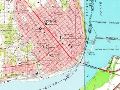
Every edition of the U.S. Geological Survey’s map of Keokuk. Tap a year, or press play to watch the town change.
1964Keokuk sheet · 1:24,000
U.S. Geological Survey historical topographic maps (public domain), via Esri’s collection of the scans. The red ring marks the center of Keokuk.
Every building
Keokuk, building by building, 1888–1919
Fire insurance maps drew every building, what it was made of and what it was used for, so insurers could price the risk of fire. Pick a year, then a sheet.
The Keokuk post office opened in 1841, the earliest record of the town by name (U.S. post office records).
How does Keokuk rank for history?
Keokuk is more historic than 96% of U.S. towns, #11 of 140 in Iowa. The History grade combines the town’s founding era, the share of homes built before 1940 and its National Register listings. It’s a character grade, so it isn’t part of the overall grade. How it works.
What is on the National Register in Keokuk?
17 listings: 15 buildings, among them the Justice Samuel Freeman Miller House (listed 1972, the first), 2 historic districts, the Park Place-Grand Avenue Residential District and the Lock and Dam No. 19 Historic District, with 67 contributing buildings, 1 site, and 2 structures. 76 historic buildings in all.
How old are the homes in Keokuk?
42% of Keokuk’s homes were built before 1940 (Census estimate, ±4.8 points), against a typical 22% for an Iowa town; the median home was built in 1951.
Founding dates: Wikidata, Wikipedia, the U.S. post office records of Blevins & Helbock (CC0) and the Census. Homes by year built: Census ACS 2020–24. National Register of Historic Places: National Park Service (list of May 22, 2026). Old photos, postcards and papers: Wikimedia Commons, the Library of Congress and other public archives, credited on each item’s page. Maps: U.S. Geological Survey historical topographic maps (via Esri) and Sanborn fire-insurance maps (Library of Congress). History text and census tables: Wikipedia (CC BY-SA 4.0). Places that used to be: USGS Geographic Names Information System (2021).
From Wikimedia Commons (5), Wikidata (1), the National Register of Historic Places (20), Wikipedia, Wikidata and Wikipedia for famous people, U.S. Geological Survey historical maps, U.S. Census counts (via Wikipedia), the US Post Offices dataset (Blevins & Helbock), the USGS Geographic Names Information System, Sanborn fire insurance maps (Library of Congress) and old county and town histories (Internet Archive). Archive images are copied here with their credits and licenses, shown on each photo’s page. Refreshed monthly.
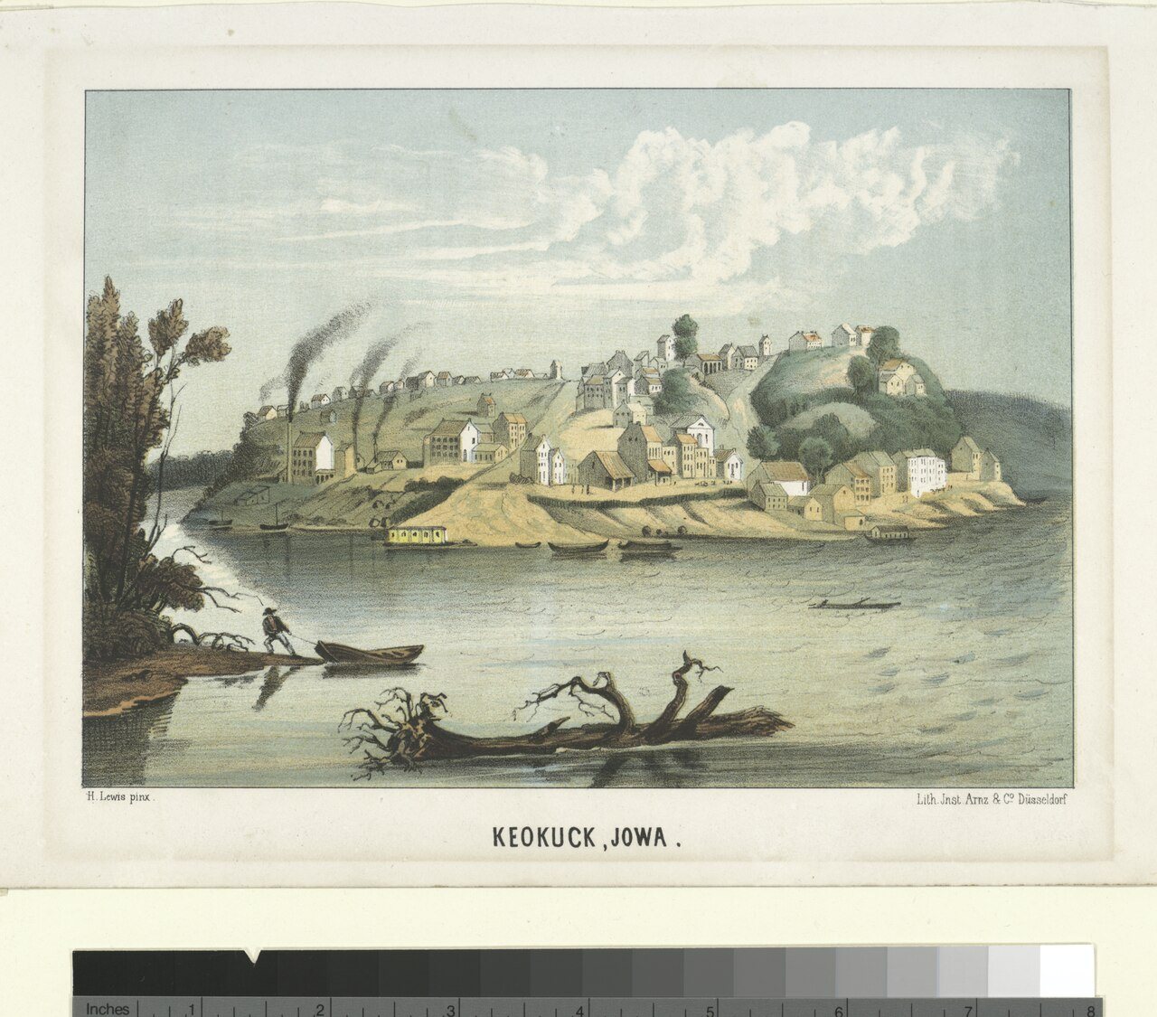


 ★ Landmark


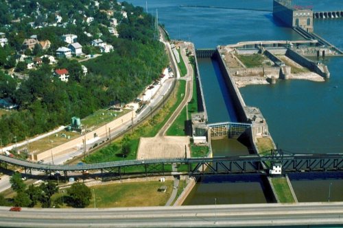




 1865
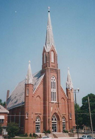
 1870