Founding year: the first Independence post office (Blevins & Helbock, CC0).The full story ↓
History grade
What drives Independence’s History grade
On its age, its old homes and the National Register, Independence is more historic than 89% of U.S. towns, #27 of 140 in Iowa. All 3 inputs are above most U.S. towns; its share of homes from before 1940 ranks highest and its National Register listings lowest.
A
HistoryA character grade: shown, never part of Independence’s overall grade.
Iowa towns list more on the Register than most of the country (a typical Iowa town has 9.1 per 10,000 residents, the U.S. 2.4), so Independence’s 22.7 sits above most of its state (69% of Iowa towns have fewer) while its 14 historic buildings outnumber those of 78% of U.S. towns.
How sure. Graded on any two of the three inputs instead, the letter would range from A− to A. The pre-1940 share is a Census survey estimate (±5.2 points). The founding year is the first post office, not a stated founding date.
Founding year: the first post office (other dates in Quick answers). Homes: Census ACS 2020–24. National Register: National Park Service, May 2026 list; each listing counted once (boundary changes and added documentation belong to their listing), and a historic district counts its contributing buildings. How TownRatings grades history →
What stands out about Independence’s past
Read from the archive, the National Register and the record. The page puts what stands out first.
Fire insurance maps drew every building, what it was made of and what it was used for, so insurers could price the risk of fire. Pick a year, then a sheet.
Independence was founded on June 15, 1847 near the center of present-day Buchanan County. The original town plat was a simple nine-block grid on the east side of the Wapsipinicon River. The town was intended as an alternative to Quasqueton (then called Quasequetuk), which was the county seat prior to 1847. The village of Independence had fewer than 15 persons when the county seat was transferred there.
Passages that mention Independence, cut from the printed page as they were published.
History of Buchanan County, Iowa, with illustrations and biographical sketches1881 · page 391Read the page →
Read the text
in the market at twenty-five cents per bushel and pork at one dollar and fifty cents per hundred. They received most of their groceries from Benton county. Until 1855 the city of Independence was in an embryo condition — but one or two small stores there; post office ke[)t at Quasqueton; no bridges across the river south of Independence, fording being the only way of crossing. Many of the settlers in this township became discouraged, sold
Text read by machine from the scan; it may contain errors.
History of Buchanan County, Iowa, and its people1914 · page 121Read the page →
Read the text
following spring. At that time he went to Warren, Illinois, by rail, thence by stage to Galena and on by boat to Dubuque. During that trip, while at Warren, he was compelled to sleep on the floor of the depot, as no other quarters could be secured. From Dubuque he traveled to Independence by farm wagon. He had previously entered two hundred and forty acres of land adjoining the town of Independence and upon his return he purchased forty acres on the south side of Main street, for which he paid four hundred and fifty dollars.
Text read by machine from the scan; it may contain errors.
History of Buchanan County, Iowa, with illustrations and biographical sketches1881 · page 48Read the page →
Read the text
Now, the Wapsipinicon is spanned with wrought iron bridges at Quasqueton, built in 1874; Independence, built in 1872, and Littleton, built in 1876. Besides these, there are two other, wooden, bridges across the main river; and an iron bridge at Fairbank, andOtteiville; and every stream in the county is substantially bridged at each highway crossing.
Text read by machine from the scan; it may contain errors.
History of Buchanan County, Iowa, and its people1914 · page 452Read the page →
Read the text
years of age when brought to the United States, so that his education was largely acquired and his trade learned in this country. He was a contractor on the Erie canal and afterward settled on a farm in Wisconsin. He came first to Iowa in 1848, taking up his abode in Independence and devoting his time to teaming between Independence and Dubuque. He afterward turned his attention to general merchandising, becoming the proprietor of one of the first stores established in Independence. He was otherwise identified with the material upbuilding of the city through the establishment of its business interests, for he operated a brick and
Text read by machine from the scan; it may contain errors.
Scans and text from the Internet Archive. Books published in 1930 or earlier, which are in the public domain.
Timeline
Independence, 1847 to 1917
Woven from the archive, old maps, post office records, the National Register and the people born here.
Nothing in the archives for these yearsWeddings on Main Street, storms, parades, school pictures, the old store. If it’s in your family album, it belongs here.
National Park Service, National Register of Historic Places. Photos from Wikimedia Commons, credited on each place’s page.
People over time
Independence, census by census
Between 1,395 and 6,392 people in every census since 1860.
17 censuses, 1860–2020.
U.S. Census Bureau decennial counts, from the census table on Independence’s Wikipedia page.
Places that used to be
Old corners, places now gone and burying grounds
Independence’s post office has been open since 1847.
Hamlets and corners on the map
Pine Ridge Mobile Home Court
Gone or out of use
Wapsipinicon Milllocale
4cemeteries and burying grounds inside Independence
German CatholicMount HopeOakwoodSaint Johns
US Post Offices dataset (Blevins & Helbock, CC0). Places and cemeteries from the USGS Geographic Names Information System (2021).
Questions about Independence’s history
What year was Independence founded?
The Independence post office opened in 1847, the earliest record of the town by name (U.S. post office records).
How does Independence rank for history?
Independence is more historic than 89% of U.S. towns, #27 of 140 in Iowa. The History grade combines the town’s founding era, the share of homes built before 1940 and its National Register listings. It’s a character grade, so it isn’t part of the overall grade. How it works.
What is on the National Register in Independence?
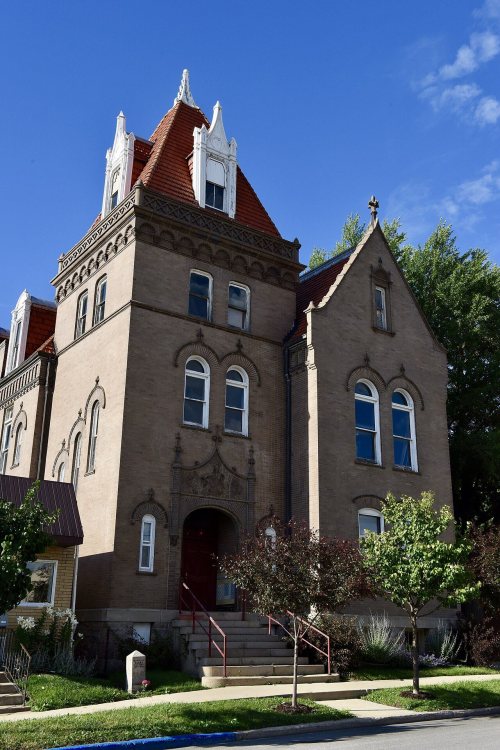
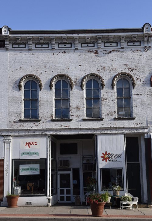
12 listings: 11 buildings, among them the Wapsipinicon Mill (listed 1975, the first), and 1 structure. 14 historic buildings in all.
How old are the homes in Independence?
26% of Independence’s homes were built before 1940 (Census estimate, ±5.2 points), against a typical 22% for an Iowa town; the median home was built in 1971.
Founding dates: Wikidata, Wikipedia, the U.S. post office records of Blevins & Helbock (CC0) and the Census. Homes by year built: Census ACS 2020–24. National Register of Historic Places: National Park Service (list of May 22, 2026). Old photos, postcards and papers: Wikimedia Commons, the Library of Congress and other public archives, credited on each item’s page. Maps: U.S. Geological Survey historical topographic maps (via Esri) and Sanborn fire-insurance maps (Library of Congress). History text and census tables: Wikipedia (CC BY-SA 4.0). Places that used to be: USGS Geographic Names Information System (2021).
From Wikimedia Commons (4), Wikidata (2), the National Register of Historic Places (12), Wikipedia, U.S. Geological Survey historical maps, U.S. Census counts (via Wikipedia), the US Post Offices dataset (Blevins & Helbock), the USGS Geographic Names Information System, Sanborn fire insurance maps (Library of Congress) and old county and town histories (Internet Archive). Archive images are copied here with their credits and licenses, shown on each photo’s page. Refreshed monthly.




 1909
 1913