The story
Read it all →How Hutchins came to be
From Wikipedia’s history of Hutchins.
Hutchins was platted in 1893. The population of the community was 56 in 1902, and 25 in 1925.
Text from Wikipedia, licensed CC BY-SA 4.0.
Each edition grades its towns against each other only.
Below: maps from 1972 on and old-book passages.
Hutchins dates its founding to 1893 (Wikipedia’s history).
Read from the archive, the National Register and the record. The page puts what stands out first.
The first neighbors to add old photos shape how Hutchins’s history is told.
From Wikipedia’s history of Hutchins.
Hutchins was platted in 1893. The population of the community was 56 in 1902, and 25 in 1925.
Text from Wikipedia, licensed CC BY-SA 4.0.
Passages that mention Hutchins, cut from the printed page as they were published.

HUTCHINS The plat of the small town of Hutchins was filed January 13, 1893. The owners of the land w^ere J. N. and L. G. Inman and it was surveyed by C. F. Vincent on October 29th and 30th, 1891. It included all of the part of the southwest quarter of the northwest quarter of Section 35, Township 96, Range 26 West, south of the right of way of the Chicago, Milwaukee & St. Paul Railroad. It is located in Orthel Township.
Text read by machine from the scan; it may contain errors.Scans and text from the Internet Archive. Books published in 1930 or earlier, which are in the public domain.
Weddings on Main Street, storms, parades, school pictures, the old store. If it’s in your family album, it belongs here.
Every edition of the U.S. Geological Survey’s map of Hutchins. Tap a year, or press play to watch the town change.
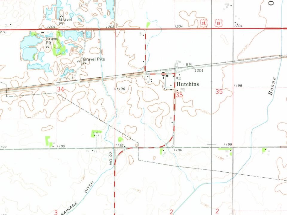
U.S. Geological Survey historical topographic maps (public domain), via Esri’s collection of the scans. The red ring marks the center of Hutchins.
In 1893, according to Wikipedia’s history of the town.
What the archives can’t tell you, neighbors can.
Founding dates: Wikidata, Wikipedia, the U.S. post office records of Blevins & Helbock (CC0) and the Census. Homes by year built: Census ACS 2020–24. National Register of Historic Places: National Park Service (list of May 22, 2026). Old photos, postcards and papers: Wikimedia Commons, the Library of Congress and other public archives, credited on each item’s page. Maps: U.S. Geological Survey historical topographic maps (via Esri) and Sanborn fire-insurance maps (Library of Congress). History text and census tables: Wikipedia (CC BY-SA 4.0). Places that used to be: USGS Geographic Names Information System (2021). How TownRatings grades history →
From Wikipedia, U.S. Geological Survey historical maps and old county and town histories (Internet Archive). Archive images are copied here with their credits and licenses, shown on each photo’s page. Refreshed monthly.
