Crawfordsville is named for the Crawford family of pioneer settlers.
The first private meeting of what would become the Republican Party came when Whig Party defectors met privately in Crawfordsville in February, 1854. The meeting was to lay the groundwork for the creation of a new political party. The first public meeting was held in Ripon, Wisconsin one month later.
This was the part of the county first settled, the claim of Adam Ritchey, the first settlement of the county, having been located here. This township, doubtless, took its name from the town of Crawfordsville, for we find that it was first called Crawfordsville precinct. The name Crawford originated with a family of that name which settled in the neighborhood of Crawfordsville at an early day. The Crawfords brought with them considerable money and entered a great deal of land, and they afterward became chiefly instrumental in the improvement of the land,
Text read by machine from the scan; it may contain errors.
The history of Washington County, Iowa, its cities, towns, and c., a biographical directory of its citizens ..1880 · page 377Read the page →
Read the text
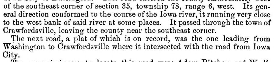
of the southeast corner of section 35, township 78, range 6, west. Its general direction conformed to the course of the Iowa river, it running very close to the west bank of said river at some places. It passed through the town of Crawfordsville, leaving the county near the southeast corner. The next road, a plat of which is on record, was the one leading from Washington to Crawfordsville where it intersected with the road from Iowa City.
Text read by machine from the scan; it may contain errors.
of the southeast corner of section 35, township 78, range 6, west. Its general direction conformed to the course of the Iowa river, it running very close to the west bank of said river at some places. It passed through the town of Crawfordsville, leaving the county near the southeast corner. The next road, a plat of which is on record, was the one leading from Washington to Crawfordsville where it intersected with the road from Iowa City.
Text read by machine from the scan; it may contain errors.
The history of Washington County, Iowa, its cities, towns, and c., a biographical directory of its citizens ..1880 · page 576Read the page →
Read the text
This was the part of the county first settled, the claim of Adam Ritchey, the first settlement of the county, having been located here. T^is township, doubtless, took its name from the town of Crawford sville, for we find that it was first called Crawfordsville precinct. The name Crawford originated with a family of that name which settled in the neighborhood of Crawfordsville at an early day. The Orawfords brought with them considerable money and entered a great deal of land, and they afterward became chiefiy instrumental in the improvement of the land,
Text read by machine from the scan; it may contain errors.
Scans and text from the Internet Archive. Books published in 1930 or earlier, which are in the public domain.
The U.S. Geological Survey’s map of Crawfordsville.
1981Crawfordsville sheet · 1:24,000
U.S. Geological Survey historical topographic maps (public domain), via Esri’s collection of the scans. The red ring marks the center of Crawfordsville.
People over time
Crawfordsville, census by census
Between 249 and 337 people in every census since 1870.
16 censuses, 1870–2020.
U.S. Census Bureau decennial counts, from the census table on Crawfordsville’s Wikipedia page.
Famous people
Famous people close to Crawfordsville
Nobody well known was born in Crawfordsville itself, so here are the best known from just nearby.
Founding dates: Wikidata, Wikipedia, the U.S. post office records of Blevins & Helbock (CC0) and the Census. Homes by year built: Census ACS 2020–24. National Register of Historic Places: National Park Service (list of May 22, 2026). Old photos, postcards and papers: Wikimedia Commons, the Library of Congress and other public archives, credited on each item’s page. Maps: U.S. Geological Survey historical topographic maps (via Esri) and Sanborn fire-insurance maps (Library of Congress). History text and census tables: Wikipedia (CC BY-SA 4.0). Places that used to be: USGS Geographic Names Information System (2021). How TownRatings grades history →
From Wikimedia Commons (6), Wikipedia, U.S. Geological Survey historical maps, U.S. Census counts (via Wikipedia), the US Post Offices dataset (Blevins & Helbock), the USGS Geographic Names Information System and old county and town histories (Internet Archive). Archive images are copied here with their credits and licenses, shown on each photo’s page. Refreshed monthly.




 2025
 2025
 2025
 2021
 2013
 2004


