Clinton dates to 1836, and 41% of its homes were built before 1940
More historic than 93% of U.S. towns · #19 of 140 in Iowa. What drives it
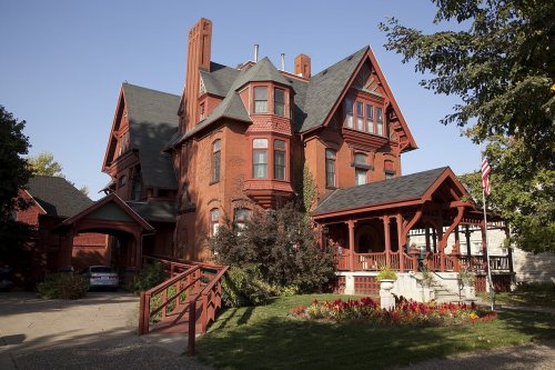
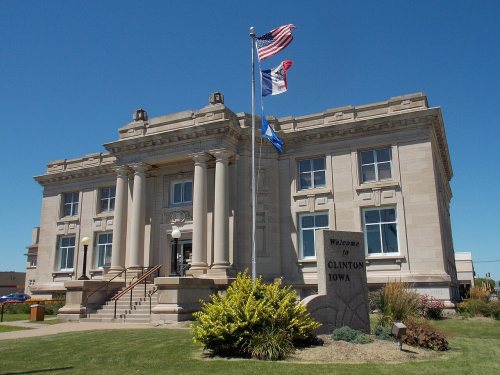
15 places in town are on the National Register, among them the Van Allen Store, a National Historic Landmark, and two historic districts with 16 buildings between them. Below: 5 old photos and papers, maps from 1885 on, and the census since 1870.
Founding year: Wikidata; Wikipedia’s history section gives the same year. First post office: 1839. Name: Wikipedia, licensed CC BY-SA 4.0.The full story ↓
History grade
What drives Clinton’s History grade
On its age, its old homes and the National Register, Clinton is more historic than 93% of U.S. towns, #19 of 140 in Iowa. All 3 inputs are above most U.S. towns; its share of homes from before 1940 ranks highest and its National Register listings lowest.
A
HistoryA character grade: shown, never part of Clinton’s overall grade.
Iowa towns list more on the Register than most of the country (a typical Iowa town has 9.1 per 10,000 residents, the U.S. 2.4), so Clinton’s 12.3 sits near the middle of its state (63% of Iowa towns have fewer) while its 30 historic buildings outnumber those of 82% of U.S. towns.
How sure. Graded on any two of the three inputs instead, the letter would range from A− to A. The pre-1940 share is a Census survey estimate (±3.0 points). Two sources give 1836.
Founding year: Wikidata (other dates in Quick answers). Homes: Census ACS 2020–24. National Register: National Park Service, May 2026 list; each listing counted once (boundary changes and added documentation belong to their listing), and a historic district counts its contributing buildings. How TownRatings grades history →
What stands out about Clinton’s past
Read from the archive, the National Register and the record. The page puts what stands out first.
National Park Service, National Register of Historic Places. Photos from Wikimedia Commons, credited on each place’s page.
On the map
Clinton on the map, 1891 to 1991
Every edition of the U.S. Geological Survey’s map of Clinton. Tap a year, or press play to watch the town change.
1891Clinton sheet · 1:62,500
U.S. Geological Survey historical topographic maps (public domain), via Esri’s collection of the scans. The red ring marks the center of Clinton.
Every building
Clinton, building by building, 1885–1917
Fire insurance maps drew every building, what it was made of and what it was used for, so insurers could price the risk of fire. Pick a year, then a sheet.
Elijah Buell, among the first European-American settlers in the Clinton area, established the town of Lyons in 1837. It was named after the French city Lyon. It grew with the lumber and railroad industry through the century, and merged in 1895 with the City of Clinton.
Clinton was platted as the Town of New York in 1836 by Joseph Bartlett. He was looking for gold deposits in the area.
In 1855, the Chicago, Iowa, Nebraska Railroad announced it would build a bridge across the Mississippi River at Little Rock Island. The Iowa Land Company named the town as Clinton, in honor of DeWitt Clinton, governor of New York State. A general city charter was adopted in 1857. Lyons Female College was established in 1858.
Passages that mention Clinton, cut from the printed page as they were published.
Clinton county history, written for the children of Clinton County1930Read the page →
Read the text
EARLY SAWMILL DAYS Anyone who wishes to get a story of early sawmill days in Clinton may well go down below the tracks in Clinton to a little store in which the presiding genius is William Croake, born in March, 1850, who came to Clinton, August 17, 1867. And William Croake has lived in this part of Clinton ever since and what he can’t tell about Clinton in its plastic days isn’t to be told, that’s all. Why in those days the slough, Beaver Slough, cut into the heart of Clinton, com-
Text read by machine from the scan; it may contain errors.
Clinton county history, written for the children of Clinton County1930Read the page →
Read the text
PLAST WDE POL ALE E When anyone visits the southern end of River Front Park in Clinton they will be standing near where the very first railway depot was built in Clinton and this station was the second railway station to be built in the state of Iowa. The building was erected in 1856 and was used by the Chicago and Nebraska Railroad until 1864 when a new depot was built not very far from the present location.
Text read by machine from the scan; it may contain errors.
Wolfe's history of Clinton County, Iowa1911 · page 366Read the page →
Read the text
Springdale cemetery, the largest cemetery of the city of Clinton, was platted and sur\eyed on lots 7 to 17 of the Iowa Land Company's subdivision of Clinton, in parts of sections i and 6, township 81, ranges 6 and 7. by the Cemetery Association of Clinton, July i, 1868. and the plat was recorded September 24, 1873. The first addition to Springdale cemetery was platted by John C. Weston and Caroline F. ^\'eston, his wife, on lot 8 and a part of lot 9 of the same subdivision and in the same sections, December 31, 1892.
Text read by machine from the scan; it may contain errors.
The history of Clinton County, Iowa, containing a history of the county, its cities, towns &c., biographical sketches of citizens1879Read the page →
Read the text
Clinton secured, in the fall of 1872, a convenient northern route, by the opening of the Chicago, Clinton & Dubuque, an important link in the system of railways parallel with the river, as, during the summer of 1879, through cars began running via the C, C. & D. and Clinton Bridge, between La Crosse and Rock Island, being the first passenger coaches other than those of the lines controlling the bridges that ever crossed it, except as specials. There have been numerous plans to build another bridge, so as to secure two competing shipping routes eastward, but hitherto none of the schemes for securing the desired
Text read by machine from the scan; it may contain errors.
Scans and text from the Internet Archive. Books published in 1930 or earlier, which are in the public domain.
Timeline
Clinton, 1836 to 1976
Woven from the archive, old maps, post office records, the National Register and the people born here.
Nothing in the archives for these yearsWeddings on Main Street, storms, parades, school pictures, the old store. If it’s in your family album, it belongs here.
In 1836, according to Wikidata and Wikipedia’s history of the town. Clinton’s post office opened in 1839, and the census of 1870 counted 6,129 people here.
How does Clinton rank for history?
Clinton is more historic than 93% of U.S. towns, #19 of 140 in Iowa. The History grade combines the town’s founding era, the share of homes built before 1940 and its National Register listings. It’s a character grade, so it isn’t part of the overall grade. How it works.
What is on the National Register in Clinton?
15 listings: 13 buildings, among them the Van Allen Store (a National Historic Landmark since 1976), and 2 historic districts, the Castle Terrace Historic District and the Wilson Buildings, with 16 contributing buildings. 30 historic buildings in all.
How old are the homes in Clinton?
41% of Clinton’s homes were built before 1940 (Census estimate, ±3.0 points), against a typical 22% for an Iowa town; the median home was built in 1953.
Founding dates: Wikidata, Wikipedia, the U.S. post office records of Blevins & Helbock (CC0) and the Census. Homes by year built: Census ACS 2020–24. National Register of Historic Places: National Park Service (list of May 22, 2026). Old photos, postcards and papers: Wikimedia Commons, the Library of Congress and other public archives, credited on each item’s page. Maps: U.S. Geological Survey historical topographic maps (via Esri) and Sanborn fire-insurance maps (Library of Congress). History text and census tables: Wikipedia (CC BY-SA 4.0). Places that used to be: USGS Geographic Names Information System (2021).
From Wikimedia Commons (5), Wikidata (1), the National Register of Historic Places (15), Wikipedia, Wikidata and Wikipedia for famous people, U.S. Geological Survey historical maps, U.S. Census counts (via Wikipedia), the US Post Offices dataset (Blevins & Helbock), the USGS Geographic Names Information System, Sanborn fire insurance maps (Library of Congress) and old county and town histories (Internet Archive). Archive images are copied here with their credits and licenses, shown on each photo’s page. Refreshed monthly.


 ★ Landmark



 1872


