The Bonaparte post office opened in 1842, the earliest record of the town by name. Another post office, New Lexington (1837), opened inside today’s city and later closed.
2020 census: 359184 years
Founding year: the first Bonaparte post office (Blevins & Helbock, CC0).The full story ↓
What stands out about Bonaparte’s past
Read from the archive, the National Register and the record. The page puts what stands out first.
The area was established in 1837 by William Meek, and named Meek's Mill. The lots were resurveyed in 1841, and the name was changed to Bonaparte. Another townsite called Napoleon was established across the river, though it was never developed. William Meek was an admirer of the Emperor, and was responsible for both names. The town was incorporated in 1899.
Bonaparte is located along the historic Mormon Trail, and there are five sites in or near Bonaparte listed on the National Register of Historic Places:
Charles E. Pickett, who served two terms as a U.S. Representative from Iowa's 3rd congressional district, was born near Bonaparte.
National Park Service, National Register of Historic Places. Photos from Wikimedia Commons, credited on each place’s page.
From the old history books
What they wrote about Bonaparte in 1878
Passages that mention Bonaparte, cut from the printed page as they were published.
The history of Van Buren County, Iowa, containing a history of the county, its cities, towns, &c, a biographical directory of citizens, war record of its volunteers in the late rebellion, general and local statistics ... history of the Northwest, history1878 · page 572Read the page →
Read the text
drug business ; in the fall of 1834, he and Messrs. Blackburn and Coates came here and made claims in the vicinity of what is now the village of Bonaparte Dr. Cresap's claim embraced a part of the plat of Bonaparte, which he, in company with Mr. William Meek, laid out in 1837 ; he followed farming and prac-
Text read by machine from the scan; it may contain errors.
The history of Van Buren County, Iowa, containing a history of the county, its cities, towns, &c, a biographical directory of citizens, war record of its volunteers in the late rebellion, general and local statistics ... history of the Northwest, history1878 · page 487Read the page →
Read the text
Bonaparte has quite a school history. The first district schoolhouse was put up in 1844. Thomas Charlton was the first teacher in the village. The house stood until 1859, when it was burned down. However, in the mean time, schools were kept in the buildings at present occupied by Mr. Carr as a shop, and in what is now Mr. King's house. After the old schoolhouse burned, the district rented schoolroom until the Directors purchased the academy in 1871.
Text read by machine from the scan; it may contain errors.
Scans and text from the Internet Archive. Books published in 1930 or earlier, which are in the public domain.
Timeline
Bonaparte, 1837 to 1873
Woven from the archive, old maps, post office records, the National Register and the people born here.
Bonaparte’s post office has been open since 1842. Another post office, New Lexington, opened and closed inside today’s town.
New Lexington
1837–1842
Bonaparte
1842–today
18301930today
Gone or out of use
Bonapartelocale
US Post Offices dataset (Blevins & Helbock, CC0). Places and cemeteries from the USGS Geographic Names Information System (2021).
Questions about Bonaparte’s history
What year was Bonaparte founded?
The Bonaparte post office opened in 1842, the earliest record of the town by name (U.S. post office records).
What is on the National Register in Bonaparte?
5 listings: 2 buildings, 2 historic districts, the Bonaparte Historic Riverfront District and the Bonaparte Pottery Archeological District, with 24 contributing buildings, and 1 structure. 26 historic buildings in all.
Founding dates: Wikidata, Wikipedia, the U.S. post office records of Blevins & Helbock (CC0) and the Census. Homes by year built: Census ACS 2020–24. National Register of Historic Places: National Park Service (list of May 22, 2026). Old photos, postcards and papers: Wikimedia Commons, the Library of Congress and other public archives, credited on each item’s page. Maps: U.S. Geological Survey historical topographic maps (via Esri) and Sanborn fire-insurance maps (Library of Congress). History text and census tables: Wikipedia (CC BY-SA 4.0). Places that used to be: USGS Geographic Names Information System (2021). How TownRatings grades history →
From Wikimedia Commons (6), the National Register of Historic Places (5), Wikipedia, Wikidata and Wikipedia for famous people, the US Post Offices dataset (Blevins & Helbock), the USGS Geographic Names Information System and old county and town histories (Internet Archive). Archive images are copied here with their credits and licenses, shown on each photo’s page. Refreshed monthly.


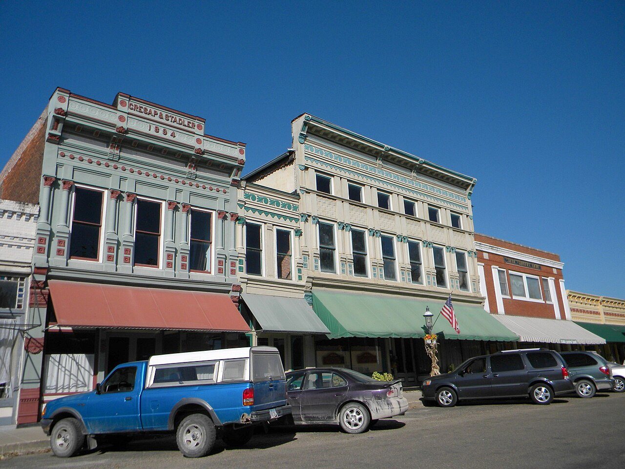




 2012
 2012
 2012
 2012
 2004
 2004