126 years in pictures
The archive holds 6 old photos and papers going back to 1911 and 4 maps from 1963 on.
1 place on the National Register of Historic Places.
- 1900Hanapepe is settled
Each edition grades its towns against each other only.

Today 2,638 people live in this town, first settled in 1900.
Hanapepe’s best subject grade is an A for the outdoors; its weakest is a D for hazard risk. Hanapepe’s January low is 64°F, where Hawaii’s towns sit at 64°F and U.S. towns at 22°F. Only 5 of the 93 Hawaii towns we compare have a lower share of residents below the poverty line than Hanapepe. 33% of the land in Hanapepe is conserved, where Hawaii’s towns sit at 12% and U.S. towns at 4.3%. Only 8 of Hawaii’s 125 towns score higher on the outdoors. Hanapepe has no overall grade: it has no figures for safety and schools, and an overall grade needs at least three of the four big subjects (cost of living, safety, schools and health).
Where Hanapepe beats most towns, and one thing worth knowing.
Where Hanapepe’s working residents go each day. Line width shows the share.
Census LEHD 2023
Each subject compared with towns across the country (schools within Hawaii), ordered by how far Hanapepe is from typical.
Hanapepe has no overall grade: it has no figures for safety and schools, and an overall grade needs at least three of the four big subjects (cost of living, safety, schools and health).
How TownRatings grades towns →
The archive holds 6 old photos and papers going back to 1911 and 4 maps from 1963 on.
1 place on the National Register of Historic Places.
Hanapepe is unincorporated, so Kauai County and regional agencies provide most services.
EPA SDWIS (Oct 9, 2026) · HIFLD + EIA-861 2025 · Census 2020 ZCTAs · NCES 2024–25 · registration: vote.gov, updated Nov 18, 2024.
Ordered by what stands out in Hanapepe.
Hanapepe’s trail density is 1.2 miles per square mile.
Trails & parks © OpenStreetMap contributors · Conserved land: USGS PAD-US
Hanapepe’s natural-hazard score from FEMA stands at 87 of 100. FEMA puts 92% of the town’s expected hazard losses down to inland flooding. Federal disaster aid has reached households in Hanapepe once, in 2006.
FEMA disaster declarations and aid · FEMA National Risk Index · OpenFEMA
Commuting out is the norm in Hanapepe: 6% of working residents work locally. Employers in Hanapepe added 132 jobs between 2013 and 2023, to 357. The median commute is under 14 miles. The top destinations are Urban Honolulu (17%), Poipu (14%) and Lihue (11%).
| Hanapepe | Hawaii towns | U.S. towns | |
|---|---|---|---|
| Median household income | $100,000 | $100,000 | $80,000 |
| Average trip to work | 27 minutes | 28 minutes | 25 minutes |
| Working residents who work in town | 5.5% | 3.6% | 8% |
Census LEHD 2023 · ACS
July afternoons reach 86°, January nights drop to 64° and snow is almost unheard of.
NOAA U.S. Climate Normals, 1991–2020
In Hanapepe, the median rent is $2,199 a month. For households locally, the share who live in a home they own is 76%.
| Hanapepe | Hawaii towns | U.S. towns | |
|---|---|---|---|
| Median rent | $2,199 a month | $2,009 a month | $1,185 a month |
| Households that own their home | 76% | 71% | 73% |
Census ACS, 2020–24 · Zillow Home Value Index · Redfin Data Center
Among 93 Hawaii towns, just 6 have a higher share of adults 18 to 64 who have no health insurance than Hanapepe. A quarter of adults have obesity locally. Two figures for adults locally: 24% worry about having enough food, 16% have been diagnosed with depression.
| Hanapepe | Hawaii towns | U.S. towns | |
|---|---|---|---|
| Sleep under 7 hours (CDC PLACES) | 46% | 45% | 36% |
| Food insecurity (CDC PLACES) | 24% | 18% | 14% |
| Depression (CDC PLACES) | 16% | 17% | 23% |
| Yearly checkup (CDC PLACES) | 73% | 76% | 79% |
| What stands out | Hanapepe | HI |
|---|---|---|
| More older adults who have lost all their teeth | 13.9% | 8.5% |
| More uninsured adults | 8.4% | 5.6% |
| More adults facing a utility shut-off | 8.5% | 5.8% |
CDC PLACES 2025 · modeled estimates for adults · CMS · HRSA
Museums, parks, gardens and other places to visit around Hanapepe. Close and well known come first.
6 mi LandmarkRussian Fort Elizabeth
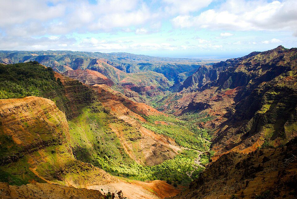
11 mi Canyon & gorgeWaimea Canyon State Park
19 mi State parkNā Pali Coast State Park
20 mi BeachHanakapiai Beach
6 mi GardenAllerton Garden5 mi GardenNational Tropical Botanical GardenRussian Fort Elizabeth: en:User:Mel29, Public domain · Waimea Canyon State Park: Aaronbernstein, CC BY-SA 3.0 · Nā Pali Coast State Park: Jmblanco74, CC BY-SA 3.0 · Hanakapiai Beach: Jeff Kubina, CC BY-SA 2.0 · Allerton Garden: Daderot., CC BY-SA 3.0
1 within 15 miles of the center of Hanapepe
About 8 of every 100 Hanapepe residents are enrolled in college, against 6 across Hawaii.
Place in Hawaii, United States
Hanapēpē is an unincorporated community in Kauaʻi County, Hawaii, United States. The name means "crushed bay" in Hawaiian, which may refer to landslides in the area. For statistical purposes, the United States Census Bureau has defined Hanapepe as a census-designated place (CDP). The population was 2,678 at the 2020 census, up from 2,153 at the 2000 census.
From Wikipedia, licensed CC BY-SA 4.0 · facts via Wikidata (CC0)
One town shares a border with Hanapepe.
Hanapepe and Eleele report no FBI crime data of their own. Hanapepe and Eleele aren’t graded (fewer than 1,000 residents, or not enough data). Compare Hanapepe with a neighbor →
Short answers, built from the data on this page.
Hanapepe has no overall grade: it has no figures for safety and schools, and an overall grade needs at least three of the four big subjects (cost of living, safety, schools and health).
Yes. That is 8.1 years of the area's median household income ($97,668 across the Kapaa, HI area). Cost of living, which also weighs rents, property taxes and how many households pay 30% or more of their income for housing, grades C−.