Lumpkin dates to 1829, and 18 of its places are on the National Register
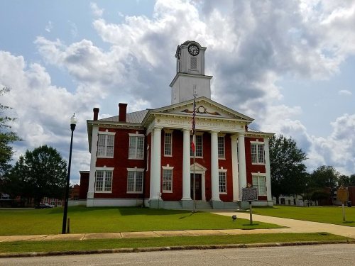
Most of Lumpkin was built recently: 10% of its homes predate 1940 and the median home dates from 1974. 18 places in town are on the National Register, among them four historic districts with 23 buildings between them. Below: 2 old photos and papers, maps from 1904 on, and the census since 1860.
This area of Georgia was inhabited by succeeding cultures of indigenous Native Americans for thousands of years before European contact. Historical tribes included the Cherokee, Choctaw and Creek, who encountered European Americans as their settlements moved into traditional territory. During the Indian removal of 1830, the United States government forced such tribes to move west of the Mississippi River to Indian Territory, to extinguish their claims and make way for more European-American settlement.
Nothing in the archives for these yearsWeddings on Main Street, storms, parades, school pictures, the old store. If it’s in your family album, it belongs here.
Every edition of the U.S. Geological Survey’s map of Lumpkin. Tap a year, or press play to watch the town change.
1950Lumpkin sheet · 1:24,000
U.S. Geological Survey historical topographic maps (public domain), via Esri’s collection of the scans. The red ring marks the center of Lumpkin.
Every building
Lumpkin, building by building, 1904–1922
Fire insurance maps drew every building, what it was made of and what it was used for, so insurers could price the risk of fire. Pick a year, then a sheet.
1904Sheet 1 of 1
Edition
Sheets
BrickWoodStone
Sanborn Map Company, via the Library of Congress. Editions published in 1930 or earlier, which are in the public domain.
Then & now
Stand where they stood
No then-and-now pairs yet. Take a photo from the same spot as an old one and they appear here side by side.
Retake this viewGeorgia - Dalton through, 1937
Find the spot, match the angle, and add your photo. It becomes the first then-and-now pair on Lumpkin’s page.
East SideEbenezerGreater Saint Mark AME ChurchNorth Side
US Post Offices dataset (Blevins & Helbock, CC0). Places and cemeteries from the USGS Geographic Names Information System (2021).
Questions about Lumpkin’s history
What year was Lumpkin founded?
In 1829, according to Wikidata. Lumpkin’s post office opened in 1831, and the census of 1860 counted 765 people here.
What is on the National Register in Lumpkin?
18 listings: 14 buildings, among them the Bedingfield Inn (listed 1973, the first), and 4 historic districts with 23 contributing buildings. 37 historic buildings in all.
Founding dates: Wikidata, Wikipedia, the U.S. post office records of Blevins & Helbock (CC0) and the Census. Homes by year built: Census ACS 2020–24. National Register of Historic Places: National Park Service (list of May 22, 2026). Old photos, postcards and papers: Wikimedia Commons, the Library of Congress and other public archives, credited on each item’s page. Maps: U.S. Geological Survey historical topographic maps (via Esri) and Sanborn fire-insurance maps (Library of Congress). History text and census tables: Wikipedia (CC BY-SA 4.0). Places that used to be: USGS Geographic Names Information System (2021). How TownRatings grades history →
From Wikimedia Commons (4), the National Register of Historic Places (18), Wikipedia, Wikidata and Wikipedia for famous people, U.S. Geological Survey historical maps, U.S. Census counts (via Wikipedia), the US Post Offices dataset (Blevins & Helbock), the USGS Geographic Names Information System and Sanborn fire insurance maps (Library of Congress). Archive images are copied here with their credits and licenses, shown on each photo’s page. Refreshed monthly.




 1937
 2011
 2005


