Flemington’s post office opened in 1889, and 1 of its places is on the National Register
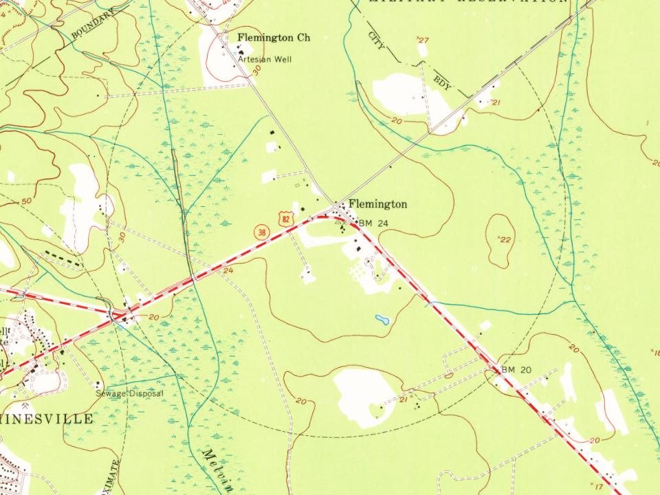
Most of Flemington was built recently: 3% of its homes predate 1940 and the median home dates from 2009. Its Register listing is the Flemington Presbyterian Church. Below: maps from 1918 on and the census since 1950.
A post office called Flemington was established in 1889, and remained in operation until 1966. The community was named after William Fleming, a pioneer settler. The Georgia General Assembly incorporated Flemington in 1941.
Passages that mention Flemington, cut from the printed page as they were published.
History of the Midway Congregational Church, Liberty County, Georgia /1903Read the page →
Read the text
On account of the withdrawal of the Walthourville and Flemington people, and abandonment of so many of the winter homes and farms, and the general dispersion and impoverishment of the inhabitants, caused by the war, the few families, some fifteen or twenty in all, composing the village of Dorchester, were about all that, was left of the white membership of the old church; the village of Jonesville the last of the summer retreats being hopelessly broken up,
Text read by machine from the scan; it may contain errors.
History of the Midway Congregational Church, Liberty County, Georgia /1903Read the page →
Read the text
The church was supplied by Rev. J. W. Montgomery, who also preached at Flemington and Walthourville churches from 1871 to 1881, by Rev. R. Q. Baker from 1881 to 1882, then again by Rev. J. W. Montgomery from 1882 to 1893, and Rev. E. W. Way from spring 1893 to 1895, and Rev. L.
Text read by machine from the scan; it may contain errors.
Scans and text from the Internet Archive. Books published in 1930 or earlier, which are in the public domain.
Timeline
Flemington, 1889 to 2020
Woven from the archive, old maps, post office records, the National Register and the people born here.
Founding dates: Wikidata, Wikipedia, the U.S. post office records of Blevins & Helbock (CC0) and the Census. Homes by year built: Census ACS 2020–24. National Register of Historic Places: National Park Service (list of May 22, 2026). Old photos, postcards and papers: Wikimedia Commons, the Library of Congress and other public archives, credited on each item’s page. Maps: U.S. Geological Survey historical topographic maps (via Esri) and Sanborn fire-insurance maps (Library of Congress). History text and census tables: Wikipedia (CC BY-SA 4.0). Places that used to be: USGS Geographic Names Information System (2021). How TownRatings grades history →
From Wikimedia Commons (4), Wikidata (1), the National Register of Historic Places (1), Wikipedia, U.S. Geological Survey historical maps, U.S. Census counts (via Wikipedia), the US Post Offices dataset (Blevins & Helbock), the USGS Geographic Names Information System and old county and town histories (Internet Archive). Archive images are copied here with their credits and licenses, shown on each photo’s page. Refreshed monthly.




 2017
 2017
 2015
 2005


