Crawfordville dates to 1825, and 29% of its homes were built before 1940
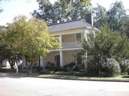
5 places in town are on the National Register, among them the Liberty Hall, a National Historic Landmark, and two historic districts with 268 buildings between them. Below: maps from 1966 on and the census since 1880.
Crawfordville was founded in 1825 as the seat of the newly formed Taliaferro County. It was incorporated as a town in 1826 and as a city in 1906. The community was named after William H. Crawford (1772–1834), U.S. Secretary of War and Secretary of the Treasury.
Every edition of the U.S. Geological Survey’s map of Crawfordville. Tap a year, or press play to watch the town change.
1966Crawfordville sheet · 1:24,000
U.S. Geological Survey historical topographic maps (public domain), via Esri’s collection of the scans. The red ring marks the center of Crawfordville.
People over time
Crawfordville, census by census
Peaked at 1,056 in 1940; 479 people lived here in 2020.
15 censuses, 1880–2020.
U.S. Census Bureau decennial counts, from the census table on Crawfordville’s Wikipedia page.
Famous people
4 famous people were born in Crawfordville
Writers, athletes, leaders and more, ranked by how widely they’re known.
Crawfordville’s post office has been open since 1826.
Gone or out of use
Friendship ChurchchurchFriendship SchoolschoolTaliaferro County Jailbuilding
2cemeteries and burying grounds inside Crawfordville
CrawfordvilleFriendship
US Post Offices dataset (Blevins & Helbock, CC0). Places and cemeteries from the USGS Geographic Names Information System (2021).
Questions about Crawfordville’s history
What year was Crawfordville founded?
In 1825, according to Wikidata. Crawfordville’s post office opened in 1826, and the census of 1880 counted 511 people here.
What is on the National Register in Crawfordville?
5 listings: 3 buildings, among them the Liberty Hall (a National Historic Landmark since 1983), and 2 historic districts, the Stephens, A. H., Memorial State Park and the Crawfordville Historic District, with 268 contributing buildings. 272 historic buildings in all.
Founding dates: Wikidata, Wikipedia, the U.S. post office records of Blevins & Helbock (CC0) and the Census. Homes by year built: Census ACS 2020–24. National Register of Historic Places: National Park Service (list of May 22, 2026). Old photos, postcards and papers: Wikimedia Commons, the Library of Congress and other public archives, credited on each item’s page. Maps: U.S. Geological Survey historical topographic maps (via Esri) and Sanborn fire-insurance maps (Library of Congress). History text and census tables: Wikipedia (CC BY-SA 4.0). Places that used to be: USGS Geographic Names Information System (2021). How TownRatings grades history →
From Wikimedia Commons (2), Wikidata (4), the National Register of Historic Places (5), Wikipedia, Wikidata and Wikipedia for famous people, U.S. Geological Survey historical maps, U.S. Census counts (via Wikipedia), the US Post Offices dataset (Blevins & Helbock) and the USGS Geographic Names Information System. Archive images are copied here with their credits and licenses, shown on each photo’s page. Refreshed monthly.


 ★ Landmark




 2012
 2005


