Demeure du Chaos opens Saint-Romain-au-Mont-d'Or’s list
Saint-Romain-au-Mont-d'Or and its surroundings hold 16 attractions, 14 châteaux and 5 museums. Mapped in Saint-Romain-au-Mont-d'Or are 4 places to visit, and within 5 km of its centre another 48. Among the sites in town, one is a listed historic monument. 4 stand within 1 km of the centre, close enough to walk between. For a full day, there is Parc Olympique lyonnais, 15 km away.
Places within 40 km of Saint-Romain-au-Mont-d'Or with an article in both French and English Wikipedia, nearest first.
Good to know in Saint-Romain-au-Mont-d'Or
What is there to see in Saint-Romain-au-Mont-d'Or?
The first on our list in Saint-Romain-au-Mont-d'Or are Demeure du Chaos, Cadole, Manoir de la Bessée and Caborne. We list 4 places in town. Another 48 are within 5 km of the centre.
Are there museums in or near Saint-Romain-au-Mont-d'Or?
6 museums and galleries in town or within 5 km, including Demeure du Chaos, Musée Ampère, Musée de l'automobile Henri-Malartre and Musée Jean-Couty.
Which places in Saint-Romain-au-Mont-d'Or are listed historic monuments?
One place on this page in Saint-Romain-au-Mont-d'Or is a listed or registered historic monument (Mérimée): Manoir de la Bessée.
What well-known places are within a day out of Saint-Romain-au-Mont-d'Or?
The nearest with articles in both French and English Wikipedia: Parc Olympique lyonnais (15 km), Musée des Beaux-Arts de Lyon (7.8 km), Primatiale Saint-Jean de Lyon (8.5 km), Parc de la Tête d'Or (6.7 km).
How is this list made?
From OpenStreetMap and Wikidata: named museums, galleries, châteaux, abbeys, gardens, zoos, theme parks and other visitor attractions whose mapped point lies inside the commune of Saint-Romain-au-Mont-d'Or, then those in the communes within 5 km of its centre, and well-known places within 40 km. Houses, ruins and gardens need a sign they’re open to visitors; places marked private, closed or disused are left out. The historic-monument link is the Culture ministry’s Mérimée record. A place that isn’t mapped isn’t listed, so this isn’t everything there is to see.
Contains public sector information under the Licence Ouverte / Open Licence 2.0 (Etalab): INSEE, DGFiP, the Interior Ministry’s statistics service (SSMSI), the Ministry of Education (DEPP), the Health Ministry’s statistics service (DREES) and the Housing Ministry (Carte des loyers). Commune boundaries: IGN Admin Express.

 AttractionParc Olympique lyonnais15 km southeast, in Décines-Charpieu
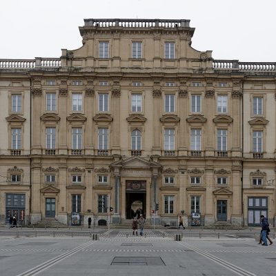 MuseumMusée des Beaux-Arts de Lyon7.8 km south, in Lyon 1er
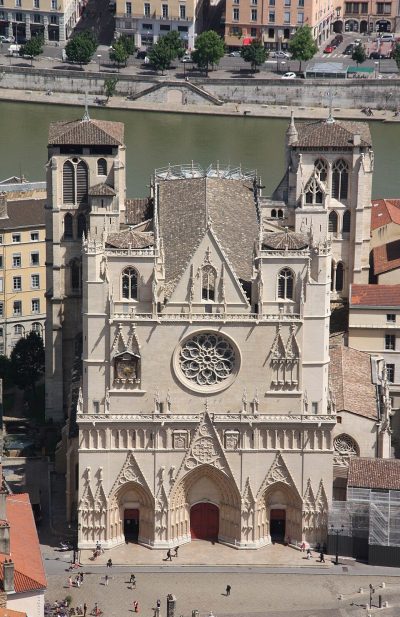 AttractionPrimatiale Saint-Jean de Lyon8.5 km south, in Lyon 5eGardenGardenParc de la Tête d'Or6.7 km south, in Lyon 6eAttractionAttractionThéâtre antique de Lyon8.6 km south, in Lyon 5eMonastery or conventMonastery or conventCouvent Sainte-Marie de La Tourette16 km west, in Éveux
 AttractionJardin botanique de Lyon7.3 km south, in Lyon 6eMuseumMuseumMusée d'Art contemporain de Lyon6.3 km south, in Lyon 6eAttractionAttractionOdéon antique de Lyon8.7 km south, in Lyon 5e
 MuseumGadagne8.1 km south, in Lyon 5e
 MuseumLugdunum8.5 km south, in Lyon 5e
 MuseumMusée des Confluences12 km south, in Lyon 2e