Château du Tourvéon
Among the sights of Collonges-au-Mont-d'Or is Château du Tourvéon. Nearby, 51 more places to visit are within 5 km. A short trip away is Parc Olympique lyonnais, 14 km off.
Château in Collonges-au-Mont-d'Or
In Collonges-au-Mont-d'Or
Château du Tourvéon is in the commune of Collonges-au-Mont-d'Or, with 51 more places to visit within 5 km. Towns near it ↓
Written from OpenStreetMap, Wikidata and Météo-France 1991–2020 normals.
Seasons in Collonges-au-Mont-d'Or
Warmest in Collonges-au-Mont-d'Or are April to October, at 17–28°C.
Château du Tourvéon
2 Wikipedia editions have an article on it.
- Type
- Château
- Covered in
- 2 Wikipedia and sister-site articles
- Commune
- Collonges-au-Mont-d'Or, Rhône
Château du Tourvéon on the map
The orange dot is Château du Tourvéon; the numbers are the places near it, as listed below.
© OpenStreetMap contributors · The dashed line is the commune of Collonges-au-Mont-d'Or. · commune boundary: IGN
The towns around Château du Tourvéon
With 7,435 people, Saint-Didier-au-Mont-d'Or is the largest of the 8. Its own town leads; the rest list it too, closest first.
- 1Collonges-au-Mont-d'Or
- 2Couzon-au-Mont-d'Or
- 3Fontaines-sur-Saône
- 4Fontaines-Saint-Martin
- 5Saint-Cyr-au-Mont-d'Or
- 6Sathonay-Camp
- 7Saint-Didier-au-Mont-d'Or
- 8Cailloux-sur-Fontaines
Collonges-au-Mont-d'Or
Couzon-au-Mont-d'Or
Fontaines-sur-Saône
Fontaines-Saint-Martin
Compare the 8 towns
| Town | Where Château du Tourvéon is | People |
|---|---|---|
| Collonges-au-Mont-d'Or | It’s in this commune | 4,669 |
| Couzon-au-Mont-d'Or | 1.7 km north of it | 2,619 |
| Fontaines-sur-Saône | 1.7 km east of it | 6,957 |
| Fontaines-Saint-Martin | 1.9 km northeast of it | 3,098 |
| Saint-Cyr-au-Mont-d'Or | 2.1 km southwest of it | 6,327 |
| Sathonay-Camp | 3 km east of it | 7,019 |
| Saint-Didier-au-Mont-d'Or | 3.3 km southwest of it | 7,435 |
| Cailloux-sur-Fontaines | 3.5 km northeast of it | 2,989 |
Around Château du Tourvéon
352 more lie within 15 km, 4 attractions, 3 museums and a garden among them.
 AttractionParc Olympique lyonnais14 km southeast, in Décines-Charpieu2
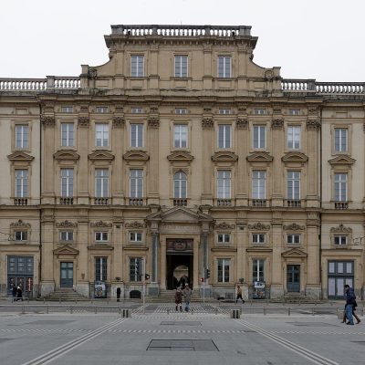 MuseumMusée des Beaux-Arts de Lyon7 km south, in Lyon 1er3
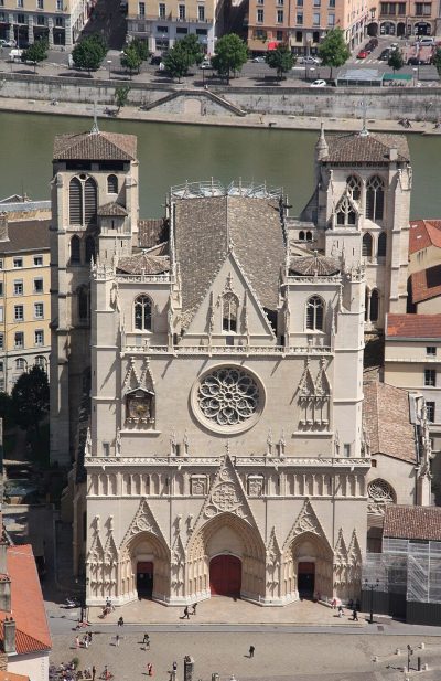 AttractionPrimatiale Saint-Jean de Lyon7.7 km south, in Lyon 5e4GardenGardenParc de la Tête d'Or5.7 km south, in Lyon 6e5AttractionAttractionThéâtre antique de Lyon7.9 km south, in Lyon 5e6MuseumMuseumMusée Ampère3.8 km northwest, in Poleymieux-au-Mont-d'Or7
 AttractionJardin botanique de Lyon6.3 km south, in Lyon 6e8MuseumMuseumMusée d'Art contemporain de Lyon5.3 km south, in Lyon 6e
Within 15 km, close and well known first. Numbers match the map.
Your questions on Château du Tourvéon
Where is Château du Tourvéon?
Château du Tourvéon is in Collonges-au-Mont-d'Or, in Rhône (Auvergne-Rhône-Alpes).
What is Château du Tourvéon?
Château.
How well known is Château du Tourvéon?
Château du Tourvéon has 2 Wikipedia and sister-site articles in different languages: #5,252 of the 37,318 French places we list.
When is the best time to visit Château du Tourvéon?
April to October are the warmest months in Collonges-au-Mont-d'Or, with afternoon highs of 17–28°C (Météo-France 1991–2020 normals).
What else is there to see near Château du Tourvéon?
Within 15 km: Parc Olympique lyonnais (14 km), Musée des Beaux-Arts de Lyon (7 km), Primatiale Saint-Jean de Lyon (7.7 km) and Parc de la Tête d'Or (5.7 km).
Sources: OpenStreetMap (© OpenStreetMap contributors, ODbL), Wikidata (CC0: what it is, its articles, how widely it is covered), the Culture ministry’s Mérimée database (Licence Ouverte 2.0), IGN commune boundaries, Météo-France 1991–2020 normals (Licence Ouverte 2.0).
Photos from Wikimedia Commons, each under its own licence (our copy, resized).
Photo credits (4)
- Parc Olympique lyonnais: AsGunReview, CC BY-SA 4.0, Wikimedia Commons
- Musée des Beaux-Arts de Lyon: Jastrow, CC BY 2.5, Wikimedia Commons
- Primatiale Saint-Jean de Lyon: Otourly, CC BY-SA 3.0, Wikimedia Commons
- Jardin botanique de Lyon: Gonedelyon, CC BY-SA 3.0, Wikimedia Commons
Contains public sector information under the Licence Ouverte / Open Licence 2.0 (Etalab): INSEE, DGFiP, the Interior Ministry’s statistics service (SSMSI), the Ministry of Education (DEPP), the Health Ministry’s statistics service (DREES) and the Housing Ministry (Carte des loyers). Commune boundaries: IGN Admin Express.