
What to see in Saint-Didier-au-Mont-d'Or, from Château de Saint-André du Coing on
Among the places to visit in and near Saint-Didier-au-Mont-d'Or are 14 attractions, 11 châteaux and 10 gardens. Look within 5 km of its centre and the list grows by 75 beyond the 15 in Saint-Didier-au-Mont-d'Or. One of those in town is a listed historic monument. Further out, Musée des Beaux-Arts de Lyon is 5.5 km away.
The best known in Saint-Didier-au-Mont-d'Or
Next to Château de Saint-André du Coing, the best known are 4 attractions and a château.
Best known first: by how many Wikipedia and sister-site articles cover each place (Wikidata’s count). It isn’t a ranking of how good they are.
Where each one is
The map stretches to Jardin des plantes de Lyon, 5 km away.
The first 20 on the list, numbered as below. The shape is the commune of Saint-Didier-au-Mont-d'Or; the orange dot is its centre. © OpenStreetMap contributors · commune boundary: IGN
By kind
Count 21 châteaux or heritage sites and 14 other sights.
Dark: in Saint-Didier-au-Mont-d'Or. Light: in the communes within 5 km of its centre.
All of it
First the 15 in town, then the 75 within 5 km of its centre.
Musée d'Art contemporain de Lyon
Museum in the 6th arrondissement of Lyon, France.
Demeure du Chaos
Museum in Saint-Romain-au-Mont-d'Or, France, created by Thierry Ehrmann.
Abbaye Notre-Dame de la Consolation de Vaise
Abbey located in Rhône, in France.
Couvent des bernardines de Lyon
Convent located in Rhône, in France.

Monastère Notre-Dame de la Déserte
Monastery located in Rhône, France.
The 15 places in Saint-Didier-au-Mont-d'Or first, then those within 5 km of its centre. Nearby, the first 40 of 75.
The history of Saint-Didier-au-Mont-d'Or → · Parks and trails in Saint-Didier-au-Mont-d'Or →
Day trips
Most famous of the 12 is Musée des Beaux-Arts de Lyon, 5.5 km from the centre.
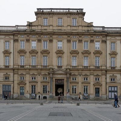 MuseumMusée des Beaux-Arts de Lyon5.5 km southeast, in Lyon 1er
 AttractionParc Olympique lyonnais15 km east, in Décines-Charpieu
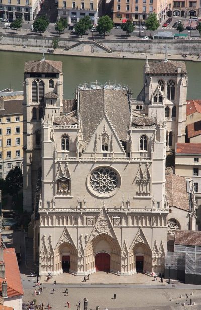 AttractionPrimatiale Saint-Jean de Lyon5.9 km south, in Lyon 5eGardenGardenParc de la Tête d'Or5.3 km southeast, in Lyon 6eAttractionAttractionThéâtre antique de Lyon5.8 km south, in Lyon 5eMonastery or conventMonastery or conventCouvent Sainte-Marie de La Tourette14 km west, in Éveux
 AttractionJardin botanique de Lyon5.9 km southeast, in Lyon 6eAttractionAttractionOdéon antique de Lyon5.9 km south, in Lyon 5e
 MuseumGadagne5.6 km south, in Lyon 5e
 MuseumLugdunum5.8 km south, in Lyon 5e
 MuseumMusée des Confluences8.8 km south, in Lyon 2e
 ZooJardin zoologique de la ville de Lyon5.6 km southeast, in Lyon 6e
Places within 40 km of Saint-Didier-au-Mont-d'Or with an article in both French and English Wikipedia, nearest first.
Seeing Saint-Didier-au-Mont-d'Or: your questions
What is there to see in Saint-Didier-au-Mont-d'Or?
The first on our list in Saint-Didier-au-Mont-d'Or are Château de Saint-André du Coing, Château de Rochecardon, Cabane Pointue and Caborne de la Fouillouse. We list 15 places in town. Another 75 are within 5 km of the centre.
Are there museums in or near Saint-Didier-au-Mont-d'Or?
10 museums and galleries in town or within 5 km, including Musée Ampère, Musée d'Art contemporain de Lyon, Demeure du Chaos and Musée de l'automobile Henri-Malartre.
Which places in Saint-Didier-au-Mont-d'Or are listed historic monuments?
One place on this page in Saint-Didier-au-Mont-d'Or is a listed or registered historic monument (Mérimée): Château de Saint-André du Coing.
What well-known places are within a day out of Saint-Didier-au-Mont-d'Or?
The nearest with articles in both French and English Wikipedia: Musée des Beaux-Arts de Lyon (5.5 km), Parc Olympique lyonnais (15 km), Primatiale Saint-Jean de Lyon (5.9 km), Parc de la Tête d'Or (5.3 km).
How is this list made?
From OpenStreetMap and Wikidata: named museums, galleries, châteaux, abbeys, gardens, zoos, theme parks and other visitor attractions whose mapped point lies inside the commune of Saint-Didier-au-Mont-d'Or, then those in the communes within 5 km of its centre, and well-known places within 40 km. Houses, ruins and gardens need a sign they’re open to visitors; places marked private, closed or disused are left out. The historic-monument link is the Culture ministry’s Mérimée record. A place that isn’t mapped isn’t listed, so this isn’t everything there is to see.
Sources: OpenStreetMap (© OpenStreetMap contributors, ODbL), Wikidata (CC0: descriptions, websites, Wikipedia articles), the Culture ministry’s Mérimée database (Licence Ouverte 2.0), IGN commune boundaries. Distances are from the commune’s centre point.
Photos from Wikimedia Commons, each under its own licence (our copy, resized).
Photo credits (9)
- Maison des Canuts: This picture belongs to Xavier Caré ., CC BY-SA 3.0, Wikimedia Commons
- Musée des Beaux-Arts de Lyon: Jastrow, CC BY 2.5, Wikimedia Commons
- Parc Olympique lyonnais: AsGunReview, CC BY-SA 4.0, Wikimedia Commons
- Primatiale Saint-Jean de Lyon: Otourly, CC BY-SA 3.0, Wikimedia Commons
- Jardin botanique de Lyon: Gonedelyon, CC BY-SA 3.0, Wikimedia Commons
- Gadagne: Mathilde HOSPITAL (Gadagne), CC BY-SA 4.0, Wikimedia Commons
- Lugdunum: Alorange, Public domain, Wikimedia Commons
- Musée des Confluences: Fred Romero from Paris, France, CC BY 2.0, Wikimedia Commons
- Jardin zoologique de la ville de Lyon: Romainberth, CC BY-SA 3.0, Wikimedia Commons
Contains public sector information under the Licence Ouverte / Open Licence 2.0 (Etalab): INSEE, DGFiP, the Interior Ministry’s statistics service (SSMSI), the Ministry of Education (DEPP), the Health Ministry’s statistics service (DREES) and the Housing Ministry (Carte des loyers). Commune boundaries: IGN Admin Express.