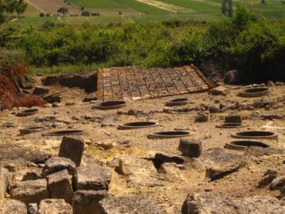
Chapelle Saint-Germain de Cesseras
Romanesque chapel located near Cesseras in the Minervois region, in the French department of Hérault.
Each edition grades its towns against each other only.

Cesseras and its surroundings hold 7 attractions, 4 archaeological sites and 2 churches. Mapped in Cesseras are 3 places to visit, and within 5 km of its centre another 14. France lists 2 of the town’s sites as historic monuments. Beyond the town, the best known is Cité de Carcassonne, 31 km off.
3 attractions, an archaeological site and a gallery follow Chapelle Saint-Germain de Cesseras.
Best known first: by how many Wikipedia and sister-site articles cover each place (Wikidata’s count). It isn’t a ranking of how good they are.
At 4.9 km, Musée archéologique du Minervois is the farthest one out.
The first 20 on the list, numbered as below. The shape is the commune of Cesseras; the orange dot is its centre. © OpenStreetMap contributors · commune boundary: IGN
There are more châteaux or heritage sites (7) than anything else, then other sights (7).
Dark: in Cesseras. Light: in the communes within 5 km of its centre.
The town has 3; within 5 km of its centre, the list finds 14 more.
Romanesque chapel located near Cesseras in the Minervois region, in the French department of Hérault.
Place where the layout of the surrounding land produces an optical illusion, making a slight downhill slope appear to be an uphill slope.
Archaeological museum of Minervois.
Church located in Hérault, in France.
The 3 places in Cesseras first, then those within 5 km of its centre.
Top of the 12 day trips: Cité de Carcassonne, at 31 km.
 AttractionCité de Carcassonne31 km southwest, in Carcassonne
 AttractionVoie Domitienne28 km southeast, in NarbonneCathedralCathedralCathédrale Saint-Just-et-Saint-Pasteur de Narbonne28 km southeast, in Narbonne
 AttractionAbbaye Sainte-Marie de Fontfroide27 km southeast, in NarbonneAttractionAttractionPic de Nore23 km northwest, in Pradelles-Cabardès
 AttractionCathédrale Saint-Michel de Carcassonne32 km southwest, in Carcassonne
 ChurchBasilique Saint-Nazaire-et-Saint-Celse de Carcassonne31 km southwest, in CarcassonneChâteauChâteauChâteaux de Lastours27 km west, in LastoursCathedralCathedralCathédrale Saint-Pons de Saint-Pons-de-Thomières19 km north, in Saint-Pons-de-Thomières
 AttractionPalais des archevêques de Narbonne28 km southeast, in NarbonneAttractionAttractionAbbaye de Sainte-Marie de Lagrasse27 km south, in Lagrasse
 AttractionOppidum d'Ensérune32 km east, in Nissan-lez-Enserune
Places within 40 km of Cesseras with an article in both French and English Wikipedia, nearest first.
The first on our list in Cesseras are Chapelle Saint-Germain de Cesseras, Dolmen de la Cigalière and Gorges de la Cesse. We list 3 places in town. Another 14 are within 5 km of the centre.
3 museums and galleries in town or within 5 km, including Musée archéologique du Minervois, Musée archéologique and Le Coin dArt.
2 places on this page in Cesseras are listed or registered historic monuments (Mérimée), including Chapelle Saint-Germain de Cesseras and Dolmen de la Cigalière.
The nearest with articles in both French and English Wikipedia: Cité de Carcassonne (31 km), Voie Domitienne (28 km), Cathédrale Saint-Just-et-Saint-Pasteur de Narbonne (28 km), Abbaye Sainte-Marie de Fontfroide (27 km).
From OpenStreetMap and Wikidata: named museums, galleries, châteaux, abbeys, gardens, zoos, theme parks and other visitor attractions whose mapped point lies inside the commune of Cesseras, then those in the communes within 5 km of its centre, and well-known places within 40 km. Houses, ruins and gardens need a sign they’re open to visitors; places marked private, closed or disused are left out. The historic-monument link is the Culture ministry’s Mérimée record. A place that isn’t mapped isn’t listed, so this isn’t everything there is to see.
Sources: OpenStreetMap (© OpenStreetMap contributors, ODbL), Wikidata (CC0: descriptions, websites, Wikipedia articles), the Culture ministry’s Mérimée database (Licence Ouverte 2.0), IGN commune boundaries. Distances are from the commune’s centre point.
Photos from Wikimedia Commons, each under its own licence (our copy, resized).
Contains public sector information under the Licence Ouverte / Open Licence 2.0 (Etalab): INSEE, DGFiP, the Interior Ministry’s statistics service (SSMSI), the Ministry of Education (DEPP), the Health Ministry’s statistics service (DREES) and the Housing Ministry (Carte des loyers). Commune boundaries: IGN Admin Express.