
Places to visit around Plurien, from Manoir de la Ville-Roger
Nothing on our list is in Plurien; the 4 places to visit are within 5 km of its centre. The commonest are 2 châteaux, a garden and an attraction. Further afield lies Fort la Latte, at 10 km.
The best known around Plurien
After Manoir de la Ville-Roger, look out for a garden, a château and an attraction.
Best known first: by how many Wikipedia and sister-site articles cover each place (Wikidata’s count). It isn’t a ranking of how good they are.
Where things are
At 4.8 km, Le Jardin des Osmanthes is the farthest one out.
The first 20 on the list, numbered as below. The shape is the commune of Plurien; the orange dot is its centre. © OpenStreetMap contributors · commune boundary: IGN
Kinds of place
It comes down to 2 châteaux, a garden and an attraction.
Dark: in Plurien. Light: in the communes within 5 km of its centre.
Everything on the list
All 4 on the list lie within 5 km of its centre.
Nothing is mapped in Plurien itself; these are within 5 km of its centre.
Worth the drive
Worth the drive, Fort la Latte (10 km) is first of the 12.
 FortFort National28 km east, in Saint-MaloChâteauChâteauChâteau de Saint-Malo28 km east, in Saint-MaloFortFortFort du Petit Bé27 km east, in Saint-Malo
 AquariumGrand aquarium de Saint-Malo30 km east, in Saint-MaloAbbeyAbbeyAbbaye de Saint-Jacut16 km east, in Saint-Jacut-de-la-Mer
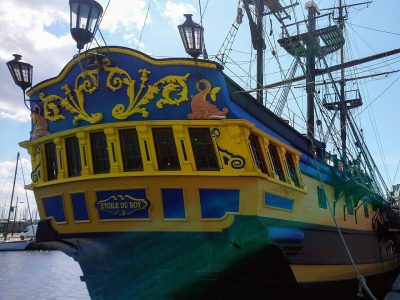 AttractionÉtoile du Roy28 km east, in Saint-MaloFortFortFort de la Conchée27 km east, in Saint-Malo
Places within 40 km of Plurien with an article in both French and English Wikipedia, nearest first.
Seeing Plurien: your questions
Are there attractions near Plurien?
Nothing is mapped in Plurien itself, but within 5 km there are Manoir de la Ville-Roger, Le Jardin des Osmanthes, Château de Vaurouault and Corps de Garde de Fosse Eyrand.
Are there museums in or near Plurien?
No museum or gallery is mapped in Plurien or within 5 km.
What well-known places are within a day out of Plurien?
The nearest with articles in both French and English Wikipedia: Fort la Latte (10 km), Cathédrale Saint-Vincent de Saint-Malo (28 km), Cathédrale Saint-Étienne de Saint-Brieuc (29 km), Château de Dinan (32 km).
How is this list made?
From OpenStreetMap and Wikidata: named museums, galleries, châteaux, abbeys, gardens, zoos, theme parks and other visitor attractions whose mapped point lies inside the commune of Plurien, then those in the communes within 5 km of its centre, and well-known places within 40 km. Houses, ruins and gardens need a sign they’re open to visitors; places marked private, closed or disused are left out. The historic-monument link is the Culture ministry’s Mérimée record. A place that isn’t mapped isn’t listed, so this isn’t everything there is to see.
Sources: OpenStreetMap (© OpenStreetMap contributors, ODbL), Wikidata (CC0: descriptions, websites, Wikipedia articles), the Culture ministry’s Mérimée database (Licence Ouverte 2.0), IGN commune boundaries. Distances are from the commune’s centre point.
Photos from Wikimedia Commons, each under its own licence (our copy, resized).
Photo credits (3)
- Fort National: Pline, CC BY-SA 3.0, Wikimedia Commons
- Grand aquarium de Saint-Malo: MaxTab, CC BY 3.0, Wikimedia Commons
- Étoile du Roy: Proullon, CC BY-SA 4.0, Wikimedia Commons
Contains public sector information under the Licence Ouverte / Open Licence 2.0 (Etalab): INSEE, DGFiP, the Interior Ministry’s statistics service (SSMSI), the Ministry of Education (DEPP), the Health Ministry’s statistics service (DREES) and the Housing Ministry (Carte des loyers). Commune boundaries: IGN Admin Express.