More historic than 18% of U.S. towns · #249 of 638 in Florida. What drives it
Most of Thonotosassa was built recently: 2% of its homes predate 1940 and the median home dates from 1989. Below: 2 old photos and papers, maps from 1943 on, and the census since 2000.
From Thonotosassa’s archive · credits on each photo
Quick answers
How Thonotosassa began
When was Thonotosassa founded?
1886
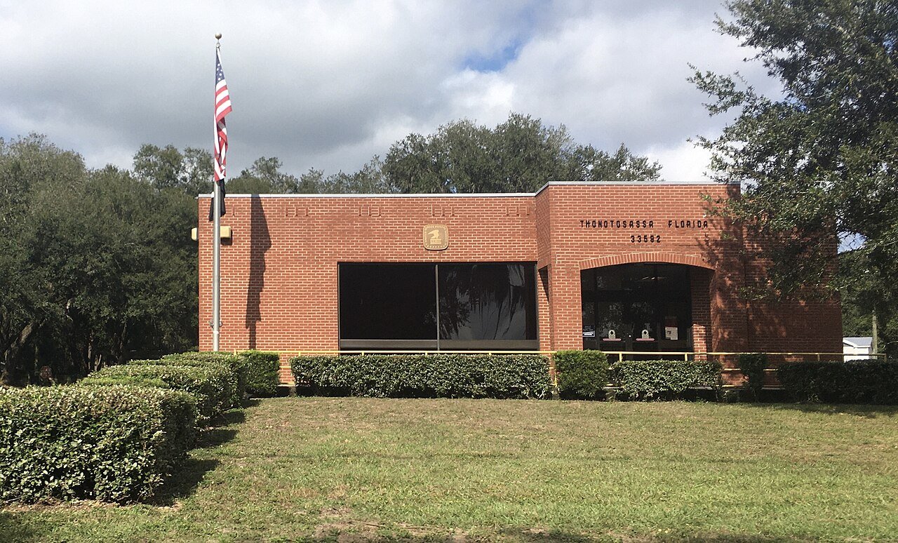
The Thonotosassa post office opened in 1886, the earliest record of the town by name. Another post office, Antioch (1892), opened inside today’s town and later closed.
First census: 6,091 in 20002020 census: 15,238140 years
How historic is Thonotosassa?
C−
More historic than 18% of U.S. towns, on its age, its old homes and the National Register.
Founding year: the first Thonotosassa post office (Blevins & Helbock, CC0).The full story ↓
History grade
What drives Thonotosassa’s History grade
On its age, its old homes and the National Register, Thonotosassa is more historic than 18% of U.S. towns, #249 of 638 in Florida. Its age holds the grade up; its share of homes from before 1940 pulls it down.
C−
HistoryA character grade: shown, never part of Thonotosassa’s overall grade.
Few Florida towns list much on the Register (a typical Florida town has 0.0 per 10,000 residents, the U.S. 2.4), so Thonotosassa’s 0.0 sits below most of its state (33% of Florida towns have fewer) while its 0 listings outnumber those of 23% of U.S. towns.
How sure. Graded on any two of the three inputs instead, the letter would range from D to C. The pre-1940 share (±1.1 points) is firm at this size. The founding year is the first post office, not a stated founding date.
Founding year: the first post office (other dates in Quick answers). Homes: Census ACS 2020–24. National Register: National Park Service, May 2026 list; each listing counted once (boundary changes and added documentation belong to their listing), and a historic district counts its contributing buildings. How TownRatings grades history →
What stands out about Thonotosassa’s past
Read from the archive, the National Register and the record. The page puts what stands out first.
The name "Thonotosassa" comes from the Seminole-Creek words ronoto "flint" and sasv "some", meaning the place was a source of valuable flint. Following the establishment of Fort Brooke in 1824 in what is now Tampa, a military road that ran northwest of Lake Thonotosassa was built between Fort Brooke and Fort King in Ocala. This road became known as the Fort King Road, which today is crossed in several locations by U.S. Route 301. Nevertheless, the presence of a Native American (probably Seminole, Creek or Mikasuki) village largely discouraged settlers from moving into the area. Following the hostilities of the Second Seminole War and with the adoption the Armed Occupation Act of 1842 American settlers began moving into the region.
Passages that mention Thonotosassa, cut from the printed page as they were published.
History of Hillsborough County, Florida1928 · page 269Read the page →
Read the text
In 1894, seeing the necessity for some means of shipping his fruit, General Hazen donated land for a depot, and with the help of Henry B. Plant.of Tampa, built a railroad from Thonotosassa to Tampa. The depot is still in use and the railroad has just been extended. In 1897 General Hazen built Grand View Hotel, the resort hotel in Hillsborough County, this proved a very popular hostelry, and in 1890 E. E. Hazen arrived from Ohio to assume charge.
Text read by machine from the scan; it may contain errors.
History of Hillsborough County, Florida1928 · page 318Read the page →
Read the text
Martin M. Miley, born in these times of danger and uncertainty, grew up on the land located by his father, and was an important factor in the development of Thonotosassa, one of the most beautiful spots in Florida. Mr. Miley served as a soldier in the Confederate Army during the Civil War. He was largely responsible for the locating of General Hazen at Thonotosassa, and was closely associated with him in establishing orange growing as a paying industry in this part of Florida.
Text read by machine from the scan; it may contain errors.
Scans and text from the Internet Archive. Books published in 1930 or earlier, which are in the public domain.
Timeline
Thonotosassa, 1886 to 1970
Woven from the archive, old maps, post office records, the National Register and the people born here.
Nothing in the archives for these yearsWeddings on Main Street, storms, parades, school pictures, the old store. If it’s in your family album, it belongs here.
The Thonotosassa post office opened in 1886, the earliest record of the town by name (U.S. post office records).
How does Thonotosassa rank for history?
Thonotosassa is more historic than 18% of U.S. towns, #249 of 638 in Florida. The History grade combines the town’s founding era, the share of homes built before 1940 and its National Register listings. It’s a character grade, so it isn’t part of the overall grade. How it works.
How old are the homes in Thonotosassa?
2% of Thonotosassa’s homes were built before 1940 (Census estimate, ±1.1 points), against a typical 0.6% for a Florida town; the median home was built in 1989.
Founding dates: Wikidata, Wikipedia, the U.S. post office records of Blevins & Helbock (CC0) and the Census. Homes by year built: Census ACS 2020–24. National Register of Historic Places: National Park Service (list of May 22, 2026). Old photos, postcards and papers: Wikimedia Commons, the Library of Congress and other public archives, credited on each item’s page. Maps: U.S. Geological Survey historical topographic maps (via Esri) and Sanborn fire-insurance maps (Library of Congress). History text and census tables: Wikipedia (CC BY-SA 4.0). Places that used to be: USGS Geographic Names Information System (2021).
From Wikimedia Commons (12), Wikipedia, U.S. Geological Survey historical maps, U.S. Census counts (via Wikipedia), the US Post Offices dataset (Blevins & Helbock), the USGS Geographic Names Information System and old county and town histories (Internet Archive). Archive images are copied here with their credits and licenses, shown on each photo’s page. Refreshed monthly.



 2019
 2019
 2013
 2013
 2013
 2013
 2013
 2012
 2012
 2004


