Tampa dates to 1823, and 79 of its places are on the National Register
More historic than 84% of U.S. towns · #12 of 638 in Florida. What drives it
Most of Tampa was built recently: 8% of its homes predate 1940 and the median home dates from 1985. 79 places in town are on the National Register, among them 4 National Historic Landmarks and ten historic districts with 4,345 buildings between them. Below: 6 old photos and papers, maps from 1884 on, and the census since 1850.
Founding year: Wikidata. First post office: 1831.The full story ↓
History grade
What drives Tampa’s History grade
On its age, its old homes and the National Register, Tampa is more historic than 84% of U.S. towns, #12 of 638 in Florida. Its National Register listings hold the grade up; its share of homes from before 1940 pulls it down.
A−
HistoryA character grade: shown, never part of Tampa’s overall grade.
Among the 400 U.S. cities of 100,000 or more, Tampa ranks #105 on History.
Few Florida towns list much on the Register (a typical Florida town has 0.0 per 10,000 residents, the U.S. 2.4), so Tampa’s 110 sits above most of its state (94% of Florida towns have fewer) while its 4,432 historic buildings outnumber those of 100% of U.S. towns.
How sure. Graded on any two of the three inputs instead, the letter would range from B to A+. The pre-1940 share (±0.5 points) is firm at this size. Two sources give 1823.
Founding year: Wikidata (other dates in Quick answers). Homes: Census ACS 2020–24. National Register: National Park Service, May 2026 list; each listing counted once (boundary changes and added documentation belong to their listing), and a historic district counts its contributing buildings. How TownRatings grades history →
What stands out about Tampa’s past
Read from the archive, the National Register and the record. The page puts what stands out first.
The country’s official list of buildings and places worth saving. 4 are National Historic Landmarks, the highest tier. Boundary changes and added documentation are counted with their listing.
National Park Service, National Register of Historic Places. Photos from Wikimedia Commons, credited on each place’s page.
Places that used to be
Lost post offices, old corners, places now gone and burying grounds
Tampa’s post office has been open since 1834. 15 other post offices opened and closed inside today’s town.
Tampa Bay
1831–1834
Tampa
1834–today
Branchville
1881–1882
Riverhead
1887–1902
Port Tampa
1890–1954
Port Tampa City
1892–1962
Fort Brook
1893–1897
Gary
1898–1913
Mills
1902–1904
Oaklawn
1902–1908
18301930today
Hamlets and corners on the map
Aberdeen on GlenAd MerAl Dana ParkAl MarAlamedaAlbionAlice HeightsAllerton ParkAlma HeightsAlmimaAlta VistaAlta Vista TractsAltamira HeightsAltamonte HeightsAltos VerdesAmeliaAnadellAndreaAnitaArbor GreeneArcherArlene ManorArlington HeightsArlington Heights North
Gone or out of use
Centro Asturiano HospitalhospitalDowntown Tampa Post Officepost officeFort BrookelocaleHillsborough County Sheriff's Office Jail Division IIIbuilding
16cemeteries and burying grounds inside Tampa
American LegionCentro EspanolGarden of MemoriesJackson HeightsMartin - ColonMemorial ParkMyrtle HillMyrtle Hill Memorial ParkOaklandOaklawnRoblesRose Hill Memorial ParkRose HillsShowmans RestWoodlawnWoodlawn
US Post Offices dataset (Blevins & Helbock, CC0). Places and cemeteries from the USGS Geographic Names Information System (2021).
The shores of Tampa Bay have been inhabited for thousands of years. A variant of the Weeden Island culture developed in the area by about 2,000 years ago. Archeological evidence suggests that these residents relied on the sea for most of their resources, as a vast majority of inhabited sites have been found on or near the shoreline, with little evidence of farming. At the time of European contact in the early 16th century, several chiefdoms of the Safety Harbor culture dominated the area.
Nothing in the archives for these yearsWeddings on Main Street, storms, parades, school pictures, the old store. If it’s in your family album, it belongs here.
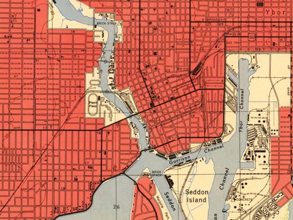
Every edition of the U.S. Geological Survey’s map of Tampa. Tap a year, or press play to watch the town change.
1921Tampa sheet · 1:62,500
U.S. Geological Survey historical topographic maps (public domain), via Esri’s collection of the scans. The red ring marks the center of Tampa.
Every building
Tampa, building by building, 1884–1922
Fire insurance maps drew every building, what it was made of and what it was used for, so insurers could price the risk of fire. Pick a year, then a sheet.
In 1823, according to Wikidata. Tampa’s post office opened in 1831, and the census of 1850 counted 974 people here.
How does Tampa rank for history?
Tampa is more historic than 84% of U.S. towns, #12 of 638 in Florida. The History grade combines the town’s founding era, the share of homes built before 1940 and its National Register listings. It’s a character grade, so it isn’t part of the overall grade. How it works.
What is on the National Register in Tampa?
79 listings, 4 of them National Historic Landmarks: 64 buildings, among them the Tampa Bay Hotel (a National Historic Landmark since 1976) and the Circulo Cubano de Tampa (listed 1972, the first), 10 historic districts with 4,345 contributing buildings, 1 site, and 4 structures. 4,432 historic buildings in all.
How old are the homes in Tampa?
8% of Tampa’s homes were built before 1940 (Census estimate), against a typical 0.6% for a Florida town; the median home was built in 1985.
Founding dates: Wikidata, Wikipedia, the U.S. post office records of Blevins & Helbock (CC0) and the Census. Homes by year built: Census ACS 2020–24. National Register of Historic Places: National Park Service (list of May 22, 2026). Old photos, postcards and papers: Wikimedia Commons, the Library of Congress and other public archives, credited on each item’s page. Maps: U.S. Geological Survey historical topographic maps (via Esri) and Sanborn fire-insurance maps (Library of Congress). History text and census tables: Wikipedia (CC BY-SA 4.0). Places that used to be: USGS Geographic Names Information System (2021).
From Wikimedia Commons (5), the Library of Congress (1), the National Register of Historic Places (79), Wikipedia, Wikidata and Wikipedia for famous people, U.S. Geological Survey historical maps, U.S. Census counts (via Wikipedia), the US Post Offices dataset (Blevins & Helbock), the USGS Geographic Names Information System and Sanborn fire insurance maps (Library of Congress). Archive images are copied here with their credits and licenses, shown on each photo’s page. Refreshed monthly.


 ★ Landmark
 ★ Landmark
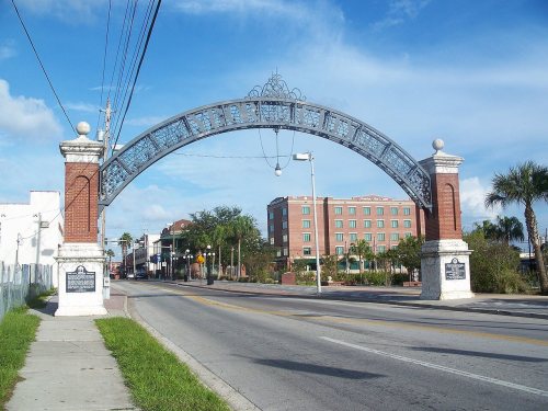 ★ Landmark
 ★ Landmark


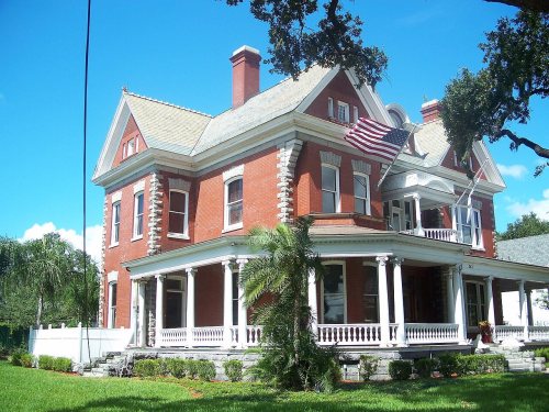




 1880
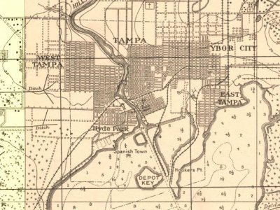
 c. 1890
 1892